Home
States
Colorado
Connecticut
Maine
Massachusetts
New Hampshire
New York
Rhode Island
Utah
Vermont
View All
Lists
NE 4,000 Footers
NE 100 Highest
NH 4,000 Footers
NH 100 Highest
NH 52 With A View
NH Belknap Range
NH Ossipee 10
Links
Trail Conditions
Trip Log
Sunrises
Sunsets
About
|
Mt. Osceola
Livermore, NH, Lincoln, NH
Trailheads, measurements, times, distances, and maps are all approximate and relative to the hike(s) as shown below.
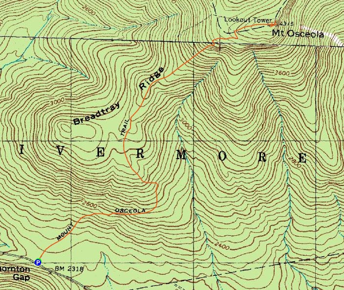
Mt. Osceola Trail to Mt. Osceola
Route: Mt. Osceola Trail
While the forecast wasn't great, it looked like I had a narrow window of dry weather.
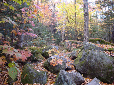
The lower portion of the Mt. Osceola Trail featured some nice foliage, which almost made up for the terrible footing. Nearing the summit, I had to deal with some pooled water on the trail, thanks to the rain earlier in the day.
The views from the near-summit ledges were decent, despite the weather - while some lower peaks nearby were in the clouds, the Tripyramids stayed in the clear.
The window of dry weather closed as I descended the ledgy portion of the trail. As a result, it was pretty slow going beyond there, with rain coming down and the headlamp on.
| Hike Ratings |
|
Getting To Trailhead: |
Easy |
| Destination: |
Mt. Osceola |
|
Length: |
Moderate |
|
Steepness: |
Moderate |
|
Navigation: |
Easy |
|
Views: |
Excellent |
|
Crowds: |
Minimal |
|
| Hike Stats |
|
Date Hiked: |
Monday, October 5, 2009 |
| Hike Commenced: |
4:36 PM |
| Parking Elevation: |
2,340' |
| Destination: |
Mt. Osceola |
| Ascent Commenced: |
4:36 PM |
| Summit Reached: |
5:54 PM |
| Time Elapsed: |
01:18 |
| Trailhead Elevation: |
2,340' |
| Summit Elevation: |
4,340' |
| Distance: |
3.2 miles |
| Vertical Gain: |
2,080' |
|
|
| Hike Ended: |
7:32 PM |
| Hike Time Elapsed: |
02:56 |
| Hike Distance: |
6.4 miles |
| Hike Vertical Gain: |
2,160' |
|
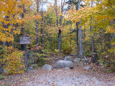
Mt. Osceola Trail trailhead at the Tripoli Road parking lot
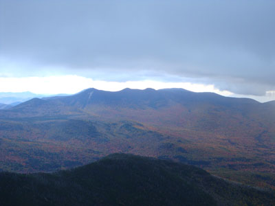
Looking at Mt. Tripyramid from the Mt. Osceola ledges
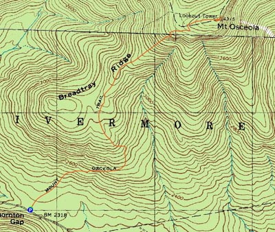

Directions to trailhead: From Waterville Valley, take Tripoli Road (bear right at the entrance to the ski area) to the top of the gap. Just after the road turns from pavement from dirt, the Mt. Osceola WMNF fee parking lot appears on the right. The trailhead is located at the back of the parking lot.
Back to Mt. Osceola Profile
|