Home
States
Colorado
Connecticut
Maine
Massachusetts
New Hampshire
New York
Rhode Island
Utah
Vermont
View All
Lists
NE 4,000 Footers
NE 100 Highest
NH 4,000 Footers
NH 100 Highest
NH 52 With A View
NH Belknap Range
NH Ossipee 10
Links
Trail Conditions
Trip Log
Sunrises
Sunsets
About
|
Mt. Passaconaway, Mt. Whiteface
Albany, NH, Waterville Valley, NH
Trailheads, measurements, times, distances, and maps are all approximate and relative to the hike(s) as shown below.
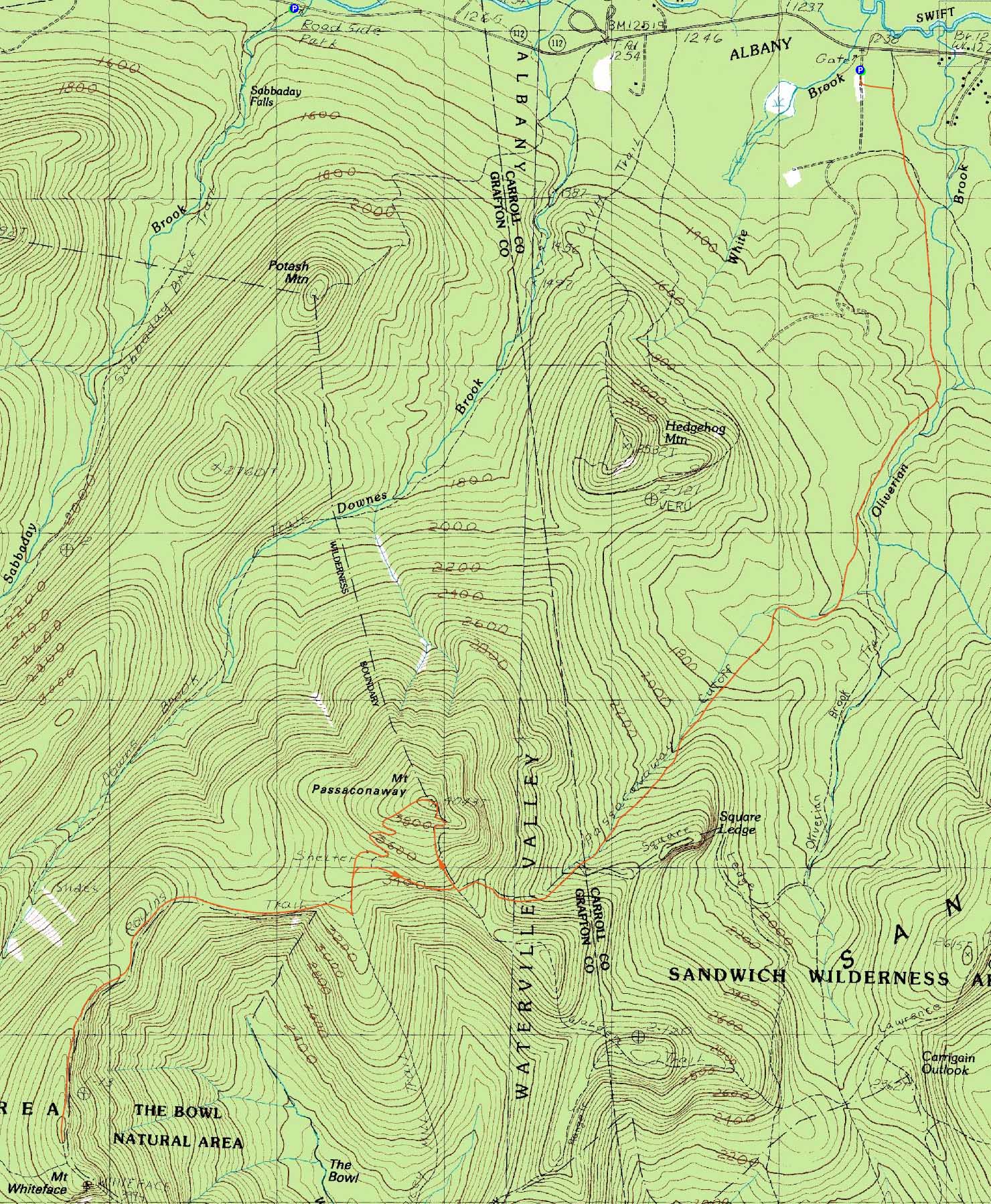
The Walden Trail on the way to Mt. Passaconaway
Route: Oliverian Brook Trail, Passaconaway Cutoff, Square Ledge Trail, Walden Trail, (Mt. Passaconaway), Dicey Mill Trail, Rollins Trail, (Mt. Whiteface), Rollins Trail, Dicey Mill Trail, East Loop, Walden Trail, Square Ledge Trail, Passaconaway Cutoff, Oliverian Brook Trail
Starting at the Oliverian Brook Trail parking area, we headed up the fairly gradual Oliverian Brook Trail. Heading onto the Passaconaway Cutoff, the trail continued to have fairly decent footing and low pitch until a brook crossing. Thereafter, the trail steepened a bit, eventually reaching the Square Ledge Trail. After a short drop, the trail then climbed a bit more steeply up to the Walden Trail.
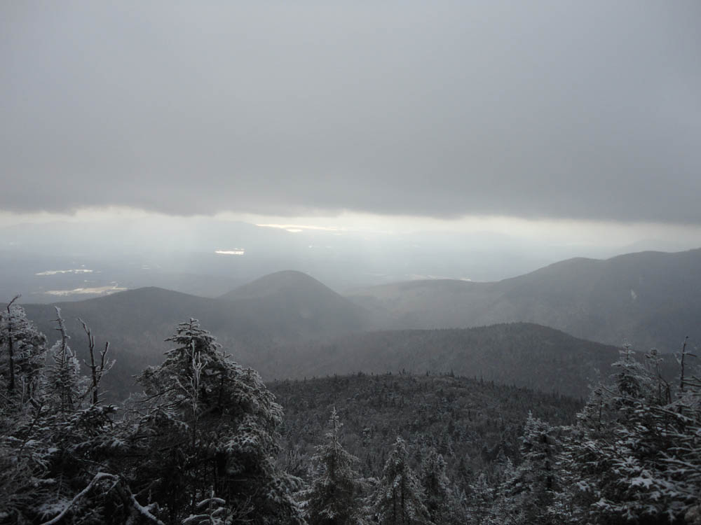
From there, we continued steeply up to the Passaconaway viewpoints, with some large ice bulges slowing progress. Views were limited due to snow flurries.
After reaching the summit, we headed down the Dicey Mill Trail, then worked over to Whiteface via the Rollins Trail. With the snow falling, it didn't seem like there would be any views, so we turned around at the true summit (rather than continue to the view ledges on the south knob).
For the return trip, we took the East Loop back from Dicey Mill to the Walden-Square Ledge trails, then descended, eventually needing headlamps around the water crossing.
| Hike Ratings |
|
Getting To Trailhead: |
Easy |
| Destination: |
Mt. Passaconaway |
|
Length: |
Moderate |
|
Steepness: |
Difficult |
|
Navigation: |
Easy |
|
Views: |
Moderate (due to weather) |
|
Crowds: |
Minimal |
| Destination: |
Mt. Whiteface |
|
Length: |
Difficult |
|
Steepness: |
Difficult |
|
Navigation: |
Easy |
|
Views: |
Minimal |
|
Crowds: |
Minimal |
|
| Hike Stats |
|
Date Hiked: |
Saturday, November 27, 2010 |
| Hike Commenced: |
7:47 AM |
| Parking Elevation: |
1,240' |
| Destination: |
Mt. Passaconaway |
| Ascent Commenced: |
7:47 AM |
| Summit Reached: |
11:03 AM |
| Time Elapsed: |
03:16 |
| Trailhead Elevation: |
1,240' |
| Summit Elevation: |
4,043' |
| Distance: |
5.1 miles |
| Vertical Gain: |
2,883' |
| Destination: |
Mt. Whiteface |
| Ascent Commenced: |
11:11 AM |
| Summit Reached: |
1:19 PM |
| Time Elapsed: |
02:08 |
| Trailhead Elevation: |
4,043' |
| Summit Elevation: |
4,020' |
| Distance: |
3.1 miles |
| Vertical Gain: |
840' |
|
|
| Hike Ended: |
5:35 PM |
| Hike Time Elapsed: |
09:48 |
| Hike Vertical Gain: |
4,060' |
|
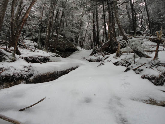
The Oliverian Brook Trail trailhead
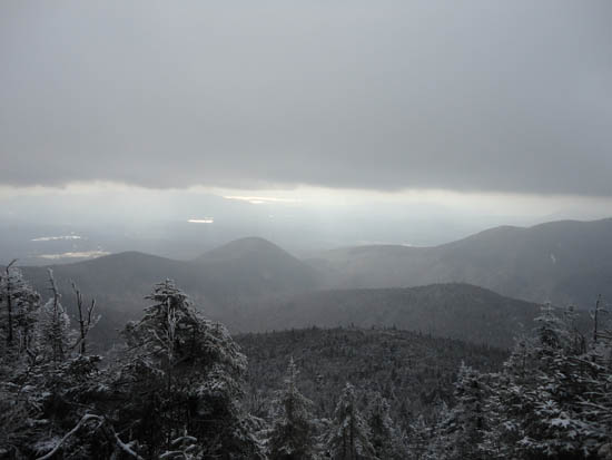
Looking into the bowl from near the Mt. Passaconaway summit

The Dicey Mill Trail on the way to Mt. Whiteface

The viewless true summit of Mt. Whiteface on the Rollins Trail
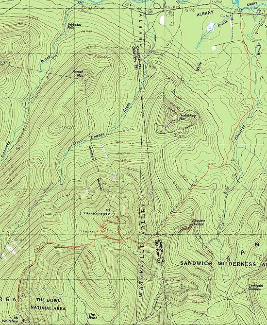

Directions to trailhead: Take Route 112 West from Conway. The Oliverian Brook Trail WMNF fee parking lot access road and trailhead will eventually be on the left, between the Champney Falls and UNH Trail trailheads.
Back to Mt. Passaconaway Profile
Back to Mt. Whiteface Profile
|