Home
States
Colorado
Connecticut
Maine
Massachusetts
New Hampshire
New York
Rhode Island
Utah
Vermont
View All
Lists
NE 4,000 Footers
NE 100 Highest
NH 4,000 Footers
NH 100 Highest
NH 52 With A View
NH Belknap Range
NH Ossipee 10
Links
Trail Conditions
Trip Log
Sunrises
Sunsets
About
|
Mt. Paugus (South Peak), NH
Tamworth, NH, Albany, NH
Trailheads, measurements, times, distances, and maps are all approximate and relative to the hike(s) as shown below.
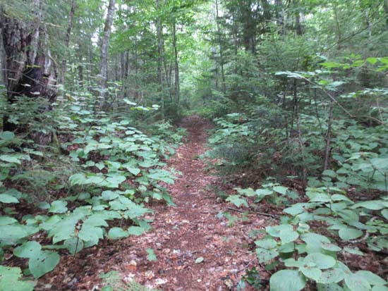
Looking up the Whitin Brook Trail
Route: Brook Trail, Old Paugus Trail, Whitin Brook Trail, Cabin Trail, Lawrence Trail, Bee Line Trail, Bolles Trail, Bickford Trail
Whitin Brook Trail had generally good footing and easy grades until the last few tenths, which were a bit steep and rough with blowdowns. This, combined with the Lawrence Trail, made for a nice ascending jog to Paugus.
On (South) Paugus, look downhill at the group of boulders, then go just to the right of them into the scrub - there's a faint herd path. This brings you to the great views.
Didn't bother to bushwhack to the true summit - once was enough.
Descent on Old Paugus Trail was nasty - quite a few blowdowns, as well as worsening slippery ledges (something should be done from both resource and safety perspective).
Bee Line was steep for awhile. The last .2 before Bolles looks seldom travelled, with a few annoying blowdowns blocking the corridor.
Bolles Trail was smooth sailing from Bee Line to Bickford. Starting around the Bee Line Cutoff junction, the snowmobile bridges have been replaced.
Took a side trip up the Bickford Trail to the Brook Trail. This section looks like it gets very little use.
| Hike Ratings |
|
Getting To Trailhead: |
Easy |
| Destination: |
Mt. Paugus (South Peak) |
|
Length: |
Moderate |
|
Steepness: |
Moderate |
|
Navigation: |
Easy |
|
Views: |
Excellent |
|
Crowds: |
Minimal |
|
| Hike Stats |
|
Date Hiked: |
Monday, August 13, 2012 |
| Parking Elevation: |
900' |
| Destination: |
Mt. Paugus (South Peak) |
| Trailhead Elevation: |
900' |
| Summit Elevation: |
3,100' |
| Vertical Gain: |
2,350' |
|
|
| Hike Vertical Gain: |
2,700' |
|
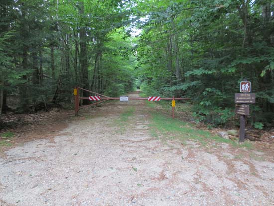
The Paugus Mill trailhead
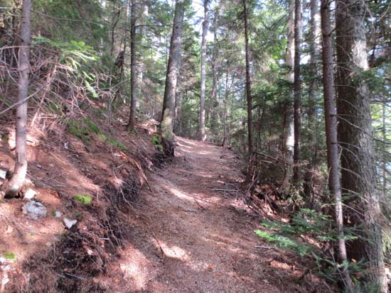
Looking up the Lawrence Trail
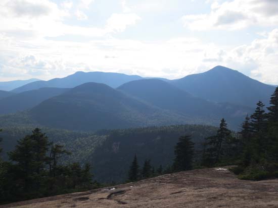
Looking at the western Sandwich Range from the ledges on the south peak of Mt. Paugus
Directions to trailhead: From Route 25, take Route 113 East to Tamworth. At the four way intersection next to the village, go straight onto 113A. Continue a few minutes, taking a right onto Fowler's Mill Road. A few minutes later, take a left onto Paugus Road. The WMNF fee parking area is at the end of this road.
Back to Mt. Paugus (South Peak) Profile
|

