Home
States
Colorado
Connecticut
Maine
Massachusetts
New Hampshire
New York
Rhode Island
Utah
Vermont
View All
Lists
NE 4,000 Footers
NE 100 Highest
NH 4,000 Footers
NH 100 Highest
NH 52 With A View
NH Belknap Range
NH Ossipee 10
Links
Trail Conditions
Trip Log
Sunrises
Sunsets
About
|
Mt. Pierce
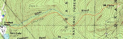
Carroll, NH, Crawford's Purchase, NH, Bean's Grant, NH
Trailheads, measurements, times, distances, and maps are all approximate and relative to the hike(s) as shown below.
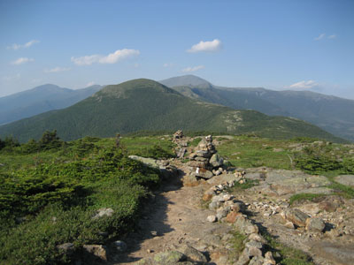
Looking down the Crawford Path
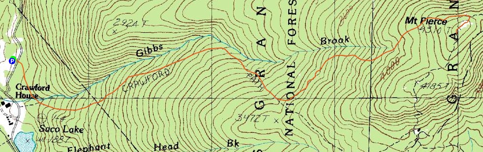
Route: Crawford Connector, Crawford Path, Webster Cliff Trail
Low on energy after work, I had two Arkansas Presidential choices - hike the former Mt. Clinton or Mt. Willey. My choice was Mt. Pierce.
The hike started off with a relatively flat .3 mile walk up the Crawford Connector. Once at the junction, the pitch picked up a little bit - but not much. The Crawford Path to Mt. Pierce is very tame - the easiest 4,000 footer hike I've done yet.
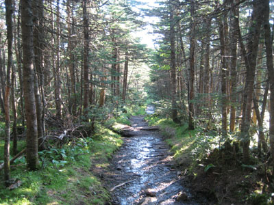
Though nice and peaceful, I found the trail to be a bit boring after awhile, as it involves many straight, gradual stretches.
Soon enough, I was out of the trees and near Mt. Pierce. Though the views to the west were hazy, the scenery to the north and north east was brilliant. While the views on the summit were decent, I found them to be more enjoyable closer to the Webster Cliff/Crawford Path junction. With the temperature near 90 degrees at the trailhead, the cooler summit temperatures combined with moderate winds made the hike well worth the limited effort.
Thanks in part to the tame trail, the knee did not feel too bad. All in all, a good hike. 4,000 footer #11.
| Hike Ratings |
|
Getting To Trailhead: |
Easy |
| Destination: |
Mt. Pierce |
|
Length: |
Moderate |
|
Steepness: |
Moderate |
|
Navigation: |
Easy |
|
Views: |
Excellent |
|
Crowds: |
Minimal |
|
| Hike Stats |
|
Date Hiked: |
Tuesday, June 26, 2007 |
| Hike Commenced: |
4:20 PM |
| Parking Elevation: |
1,920' |
| Destination: |
Mt. Pierce |
| Ascent Commenced: |
4:21 PM |
| Summit Reached: |
5:54 PM |
| Time Elapsed: |
01:33 |
| Trailhead Elevation: |
1,920' |
| Summit Elevation: |
4,310' |
| Distance: |
3.2 miles |
| Vertical Gain: |
2,430' |
|
|
| Hike Ended: |
7:41 PM |
| Hike Time Elapsed: |
03:21 |
| Hike Distance: |
6.4 miles |
| Hike Vertical Gain: |
2,470' |
|
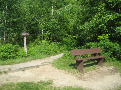
Crawford Connector trailhead
Looking northeast at Mt. Eisenhower and Mt. Washington from near the Mt. Pierce summit

Directions to trailhead: Take Route 302 West from Bartlett into Carroll. Just after Saco Lake, take a right onto Mt. Clinton Road. Shortly thereafter, take a left into the WMNF fee parking area driveway and Crawford Connector trailhead.
Back to Mt. Pierce Profile
|