Home
States
Colorado
Connecticut
Maine
Massachusetts
New Hampshire
New York
Rhode Island
Utah
Vermont
View All
Lists
NE 4,000 Footers
NE 100 Highest
NH 4,000 Footers
NH 100 Highest
NH 52 With A View
NH Belknap Range
NH Ossipee 10
Links
Trail Conditions
Trip Log
Sunrises
Sunsets
About
|
Mt. Pierce
Carroll, NH, Crawford's Purchase, NH, Bean's Grant, NH
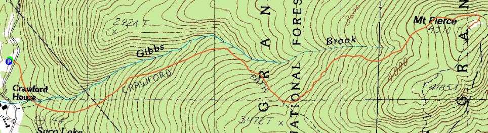
Trailheads, measurements, times, distances, and maps are all approximate and relative to the hike(s) as shown below.
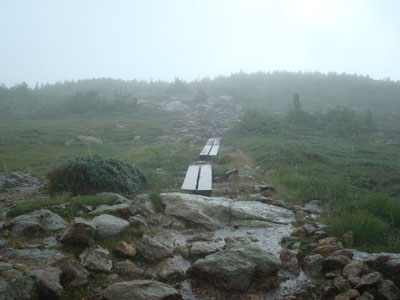
Looking up the Webster Cliff Trail during a downpour
Route: Crawford Connector, Crawford Path, Webster Cliff Trail
The forecast said "the first precipitation free day...in quite a while." Good enough, I figured, so I took the afternoon off from work.
During the morning, it rained. On the way up, it rained. Perhaps the term precipitation doesn't include rain.
The hike up the Crawford Path was rather mucky, with off and on sprinkles. It seemed like a bunch of people were heading down from the hut, as the trail was rather busy up to the cut off junction.
As I emerged from the trees, an all out downpour started. Ridiculous. Fortunately, the rain let up for a bit after I reached the summit, so I was able to hang out for awhile, enjoying an occasional view through the clouds.
The descent was wet as well, as was the drive home. These weather forecasts are ridiculous. It was nice to get a hike in, but a waste of an afternoon off.
| Hike Ratings |
|
Getting To Trailhead: |
Easy |
| Destination: |
Mt. Pierce |
|
Length: |
Moderate |
|
Steepness: |
Moderate |
|
Navigation: |
Easy |
|
Views: |
Excellent |
|
Crowds: |
Heavy |
|
| Hike Stats |
|
Date Hiked: |
Tuesday, August 5, 2008 |
| Hike Commenced: |
1:22 PM |
| Parking Elevation: |
1,920' |
| Destination: |
Mt. Pierce |
| Ascent Commenced: |
1:22 PM |
| Summit Reached: |
2:52 PM |
| Time Elapsed: |
01:30 |
| Trailhead Elevation: |
1,920' |
| Summit Elevation: |
4,310' |
| Distance: |
3.2 miles |
| Vertical Gain: |
2,430' |
|
|
| Hike Ended: |
5:03 PM |
| Hike Time Elapsed: |
03:41 |
| Hike Distance: |
6.4 miles |
| Hike Vertical Gain: |
2,470' |
|
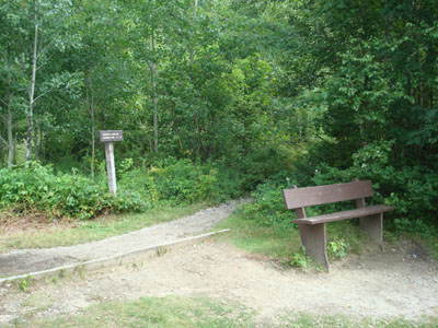
Crawford Connector trailhead
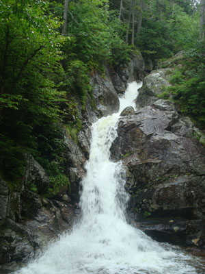
Gibbs Falls
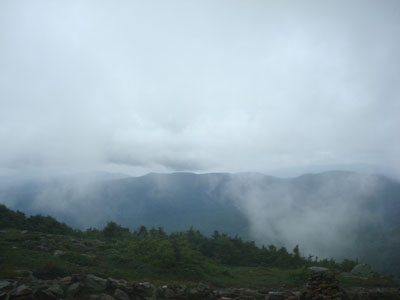
A brief break in the clouds near the summit of Mt. Pierce
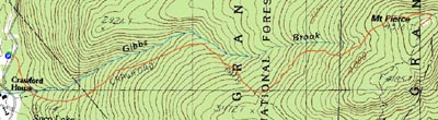

Directions to trailhead: Take Route 302 West from Bartlett into Carroll. Just after Saco Lake, take a right onto Mt. Clinton Road. Shortly thereafter, take a left into the WMNF fee parking area driveway and Crawford Connector trailhead.
Back to Mt. Pierce Profile
|