Home
States
Colorado
Connecticut
Maine
Massachusetts
New Hampshire
New York
Rhode Island
Utah
Vermont
View All
Lists
NE 4,000 Footers
NE 100 Highest
NH 4,000 Footers
NH 100 Highest
NH 52 With A View
NH Belknap Range
NH Ossipee 10
Links
Trail Conditions
Trip Log
Sunrises
Sunsets
About
|
Mt. Pierce, Mt. Eisenhower
Bean's Grant, NH, Chandler's Purchase, NH
Trailheads, measurements, times, distances, and maps are all approximate and relative to the hike(s) as shown below.
Looking down the Crawford Path
Route: Crawford Connector, Crawford Path, Webster Cliff Trail, (Mt. Pierce), Webster Cliff Trail, Crawford Path, Mt. Eisenhower Loop, (Mt. Eisenhower), Mt. Eisenhower Loop, Crawford Path, Crawford Connector
With a very windy higher summits forecast (60-80 mph), I decided to head above treeline.
I was rather pleased to see the Crawford Connector parking lot was plowed - it hadn't for over a week due to a broken snowplow. The Crawford Connector, as a result was in somewhat rough shape - three or four blowdowns in the first short segment in fact. The Crawford Path was in fairly good shape, however, as it was fairly easily booted (I chose to wear Microspikes.
Nearing the alpine zone, I stopped for awhile to gear up - adding a bunch of layers, etc.
When I first arrived at the Mt. Pierce summit, there weren't any views to be had. After reaching the windy summit, I decided to put on my crampons and attempt to walk along the ridge toward Eisenhower.
The stretch of trail to Eisenhower was rather interesting - high winds, somewhat limited visibility, and lots of blue ice. I found it to be good practice for using crampons, walking in sustained high winds, and wearing full face protection (unfortunately, my balaclava didn't quite cover everything around my goggles, so I ended up with some frostnip).
While I hadn't the full intention of ascending Eisenhower, I eventually found myself at the loop junction. At this point, since I was less than half a mile away and feeling warm, I decided to go for it. The first part of the loop trail was protected a little bit from the northwesterly winds. Once I cleared the shoulder, however, reality hit - sustained winds bearing down on me as I slowly made my way to the summit. After attempting to take a few photos in the very high winds while hiding behind the cairn, I decided to attempt to head down the Edmands Path and thus reduce my remaining above treeline hiking by about a mile. A few steps later, I realized it was going to be very tough to make it down that section of the loop trail. Since it's never good to make fast decisions with relative high stakes like this, I crouched down for a minute and thought about my options - get knocked around trying to get to the Edmands Path or try to go back the way I came, with a good 1.5 miles of exposure. Not wanting to deal with the exposed section on the northwest side of the peak, I decided to book it back down the way I came.
After making the tough descent in the high winds off the loop trail, I was back on the Crawford Path working my way across the windy ridge. Suddenly, things began to lighten up and visibility started to improve dramatically (though, my goggles were iced up so badly at this point that I could only see a few blurry feet in front of me). Sure enough (without goggles), I could see Bretton Woods and Mt. Isolation - after being in limited visibility for hours, I couldn't help but start yelling!
Back at the Webster Cliff junction, I headed partway up Pierce again to grab a few photos. While the winds weren't as bad there as on Eisenhower, they were nonetheless strong enough to render most of my photos useless due to excessive blur from camera movement.
Back in the trees, I decided to finally take a lunch break and regroup. I enjoyed a leisurely stroll back to the parking lot, cleaning up what blowdowns I could. Near the bottom, I stopped by to see Gibbs Falls seemingly frozen in place.
While it was a bit of a challenge, I was nonetheless glad to have had a few hours of bitter cold, high wind, above treeline experience.
| Hike Ratings |
|
Getting To Trailhead: |
Easy |
| Destination: |
Mt. Pierce |
|
Length: |
Moderate |
|
Steepness: |
Moderate |
|
Navigation: |
Easy |
|
Views: |
Excellent |
|
Crowds: |
Moderate |
| Destination: |
Mt. Eisenhower |
|
Length: |
Moderate |
|
Steepness: |
Difficult |
|
Navigation: |
Moderate (due to weather) |
|
Views: |
Minimal (due to weather) |
|
Crowds: |
Minimal |
|
| Hike Stats |
|
Date Hiked: |
Saturday, January 3, 2009 |
| Hike Commenced: |
8:31 AM |
| Parking Elevation: |
1,920' |
| Destination: |
Mt. Pierce |
| Ascent Commenced: |
8:31 AM |
| Summit Reached: |
10:22 AM |
| Time Elapsed: |
01:51 |
| Trailhead Elevation: |
1,920' |
| Summit Elevation: |
4,310' |
| Distance: |
3.2 miles |
| Vertical Gain: |
2,430' |
| Destination: |
Mt. Eisenhower |
| Ascent Commenced: |
10:38 AM |
| Summit Reached: |
12:01 PM |
| Time Elapsed: |
01:23 |
| Trailhead Elevation: |
4,310' |
| Summit Elevation: |
4,780' |
| Distance: |
1.7 miles |
| Vertical Gain: |
920' |
|
|
| Hike Ended: |
2:40 PM |
| Hike Time Elapsed: |
06:09 |
| Hike Vertical Gain: |
3,770' |
|
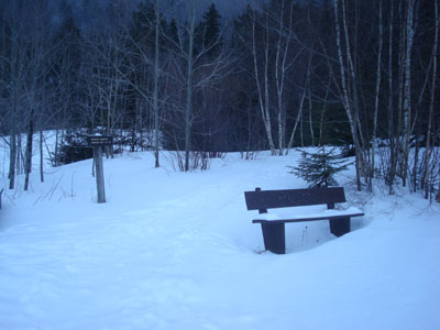
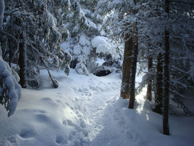
Crawford Connector trailhead
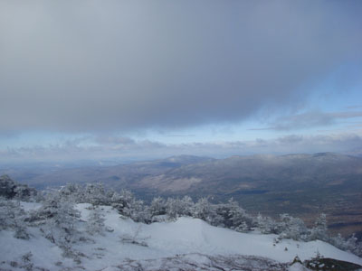
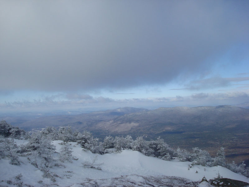
Looking northwest from near the summit of Mt. Pierce
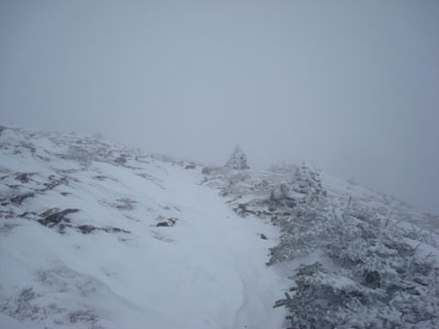
Looking up the Mt. Eisenhower Loop trail
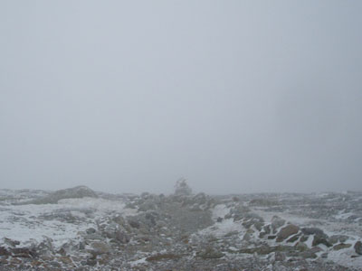
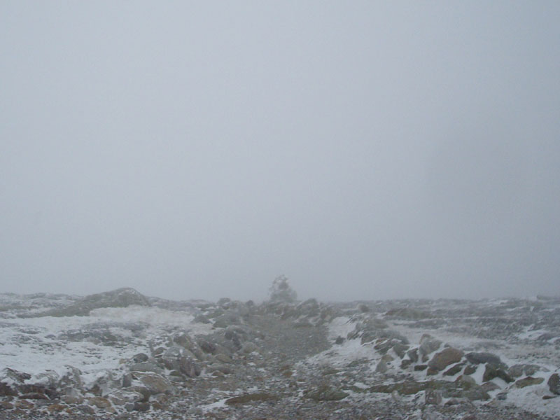
The view from the Mt. Eisenhower summit
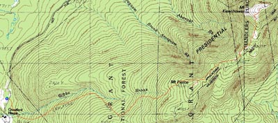

Directions to trailhead: Take Route 302 West from Bartlett into Carroll. Just after Saco Lake, take a right onto Mt. Clinton Road. Shortly thereafter, take a left into the WMNF fee parking area driveway and Crawford Connector trailhead.
Back to Mt. Pierce Profile
Back to Mt. Eisenhower Profile
|