Home
States
Colorado
Connecticut
Maine
Massachusetts
New Hampshire
New York
Rhode Island
Utah
Vermont
View All
Lists
NE 4,000 Footers
NE 100 Highest
NH 4,000 Footers
NH 100 Highest
NH 52 With A View
NH Belknap Range
NH Ossipee 10
Links
Trail Conditions
Trip Log
Sunrises
Sunsets
About
|
Mt. Pierce, Mt. Eisenhower
Bean's Grant, NH, Chandler's Purchase, NH
Trailheads, measurements, times, distances, and maps are all approximate and relative to the hike(s) as shown below.
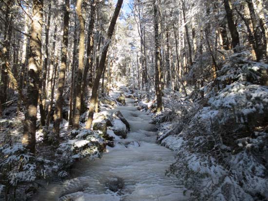
Looking down the icy Crawford Path
Route: Crawford Connector, Crawford Path, Webster Cliff Trail, (Mt. Pierce), Webster Cliff Trail, Crawford Path, Mt. Eisenhower Loop, (Mt. Eisenhower), Mt. Eisenhower Loop, Crawford Path, Crawford Connector
Icy!
Crawford Connector plus first half mile of Crawford Path above there were generally dry trail with some avoidable blue ice bulges and black ice.
Blue ice bulges increased as the Mizpah Cutoff junction approached. From Mizpah Cutoff junction to the Webster Cliff junction, much of the trail was frozen blue ice. We were able to pick our way up on Microspikes with care, but used crampons for the descent. Webster Cliff Trail from Crawford Path to the summit had some ice, but Micros were adequate for this short portion.
Crawford Path between the peaks had lots of blue ice bulges, some at angles. Initially we attempted to continue (on ascent) in Microspikes (new ones were okay initially, dull ones were completely inadequate), however we were forced to switch to crampons prior to reaching the col. Blue ice patches continued for much of the way to the Eisenhower Loop junction.
Above treeline, the Eisenhower Loop wasn't too bad - some frozen granular and a little bit of snow here and there. For this short section, Microspikes would have been fine, however we left our crampons on.
Other than an old drift or two, we never encountered more than a dusting to an inch of snowpack.
Bluebird day, a little chilly up high, but winds were minimal.
| Hike Ratings |
|
Getting To Trailhead: |
Easy |
| Destination: |
Mt. Pierce |
|
Length: |
Moderate |
|
Steepness: |
Moderate |
|
Navigation: |
Easy |
|
Views: |
Excellent |
|
Crowds: |
Moderate |
| Destination: |
Mt. Eisenhower |
|
Length: |
Moderate |
|
Steepness: |
Difficult |
|
Navigation: |
Moderate |
|
Views: |
Excellent |
|
Crowds: |
Moderate |
|
| Hike Stats |
|
Date Hiked: |
Saturday, December 15, 2012 |
| Parking Elevation: |
1,920' |
| Destination: |
Mt. Pierce |
| Time Elapsed: |
01:49 |
| Trailhead Elevation: |
1,920' |
| Summit Elevation: |
4,310' |
| Distance: |
3.2 miles |
| Vertical Gain: |
2,430' |
| Destination: |
Mt. Eisenhower |
| Time Elapsed: |
01:16 |
| Trailhead Elevation: |
4,310' |
| Summit Elevation: |
4,780' |
| Distance: |
1.7 miles |
| Vertical Gain: |
920' |
|
|
| Hike Time Elapsed: |
6:18 |
| Hike Vertical Gain: |
3,770' |
|
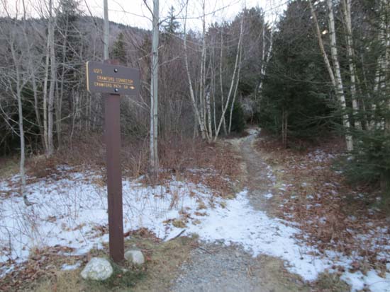
Crawford Connector trailhead

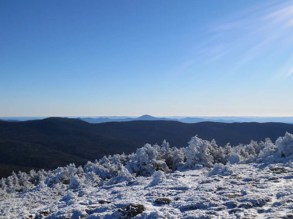
Looking over the Montalban Ridge at Kearsarge North Mountain from near the summit of Mt. Pierce
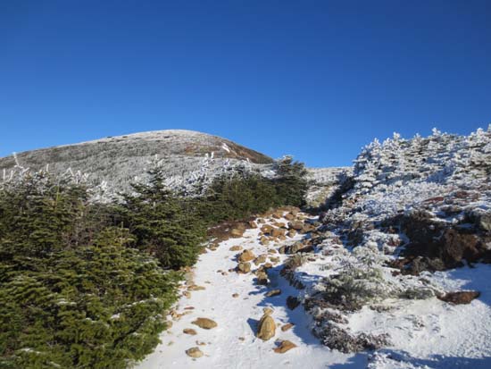
The Crawford Path on the way to Mt. Eisenhower
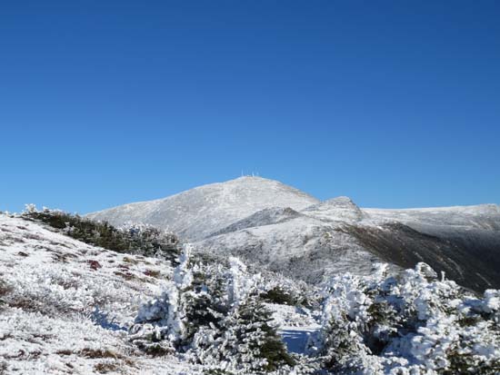
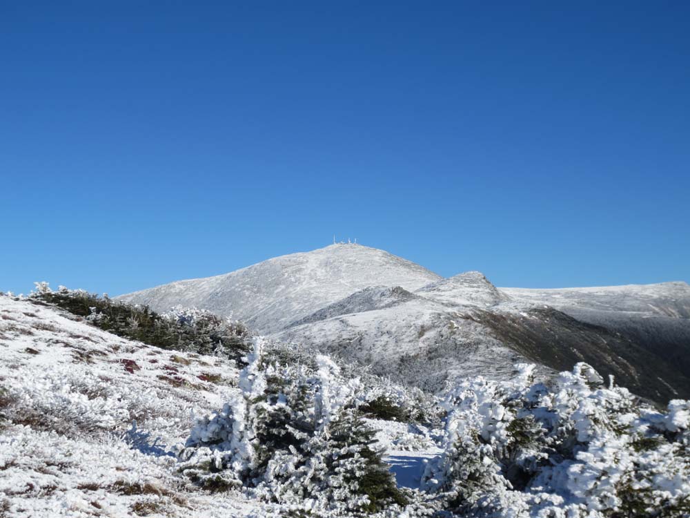
Mt. Washington and Mt. Monroe as seen from near the top of Mt. Eisenhower
Directions to trailhead: Take Route 302 West from Bartlett into Carroll. Just after Saco Lake, take a right onto Mt. Clinton Road. Shortly thereafter, take a left into the WMNF fee parking area driveway and Crawford Connector trailhead.
Back to Mt. Pierce Profile
Back to Mt. Eisenhower Profile
|