Home
States
Colorado
Connecticut
Maine
Massachusetts
New Hampshire
New York
Rhode Island
Utah
Vermont
View All
Lists
NE 4,000 Footers
NE 100 Highest
NH 4,000 Footers
NH 100 Highest
NH 52 With A View
NH Belknap Range
NH Ossipee 10
Links
Trail Conditions
Trip Log
Sunrises
Sunsets
About
|
Mt. Prospect
Holderness, NH
Trailheads, measurements, times, distances, and maps are all approximate and relative to the hike(s) as shown below.
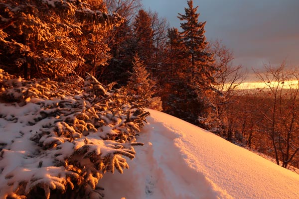
The trail to Mt. Prospect
Route: Unknown trail
Trail had 1-2" of powder from yesterday's storm. Did not encounter and hidden ice. A few portions of trail still had unfrozen ground, so tracks could set up as slush or ice.
| Hike Ratings |
|
Getting To Trailhead: |
Easy |
| Destination: |
Mt. Prospect |
|
Length: |
Moderate |
|
Steepness: |
Moderate |
|
Navigation: |
Moderate |
|
Views: |
Excellent |
|
Crowds: |
Minimal |
|
| Hike Stats |
|
Date Hiked: |
Tuesday, December 6, 2016 |
| Parking Elevation: |
1,080' |
| Destination: |
Mt. Prospect |
| Time Elapsed: |
00:31 |
| Trailhead Elevation: |
1,080' |
| Summit Elevation: |
2,064' |
| Distance: |
1.6 miles |
| Vertical Gain: |
1,019' |
|
|
| Hike Time Elapsed: |
01:18 |
| Hike Vertical Gain: |
1,054' |
|
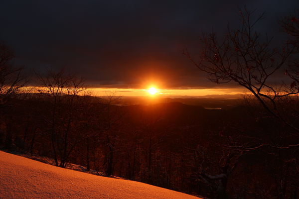
The sunrise from the northwestern Mt. Prospect viewpoint
Directions to trailhead: From Meredeth, take Route 25 west, then take a right onto Route 175 north. Just prior to the 175A junction, take a right onto Mt. Prospect Road. After passing Prospect Ridge Road on the right and dipping down a bit, the road climbs and soon turns to the left. The trailhead is on the right (two granite columns laying on their side). There is some room to park on the side of the road next to the trailhead.
Back to Mt. Prospect Profile
|

