Home
States
Colorado
Connecticut
Maine
Massachusetts
New Hampshire
New York
Rhode Island
Utah
Vermont
View All
Lists
NE 4,000 Footers
NE 100 Highest
NH 4,000 Footers
NH 100 Highest
NH 52 With A View
NH Belknap Range
NH Ossipee 10
Links
Trail Conditions
Trip Log
Sunrises
Sunsets
About
|
Mt. Prospect
Holderness, NH
Trailheads, measurements, times, distances, and maps are all approximate and relative to the hike(s) as shown below.
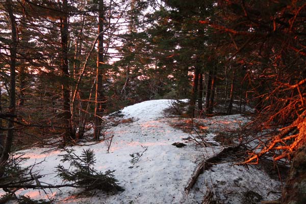
The trail to Mt. Prospect
Route: Unknown trail
Still full snowpack from the road to the summit ridge (1 to 2 feet deep). The stretch of trail from the ridge viewpoint to the summit has largely melted out. A few moderate length stretches of blue ice. Snow was firm this morning with temperatures in the teens. I wore snowshoes roundtrip, but didn't like beating them up on the ridge. Until we get more snow, I would consider sharp Microspikes if temperatures are below freezing and snowshoes if temperatures are at/above freezing or it's sunny.
| Hike Ratings |
|
Getting To Trailhead: |
Easy |
| Destination: |
Mt. Prospect |
|
Length: |
Moderate |
|
Steepness: |
Moderate |
|
Navigation: |
Moderate |
|
Views: |
Excellent |
|
Crowds: |
Minimal |
|
| Hike Stats |
|
Date Hiked: |
Friday, February 23, 2018 |
| Parking Elevation: |
1,080' |
| Destination: |
Mt. Prospect |
| Time Elapsed: |
00:33 |
| Trailhead Elevation: |
1,080' |
| Summit Elevation: |
2,064' |
| Distance: |
1.6 miles |
| Vertical Gain: |
1,019' |
|
|
| Hike Time Elapsed: |
00:58 |
| Hike Vertical Gain: |
1,054' |
|
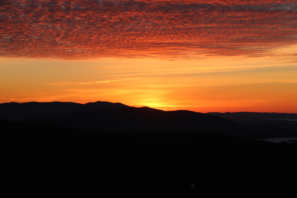
The sunrise from near the summit of Mt. Prospect
Directions to trailhead: From Meredeth, take Route 25 west, then take a right onto Route 175 north. Just prior to the 175A junction, take a right onto Mt. Prospect Road. After passing Prospect Ridge Road on the right and dipping down a bit, the road climbs and soon turns to the left. The trailhead is on the right (two granite columns laying on their side). There is some room to park on the side of the road next to the trailhead.
Back to Mt. Prospect Profile
|

