Home
States
Colorado
Connecticut
Maine
Massachusetts
New Hampshire
New York
Rhode Island
Utah
Vermont
View All
Lists
NE 4,000 Footers
NE 100 Highest
NH 4,000 Footers
NH 100 Highest
NH 52 With A View
NH Belknap Range
NH Ossipee 10
Links
Trail Conditions
Trip Log
Sunrises
Sunsets
About
|
Mt. Roberts
Moultonborough, NH
Trailheads, measurements, times, distances, and maps are all approximate and relative to the hike(s) as shown below.
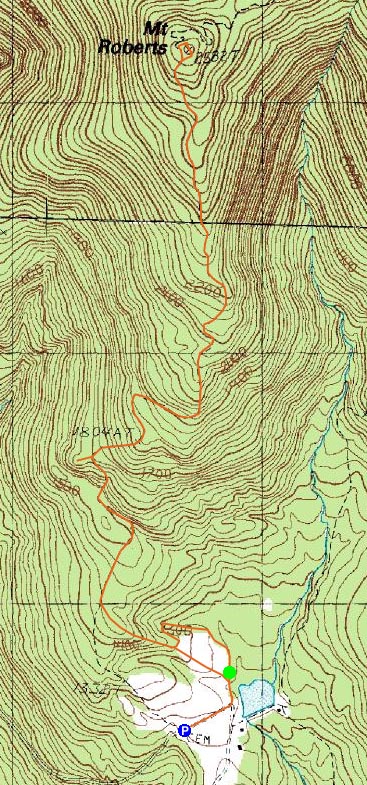
Looking down the icy Mt. Roberts Trail
Route: Mt. Roberts Trail
After hiking Kearsarge North Mountain, I decided I had enough time to head down to Mt. Roberts and do some ice storm cleanup work on the trail. Arriving at the trailhead, I could see it was still very much a nice, blue sky day.
Since I was racing daylight, I tried to get as much trail clean up done as I could prior to reaching the summit, slowing my pace. I found the ledge walk to be particularly beautiful, as the ice offered a neat contrast against the lake backdrop.
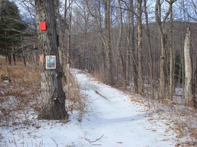
The views from the summit were much better than I've been accustomed to - a white Mount Washington lighted up the horizon, making for great scenery.
The descent was particularly colorful - shortly after passing the ledges, the horizon started to gain color. Reaching the spur trail to a knob, I realized I was well timed to see the sunset. Sure enough, I ended up seeing a nice sunset there and was able to get beautiful colors for the duration of the hike.
| Hike Ratings |
|
Getting To Trailhead: |
Easy |
| Destination: |
Mt. Roberts |
|
Length: |
Moderate |
|
Steepness: |
Moderate |
|
Navigation: |
Easy |
|
Views: |
Excellent |
|
Crowds: |
Minimal |
|
| Hike Stats |
|
Date Hiked: |
Saturday, December 13, 2008 |
| Hike Commenced: |
1:30 PM |
| Parking Elevation: |
1,240' |
| Destination: |
Mt. Roberts |
| Ascent Commenced: |
1:37 PM |
| Summit Reached: |
3:04 PM |
| Time Elapsed: |
01:27 |
| Trailhead Elevation: |
1,250' |
| Summit Elevation: |
2,582' |
| Distance: |
2.5 miles |
| Vertical Gain: |
1,407' |
|
|
| Hike Ended: |
4:34 PM |
| Hike Time Elapsed: |
02:57 |
| Hike Vertical Gain: |
1,582' |
|
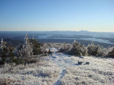
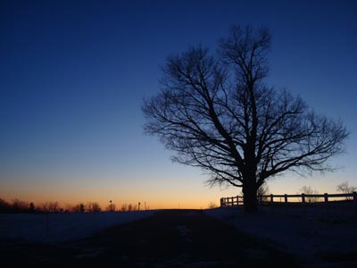
Mt. Roberts Trail trailhead near the horse barn
Looking at Mt. Washington from the Mt. Roberts summit.
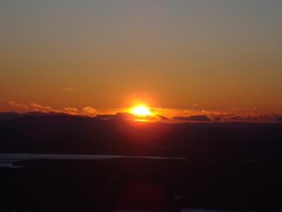
The sunset as seen from the knob near the Mt. Roberts Trail
Sunset colors as seen from the road near the Mt. Roberts Trail trailhead
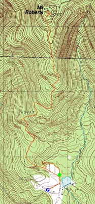

Directions to trailhead: Take Route 109 South from Route 25. Bear left onto Route 171. Shortly thereafter, take a left onto Ossipee Park Road. The small hiker parking lot is located just after the gatehouse, on the right. Continue on the road on foot, taking a left at the intersection. The Mt. Roberts Trail trailhead is located at the corner of the field near the barn.
Back to Mt. Roberts Profile
|