Home
States
Colorado
Connecticut
Maine
Massachusetts
New Hampshire
New York
Rhode Island
Utah
Vermont
View All
Lists
NE 4,000 Footers
NE 100 Highest
NH 4,000 Footers
NH 100 Highest
NH 52 With A View
NH Belknap Range
NH Ossipee 10
Links
Trail Conditions
Trip Log
Sunrises
Sunsets
About
|
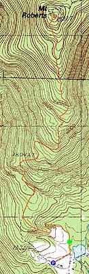
Mt. Roberts
Moultonborough, NH
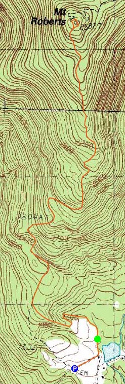
Trailheads, measurements, times, distances, and maps are all approximate and relative to the hike(s) as shown below.
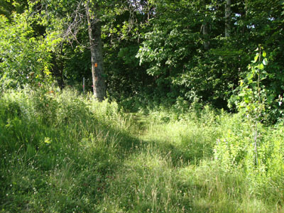
Looking down the Mt. Roberts Trail
Route: Mt. Roberts Trail
With nice weather rolling in during the day, I headed down to Mt. Roberts after a long day at work for a quick hike.
For the first time in the three years I've hiked Mt. Roberts, there were horses in the pasture - neat!
With limited daylight, I jogged the flats. Reaching the ledges, the scenery slowed my progress a bit - and ripe blueberries slowed it even more.
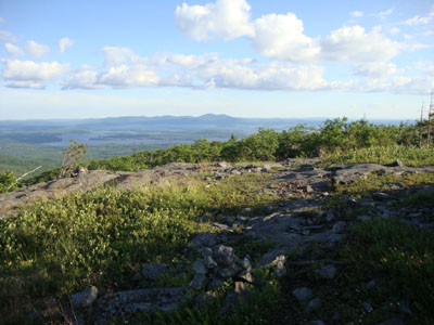
Eventually reaching the summit via the grassy upper carriage road, I found one tick - not bad considering all of the long grass. From the summit, I had decent views to the north, though Mt. Washington was obscured by clouds.
The return trip was slowed once again by blueberries. Between those, the good views, blue sky, and relative brisk air, it was nice to get out!
| Hike Ratings |
|
Getting To Trailhead: |
Easy |
| Destination: |
Mt. Roberts |
|
Length: |
Moderate |
|
Steepness: |
Moderate |
|
Navigation: |
Easy |
|
Views: |
Excellent |
|
Crowds: |
Minimal |
|
| Hike Stats |
|
Date Hiked: |
Tuesday, June 29, 2010 |
| Hike Commenced: |
5:58 PM |
| Parking Elevation: |
1,240' |
| Destination: |
Mt. Roberts |
| Ascent Commenced: |
6:01 PM |
| Summit Reached: |
6:50 PM |
| Time Elapsed: |
00:49 |
| Trailhead Elevation: |
1,250' |
| Summit Elevation: |
2,582' |
| Distance: |
2.5 miles |
| Vertical Gain: |
1,407' |
|
|
| Hike Ended: |
7:47 PM |
| Hike Time Elapsed: |
01:49 |
| Hike Vertical Gain: |
1,582' |
|
Mt. Roberts Trail trailhead near the horse barn
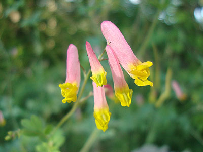
Pale Corydalis as seen along the Mt. Roberts Trail

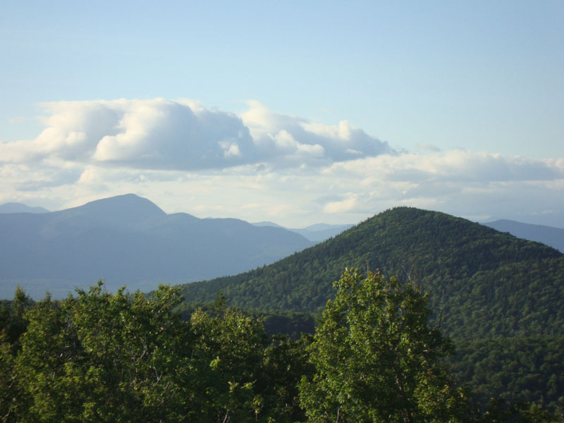
Mt. Passaconaway and Black Snout as seen from the Mt. Roberts summit.

Directions to trailhead: Take Route 109 South from Route 25. Bear left onto Route 171. Shortly thereafter, take a left onto Ossipee Park Road. The small hiker parking lot is located just after the gatehouse, on the right. Continue on the road on foot, taking a left at the intersection. The Mt. Roberts Trail trailhead is located at the corner of the field near the barn.
Back to Mt. Roberts Profile
|