Home
States
Colorado
Connecticut
Maine
Massachusetts
New Hampshire
New York
Rhode Island
Utah
Vermont
View All
Lists
NE 4,000 Footers
NE 100 Highest
NH 4,000 Footers
NH 100 Highest
NH 52 With A View
NH Belknap Range
NH Ossipee 10
Links
Trail Conditions
Trip Log
Sunrises
Sunsets
About
|
Mt. Rowe
Gilford, NH
Trailheads, measurements, times, distances, and maps are all approximate and relative to the hike(s) as shown below.

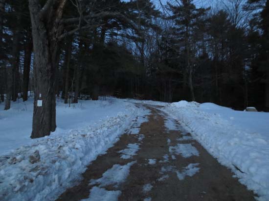
Looking down the Ridge Trail near the top of Mt. Rowe
Route: Ridge Trail, bushwhack
First portion of Ridge Trail (aka Try Me Trail) was plowed up to the top ski jump side trail. Above there, the trail was groomed all the way to the summit. I wore snowshoes for this portion, but it looks like others booted without issue.
Went partway across the ridge to the open viewpoint - snowshoes definitely recommended for this. Probably 1.5 feet of snowpack with a breakable crust on top (some deeper drifts as well).
Bushwhacked down the top of the abandoned Fletcher Hale Trail (decade old sapling growth on this portion, so too tight for skiing). Eventually it emptied into a somewhat cleared slope with some brush sticking open, then into the cross country ski trail network (snowshoes or XC skis required), then into the plowed area at the bottom of the largest ski jump. From there I walked the plowed paved access road back to the base lodge.
| Hike Ratings |
|
Getting To Trailhead: |
Easy |
| Destination: |
Mt. Rowe |
|
Length: |
Easy |
|
Steepness: |
Moderate |
|
Navigation: |
Moderate |
|
Views: |
Excellent |
|
Crowds: |
Minimal |
|
| Hike Stats |
|
Date Hiked: |
Thursday, February 14, 2013 |
| Parking Elevation: |
935' |
| Destination: |
Mt. Rowe |
| Time Elapsed: |
00:22 |
| Trailhead Elevation: |
935' |
| Summit Elevation: |
1,680' |
| Vertical Gain: |
745' |
|
|
| Hike Time Elapsed: |
01:43 |
| Hike Vertical Gain: |
785' |
|
The Ridge Trail trailhead
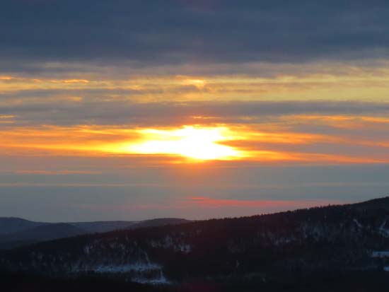
Sunrise from near the summit of Mt. Rowe
Directions to trailhead: Take Route 11A to Gunstock entrance, parking lot near the base lodge of the ski area. Trailhead is on the other side of the base lodge, near the skateboard park.
Back to Mt. Rowe Profile
|

