Home
States
Colorado
Connecticut
Maine
Massachusetts
New Hampshire
New York
Rhode Island
Utah
Vermont
View All
Lists
NE 4,000 Footers
NE 100 Highest
NH 4,000 Footers
NH 100 Highest
NH 52 With A View
NH Belknap Range
NH Ossipee 10
Links
Trail Conditions
Trip Log
Sunrises
Sunsets
About
|
Mt. Rowe
Gilford, NH
Trailheads, measurements, times, distances, and maps are all approximate and relative to the hike(s) as shown below.
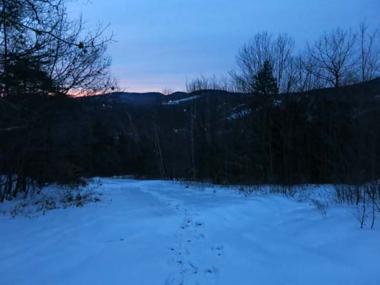
Looking down the Ridge Trail
Route: Ridge Trail
First portion of Belknap Range Trail (ie White blazed trail ie tower access road) was plowed. Above the ski jump turn off, there were a pair of snowshoe tracks heading up to the tower. Generally about 1-2" of sugar snow under a breakable ice crust. I was able to bareboot up the snowshoe tracks without sinking or slipping. Up on the ridge, the snowshoe track was a bit more defined, but once again bootable. That said, if doing a longer hike on lesser used trails in the area right now, I suspect snowshoes would be the best choice.
| Hike Ratings |
|
Getting To Trailhead: |
Easy |
| Destination: |
Mt. Rowe |
|
Length: |
Easy |
|
Steepness: |
Moderate |
|
Navigation: |
Moderate |
|
Views: |
Excellent |
|
Crowds: |
Minimal |
|
| Hike Stats |
|
Date Hiked: |
Tuesday, December 6, 2015 |
| Parking Elevation: |
935' |
| Destination: |
Mt. Rowe |
| Time Elapsed: |
00:16 |
| Trailhead Elevation: |
935' |
| Summit Elevation: |
1,680' |
| Vertical Gain: |
745' |
|
|
| Hike Time Elapsed: |
01:09 |
| Hike Vertical Gain: |
765' |
|
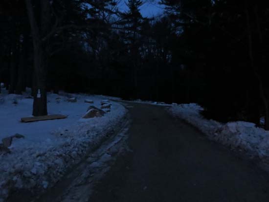
The Ridge Trail trailhead
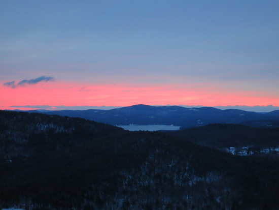
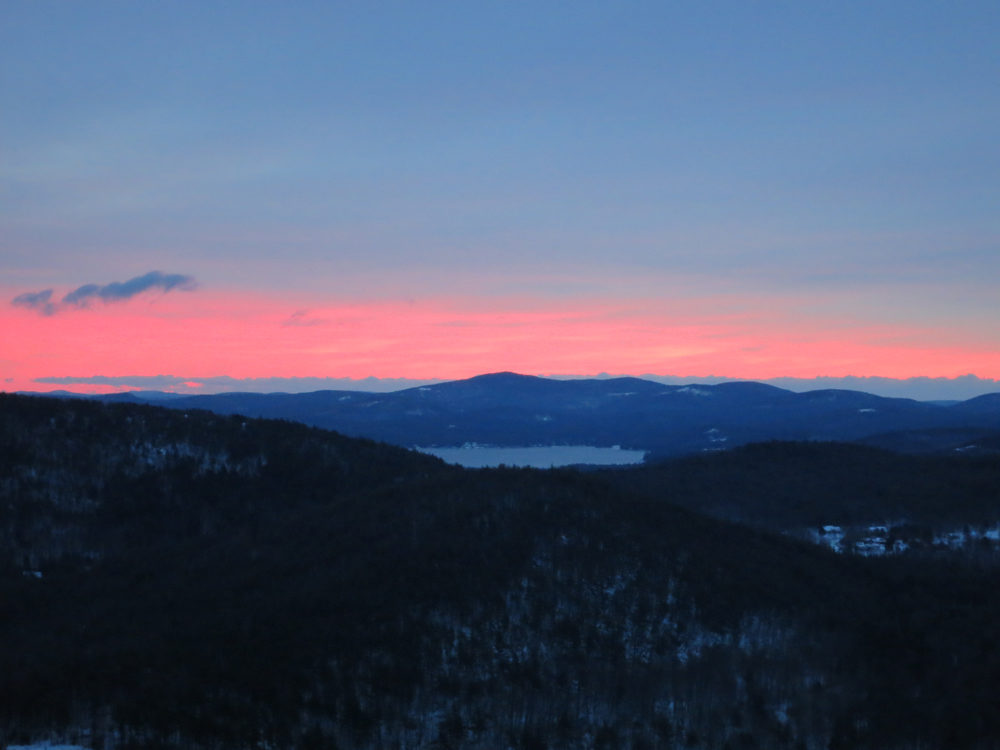
The sunrise from the south ridge of Mt. Rowe
Directions to trailhead: Take Route 11A to Gunstock entrance, parking lot near the base lodge of the ski area. Trailhead is on the other side of the base lodge, near the skateboard park.
Back to Mt. Rowe Profile
|