Home
States
Colorado
Connecticut
Maine
Massachusetts
New Hampshire
New York
Rhode Island
Utah
Vermont
View All
Lists
NE 4,000 Footers
NE 100 Highest
NH 4,000 Footers
NH 100 Highest
NH 52 With A View
NH Belknap Range
NH Ossipee 10
Links
Trail Conditions
Trip Log
Sunrises
Sunsets
About
|
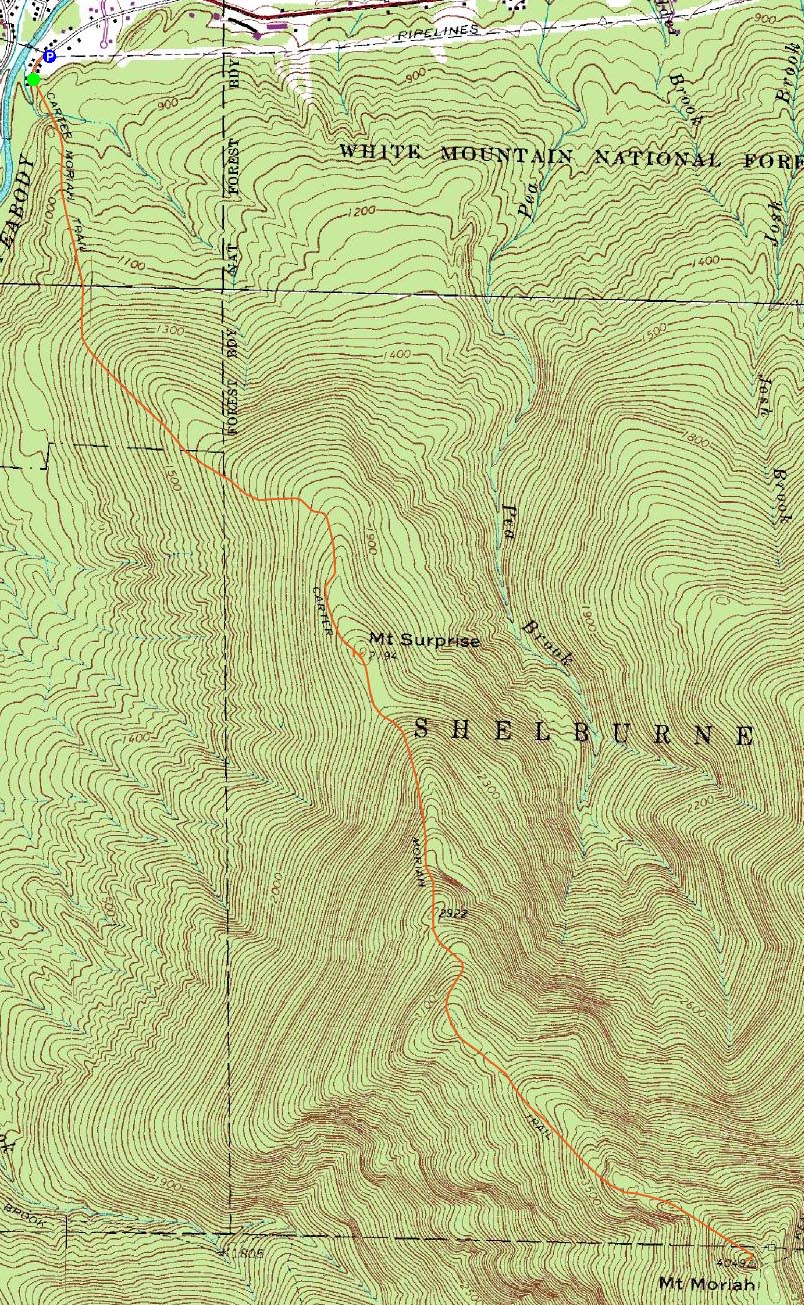
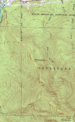
Mt. Surprise, Mt. Moriah
Gorham, NH, Shelburne, NH, Bean's Purchase, NH
Trailheads, measurements, times, distances, and maps are all approximate and relative to the hike(s) as shown below.
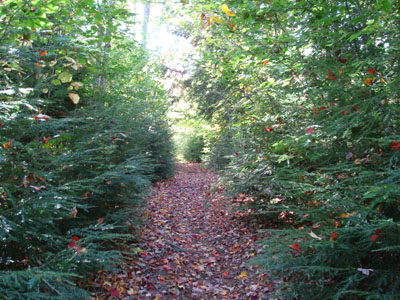
Looking up the Carter Moriah Trail on the way to Mt. Surprise
Route: Carter Moriah Trail, (Mt. Surprise), Carter Moriah Trail, (Mt. Moriah), Carter Moriah Trail
After a busy Saturday, complete with lots of driving and a late bedtime, my options were somewhat limited due to lack of energy and time (still had a full day of work remaining before Monday morning). Answer? Mt. Moriah.
Arriving at the trailhead, there was no room - I didn't want to park on someone's lawn, so I backtracked down the road to a dirt parking lot of sorts under some high tension lines.
The Carter Moriah Trail started off with a quick, moderate ascent before becoming more gradual. For most of the hike to Mt. Surprise, the trail was essentially an old logging road of sorts.
Though Mt. Surprise is not marked as such, my best guess is that it is to the left of the trail just after the first set of open ledges. Immediately behind the wooded summit is a neat split rock of sorts - a straight 2.5 to 3 foot wide cut down the middle. The ledges below Mt. Surprise offered nice, though obstructed by the occasional tree, views of the Northern Presidentials.
Continuing up the Carter Moriah Trail, things started to get more aggressive - there were multiple small scrambles up a series of ledges. The views at this point were much better than the good views on Mt. Surprise.
After awhile, the trail ducks into the woods and follows a set of very rotten bog-logs. I don't know how old these are, but they're about as solid as Carrot Top's career. Pretty soon it may be wet and muddy!
The trail continued its ascent - flats and dips and short steep pitches. At this point, there were multiple places where I thought I could see blue sky above Mt. Moriah through the trees - not the case though, as it was a bit south of where I was looking.
Eventually, I hit the last ascent - steep, wet, and rocky. Rounding a corner, I was at the summit and the excellent rock viewpoint with a small crowd.
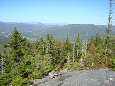
The views were excellent - the Presidentials, Kearsarge North, the Evans Notch peaks, Old Speck, and even some of the Maine 4,000 footers further north were all easily seen.
After chatting a bit and having lunch, I headed back. Just a bit before Mt. Surprise, a big yellow jacket came out of nowhere and stung me just below my elbow. There was a little bit of swelling at first, but a day later big time swelling! No clue where he came from or why he stung me, but nonetheless it was all rather vexing!
The soundtrack of the descent was Loose Fur's Loose Fur album, Ben Folds' Songs For Silverman, and the Moody Blues' In Search of the Lost Chord. And no, the lost chord is not B. Wow, what a lame joke.
| Hike Ratings |
|
Getting To Trailhead: |
Easy |
| Destination: |
Mt. Surprise |
|
Length: |
Moderate |
|
Steepness: |
Moderate |
|
Navigation: |
Easy |
|
Views: |
Excellent |
|
Crowds: |
Minimal |
| Destination: |
Mt. Moriah |
|
Length: |
Moderate |
|
Steepness: |
Very Difficult |
|
Navigation: |
Easy |
|
Views: |
Excellent |
|
Crowds: |
Heavy |
|
| Hike Stats |
|
Date Hiked: |
Sunday, September 30, 2007 |
| Hike Commenced: |
11:16 AM |
| Parking Elevation: |
790' |
| Destination: |
Mt. Surprise |
| Ascent Commenced: |
11:17 AM |
| Summit Reached: |
12:03 PM |
| Time Elapsed: |
00:46 |
| Trailhead Elevation: |
790' |
| Summit Elevation: |
2,194' |
| Distance: |
2 miles |
| Vertical Gain: |
1,434' |
| Destination: |
Mt. Moriah |
| Ascent Commenced: |
12:06 PM |
| Summit Reached: |
1:19 PM |
| Time Elapsed: |
01:13 |
| Trailhead Elevation: |
2,185' |
| Summit Elevation: |
4,049' |
| Distance: |
2.5 miles |
| Vertical Gain: |
2,134' |
|
|
| Hike Ended: |
4:06 PM |
| Hike Time Elapsed: |
04:50 |
| Hike Distance: |
9 miles |
| Hike Vertical Gain: |
3,878' |
|
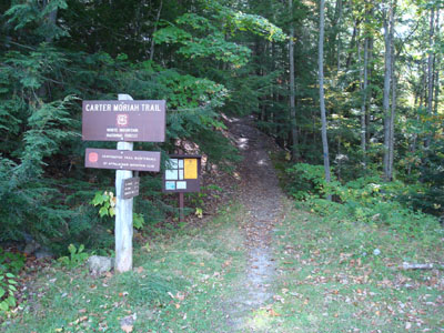
The Carter Moriah Trail trailhead on Bangor Street

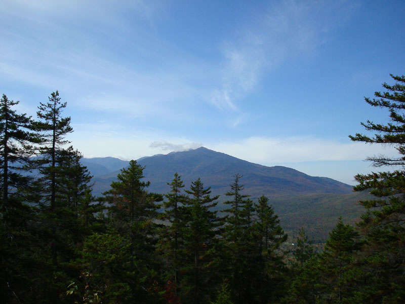
Looking west southwest at Mt. Madison from the ledges below the Mt. Surprise summit
Looking down the Carter Moriah Trail on the way to Mt. Moriah

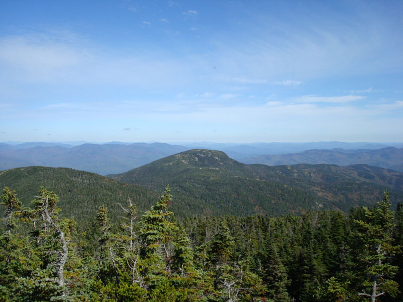
Looking northeast at Shelburne Moriah Mountain from Mt. Moriah

Directions to trailhead: Take Route 16 North to Gorham, then take US 2 East. Just after crossing the river, take a right onto Bangor Street. There is limited parking at the trailhead and at a dirt lot under some power lines. Trailhead is at the end of this street on the left.
Back to Mt. Surprise Profile
Back to Mt. Moriah Profile
|