Home
States
Colorado
Connecticut
Maine
Massachusetts
New Hampshire
New York
Rhode Island
Utah
Vermont
View All
Lists
NE 4,000 Footers
NE 100 Highest
NH 4,000 Footers
NH 100 Highest
NH 52 With A View
NH Belknap Range
NH Ossipee 10
Links
Trail Conditions
Trip Log
Sunrises
Sunsets
About
|
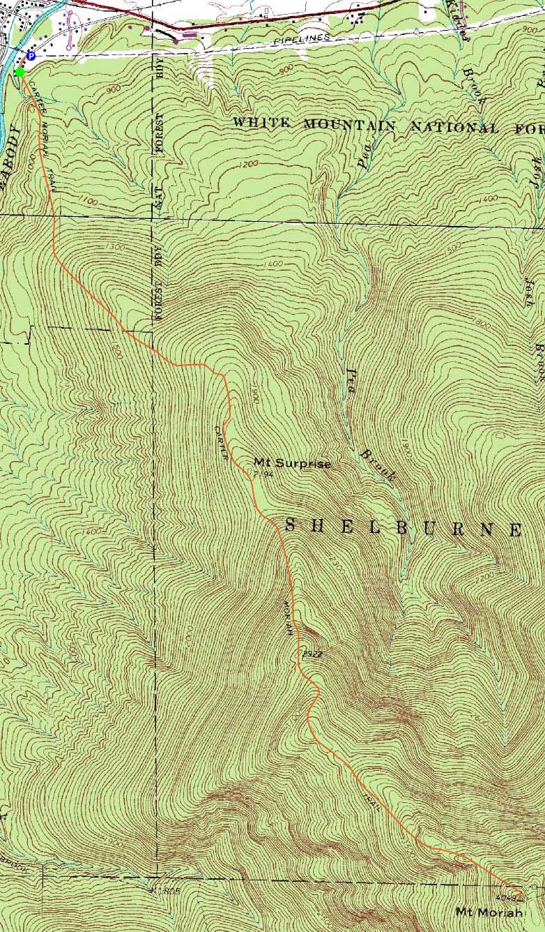
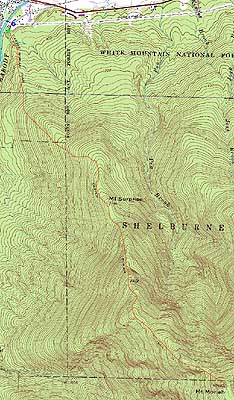
Mt. Surprise, Mt. Moriah
Gorham, NH, Shelburne, NH, Bean's Purchase, NH
Trailheads, measurements, times, distances, and maps are all approximate and relative to the hike(s) as shown below.
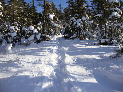
Looking up the Carter Moriah Trail on the way to Mt. Surprise
Route: Carter Moriah Trail
After a more-energy-and-time-consuming-than-expected hike up Mt. Jackson in the morning, I was tempted to call it a day. Common sense didn't prevail, however, as I grabbed a quick bite to eat and headed up to Gorham.
While the first quarter mile or so of the Carter Moriah Trail was bare, things soon became white. At first, the footbed was wet, but snow free. Well before reaching Mt. Surprise, though, the snow closed in on the trail. Nonetheless, due to lots of bareboot traffic, I was able to continue over the Mt. Surprise ledges (nice views of the Presidentials emerging from the clouds) barebootedly.
Reaching the second set of ledges above Mt. Surprise, tracks departed in multiple directions. Donning my snowshoes, I followed what seemed to be the best ones in a circle, prior to finding the entrance back into the woods. While I probably should have taken off the snowshoes at this point, I continued with them on all the way to the summit, over the countless ups, downs, and false hope moments. Due to the bareboot traffic, it was less than comfortable to be wearing the shoes, as the center packed nature of the footbed resulted in slanted snowshoes. Not able to correct this with snowshoe packing on the ascent, I took them off for the descent.
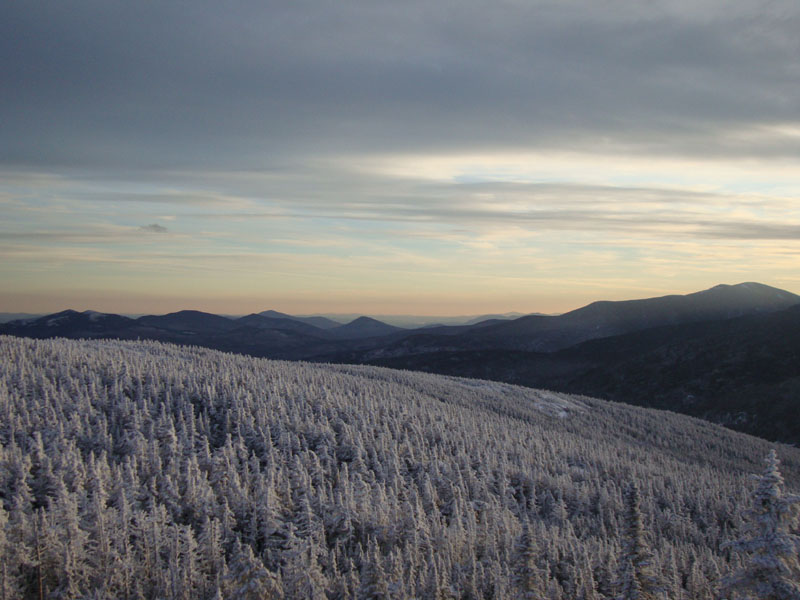
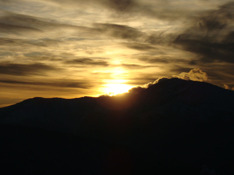
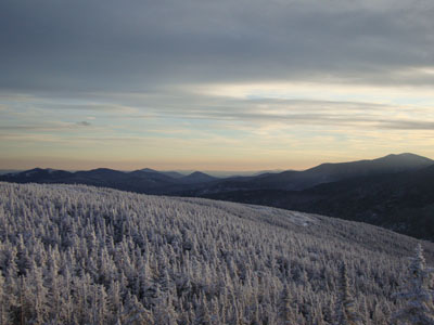
The views from the summit were quite striking - I had summitted about half an hour later than I had hoped, which wasn't necessarily a bad thing, as the sun was just about to set behind Mt. Washington. While I was tempted to wait and see if the colors were going to continue to improve (very little wind and mild temperatures made for easy viewing), my injured knee started to stiffen up dramatically - it was time to go.
With a nearly full, waxing moon, I was able to walk most of the way back without needing my headlamp. While the trail seemed to go on forever, the open ledge portions were quite enjoyable, as they were backlit with the lights of Gorham, Pine Mountain, and Mt. Washington. Finally reaching the trailhead, I was glad to be getting down, getting done, and on my way to getting dinner.
| Hike Ratings |
|
Getting To Trailhead: |
Easy |
| Destination: |
Mt. Surprise |
|
Length: |
Moderate |
|
Steepness: |
Moderate |
|
Navigation: |
Easy |
|
Views: |
Excellent |
|
Crowds: |
Minimal |
| Destination: |
Mt. Moriah |
|
Length: |
Moderate |
|
Steepness: |
Very Difficult |
|
Navigation: |
Moderate |
|
Views: |
Excellent |
|
Crowds: |
Minimal |
|
| Hike Stats |
|
Date Hiked: |
Sunday, November 29, 2009 |
| Hike Commenced: |
12:35 PM |
| Parking Elevation: |
790' |
| Destination: |
Mt. Moriah |
| Ascent Commenced: |
12:36 PM |
| Summit Reached: |
3:38 PM |
| Time Elapsed: |
03:02 |
| Trailhead Elevation: |
790' |
| Summit Elevation: |
4,049' |
| Distance: |
4.5 miles |
| Vertical Gain: |
3,558' |
|
|
| Hike Ended: |
6:39 PM |
| Hike Time Elapsed: |
06:04 |
| Hike Distance: |
9 miles |
| Hike Vertical Gain: |
3,868' |
|
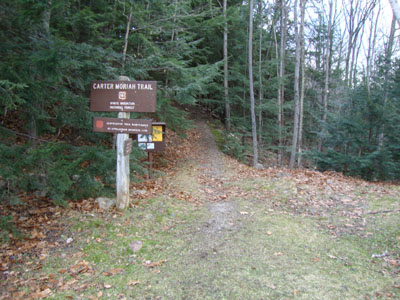
The Carter Moriah Trail trailhead on Bangor Street
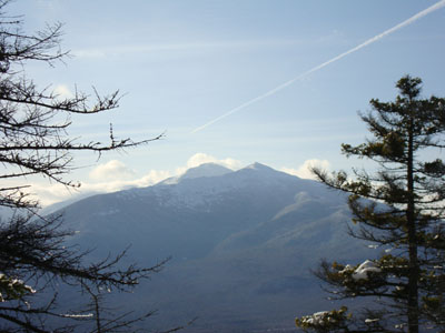
Looking at Mt. Madison and Mt. Adams from the ledges below the Mt. Surprise summit
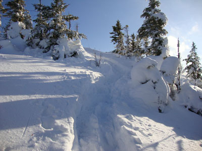
Looking up the Carter Moriah Trail between Mt. Surprise and Mt. Moriah
Looking into the Wild River wilderness from Mt. Moriah

The sunset as seen from Mt. Moriah
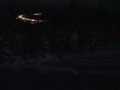
Descending the moonlit Carter Moriah Trail with Gorham in the background

Directions to trailhead: Take Route 16 North to Gorham, then take US 2 East. Just after crossing the river, take a right onto Bangor Street. Trailhead is at the end of this street on the left. There is limited parking at the trailhead.
Back to Mt. Surprise Profile
Back to Mt. Moriah Profile
|