Home
States
Colorado
Connecticut
Maine
Massachusetts
New Hampshire
New York
Rhode Island
Utah
Vermont
View All
Lists
NE 4,000 Footers
NE 100 Highest
NH 4,000 Footers
NH 100 Highest
NH 52 With A View
NH Belknap Range
NH Ossipee 10
Links
Trail Conditions
Trip Log
Sunrises
Sunsets
About
|
Neville Peak, Nottingham Mountain
Epsom, NH, Deerfield, NH
Trailheads, measurements, times, distances, and maps are all approximate and relative to the hike(s) as shown below.
Leaving Tarlton Road on the way to Neville Peak
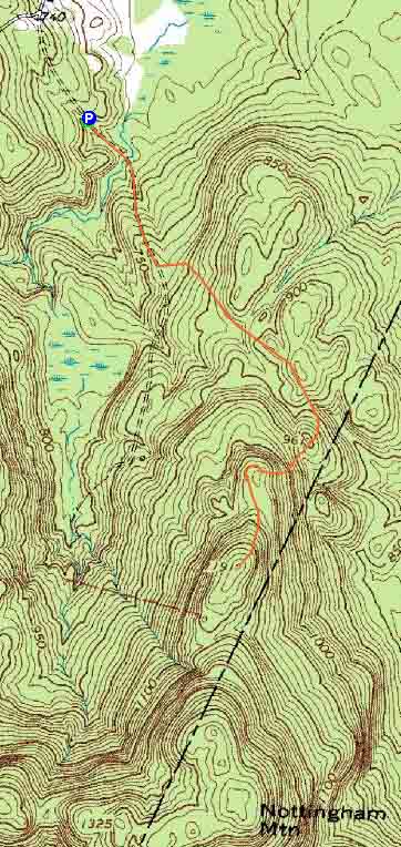
Route: Tarlton Road, Neville Peak Trail, (Neville Peak), woods road, bushwhack, (Nottingham Mountain), woods road, bushwhack, woods road, (Neville Peak), Neville Peak Trail, Tarlton Road
Trails were generally dry.
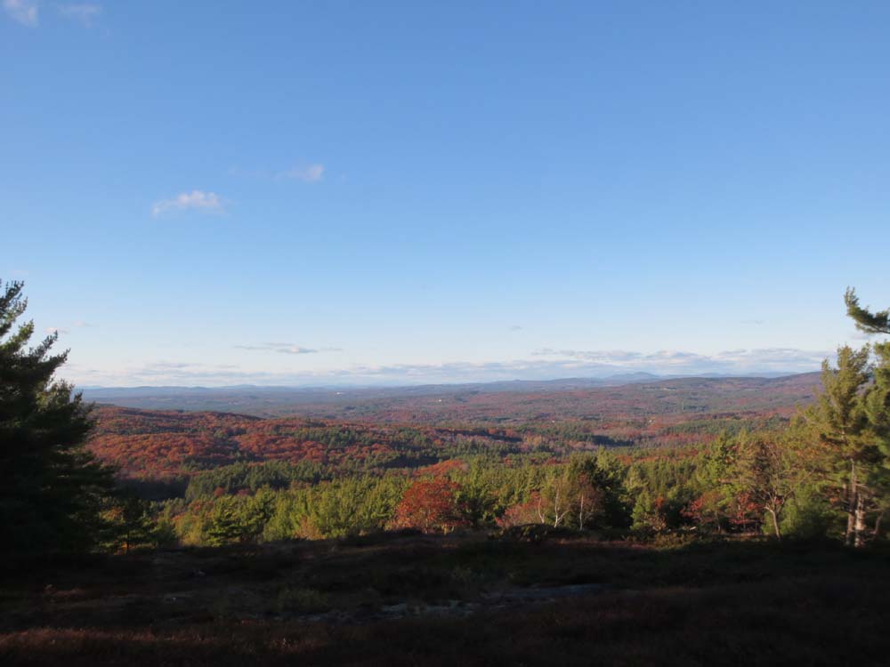
Took the gated Tarlton Road walk to the large cellarhole (on the right), then took a left onto snowmobile corridor 361E. Maybe 1/10 mile later at a fork, I went right onto a flagged trail (I believe Neville Peak Trail), which lead up to the Neville Peak ledges. Looks like portions are somewhat new, but footbed was apparent in others. Excellent views from the summit, as well as a couple of directional views prior.
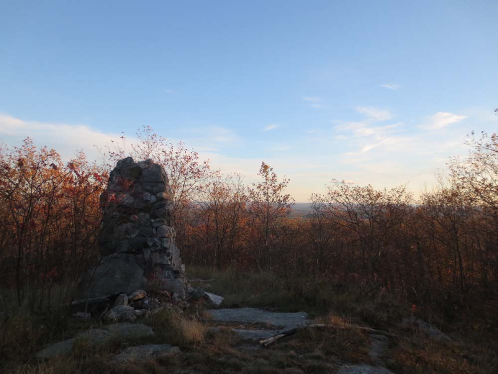
From there, I followed a road north, then continued downhill on it, hoping to hit another old road (which turned out to be a drainage). I then bushwhacked up to Nottingham Mountain in mostly open woods, passing over a few ledgey areas with partial views. Soon thereafter, I ran into the jeep road on Nottingham Mountain. Not much in way of views from the summit area, except of an old chimney and outhouse.
I then followed the road briefly, but resumed bushwhacking to Neville, as the road continued southwest (whereas I came from the north).
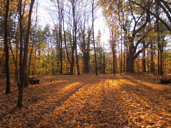
Though foliage is definitely past peak, there were a few isolated areas with great color still.
Very neat area that will warrant some more exploration. May be worthy of inclusion in the next AMC Southern New Hampshire Guide.
| Hike Ratings |
|
Getting To Trailhead: |
Easy |
| Destination: |
Neville Peak |
|
Length: |
Moderate |
|
Steepness: |
Moderate |
|
Navigation: |
Moderate |
|
Views: |
Excellent |
|
Crowds: |
Minimal |
| Destination: |
Nottingham Mountain |
|
Length: |
Moderate |
|
Steepness: |
Moderate |
|
Navigation: |
Difficult |
|
Views: |
Minimal |
|
Crowds: |
Minimal |
|
| Hike Stats |
|
Date Hiked: |
Friday, October 25, 2013 |
| Parking Elevation: |
700' |
| Destination: |
Neville Peak |
| Time Elapsed: |
00:28 |
| Trailhead Elevation: |
700' |
| Summit Elevation: |
1,191' |
| Distance: |
1.5 miles |
| Vertical Gain: |
611' |
| Destination: |
Nottingham Mountain |
| Time Elapsed: |
00:29 |
| Trailhead Elevation: |
1,191' |
| Summit Elevation: |
1,345' |
| Vertical Gain: |
365' |
|
|
| Hike Time Elapsed: |
01:47 |
| Hike Vertical Gain: |
1,126' |
|
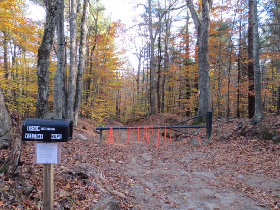
The Tarlton Road gate

Looking northwest from Neville Peak
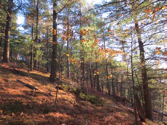
Open woods bushwhacking on the way up Nottingham Mountain
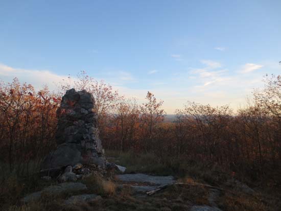
Probably once a nice southern viewpoint on Nottingham Mountain
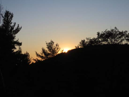
The sunset from Neville Peak

Directions to trailhead: From the Epsom traffic circle, take US 202 East, then take a right onto Center Hill Road. Soon thereafter, take a right onto Mountain Road. At a fork, bear left onto Tarlton Road. Soon thereafter, a small parking lot will be located on the left, next to the gate.
Back to Neville Peak Profile
Back to Nottingham Mountain Profile
|