Home
States
Colorado
Connecticut
Maine
Massachusetts
New Hampshire
New York
Rhode Island
Utah
Vermont
View All
Lists
NE 4,000 Footers
NE 100 Highest
NH 4,000 Footers
NH 100 Highest
NH 52 With A View
NH Belknap Range
NH Ossipee 10
Links
Trail Conditions
Trip Log
Sunrises
Sunsets
About
|
North Bald Cap
Success, NH
Trailheads, measurements, times, distances, and maps are all approximate and relative to the hike(s) as shown below.
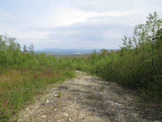
Looking down the logging road
Route: Logging roads, bushwhack
Logging roads and woods were dry and quite dusty (lots of pollen).
From where we parked at 1,850 feet (northwest of the peak), we took a left onto another logging road, dead ending at a landing at about 2,020 feet. The regrowth above it is initially unsavory due to prickers. On the descent, we stayed alongside the brook, which hadn't been logged and was relatively open woods.
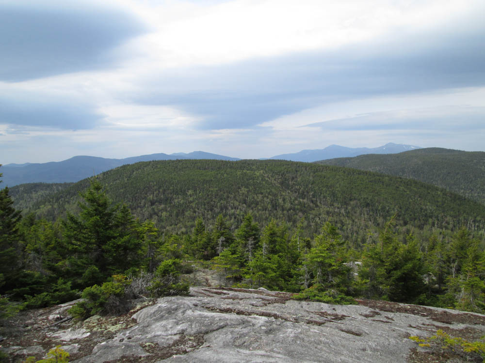
Above the logged area, the woods were generally open (hardwoods and then softwoods; the logging road on the USGS map is still there and possibly viable), transitioning into ledges. Fantastic views of the Kilkenny Ridge, Presidentials, and Evans Notch.
The recognized highpoint was a very short, but somewhat scrappy bushwhack from the ledges.
We then bushwhacked to some of the eastern ledges, which also had great views (Success, Old Speck). From there we could also see the back up plan still was unsavory (going in from the logging east of the peak, which I had gone through to get to the Mahoosuc Trail a few years back) due to regrowth and slash.
Overall, a very nice peak. Amazing there isn't a trail to the ledges.
| Hike Ratings |
|
Getting To Trailhead: |
Moderate |
| Destination: |
North Bald Cap |
|
Length: |
Moderate |
|
Steepness: |
Difficult |
|
Navigation: |
Difficult |
|
Views: |
Excellent |
|
Crowds: |
Minimal |
|
| Hike Stats |
|
Date Hiked: |
Monday, May 25, 2015 |
| Parking Elevation: |
1,850' |
| Destination: |
North Bald Cap |
| Time Elapsed: |
01:02 |
| Trailhead Elevation: |
1,850' |
| Summit Elevation: |
2,893' |
| Vertical Gain: |
1,093' |
|
|
| Hike Time Elapsed: |
02:34 |
| Hike Vertical Gain: |
1,143' |
|
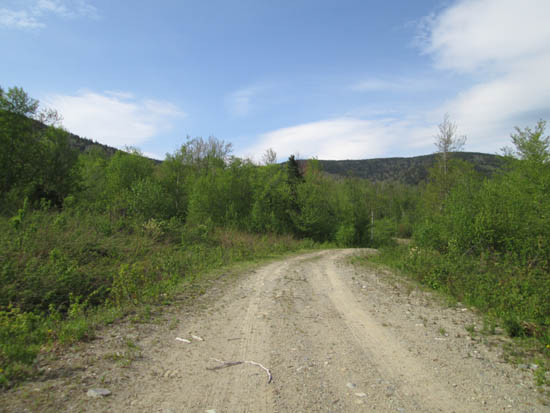
The logging road prior to the pulled culvert
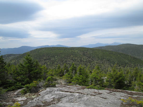
Looking at the Carter-Moriah and Presidential Ranges from the southern North Bald Cap ledges
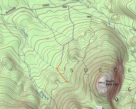

Directions to trailhead: From Success Pond Road outside of Berlin, we turned onto the logging road located between the Success Outlook and North Bald Cap (sign on Success Pond Road for Shelburne Trail), then took an immediate right onto another logging road (the latter not recommended for cars). We parked near the water crossing at about 1,850 feet (bridge/culvert has been pulled).
Back to North Bald Cap Profile
|