Home
States
Colorado
Connecticut
Maine
Massachusetts
New Hampshire
New York
Rhode Island
Utah
Vermont
View All
Lists
NE 4,000 Footers
NE 100 Highest
NH 4,000 Footers
NH 100 Highest
NH 52 With A View
NH Belknap Range
NH Ossipee 10
Links
Trail Conditions
Trip Log
Sunrises
Sunsets
About
|
North Twin Mountain
Bethlehem, NH, Franconia, NH
Trailheads, measurements, times, distances, and maps are all approximate and relative to the hike(s) as shown below.
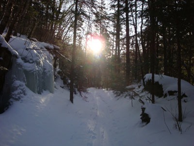
Looking up the North Twin Trail
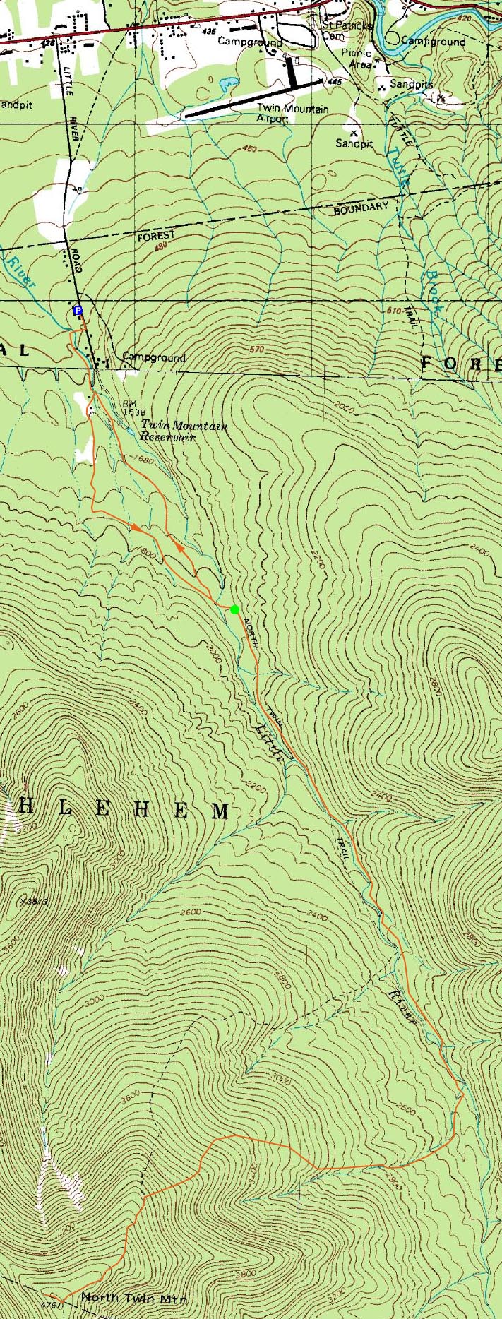
Route: Little River Road, Corridor 11S, Corridor 11 Bypass, Haystack Road, North Twin Trail, herd path, North Twin Trail, view spur path, (North Twin Mountain), view spur path, North Twin Trail, herd path, North Twin Trail, Haystack Road, herd path, Corridor 11 Bypass, Corridor 11N, Little River Road
After staring at it from nearby South Twin a week earlier, I was eager to get to North Twin Mountain. On a cold, increasingly cloudy day, I decided to head up and get North Twin.
Arriving at the 7 Dwarfs restaruant, I paid the very fair $6 parking fee (private property, plowed spaces, warm cafeteria with restroom, direct access to the snowmobile trails), and was soon on my way. Apparently, the temperature was -25 degrees.
Since I was on snowmobile trails, I was able to bareboot for much of the distance to the trailhead. Arriving at Haystack Road, I finally put on my snowshoes and headed to the North Twin Trail.
The North Twin Trail was, at first, fairly well broken out by backcountry skiers. Skipping the first water crossing, I followed the herd path past the entrance to the Firewarden's Trail and was breaking trail thereafter. At first, it was about 3-6" of powder. Beyond the third water crossing, the snow depths started to increase. After crossing the unbridged (but not too tough) brook crossings, the snow was closer to half a foot. Up higher, closer to a foot.
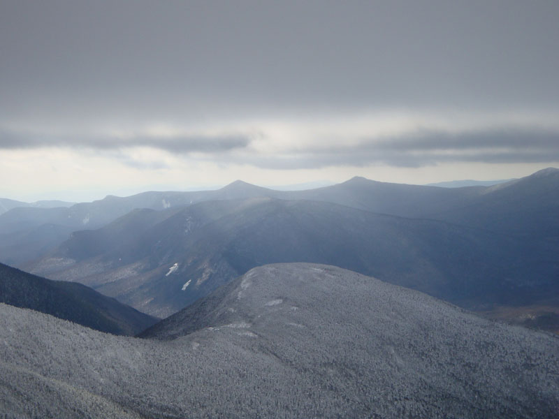
By the time I reached the first viewpoint, the trail was heavily drifted and there were no signs of any previous use. The stretch between viewpoints was also heavily drifted. Arriving at the vista just beyond the summit, I was hit by the first significant winds of the day. The views were decent, though darkened by clouds.
Back at the trail junction, I swapped baselayers and put on some jackets. Other than stopping to cut up blowdowns, the descent wasn't particularly notable, though the additional sunshine that poked through later was nice. Back at the Firewarden's Trail trailhead, I could see there had been a decent amount of skier traffic during the day. Following their tracks after reaching the North Twin Trail trailhead, I made my way down a herd path of sorts, which ended at the west end of the closed bridge. From there, I followed the snowmobile trail back to the 7 Dwarfs and had a hot chocolate.
| Hike Ratings |
|
Getting To Trailhead: |
Difficult |
| Destination: |
North Twin Mountain |
|
Length: |
Difficult |
|
Steepness: |
Difficult |
|
Navigation: |
Moderate |
|
Views: |
Excellent |
|
Crowds: |
Minimal |
|
| Hike Stats |
|
Date Hiked: |
Saturday, January 17, 2009 |
| Hike Commenced: |
8:22 AM |
| Parking Elevation: |
1,560' |
| Destination: |
North Twin Mountain |
| Ascent Commenced: |
8:56 AM |
| Summit Reached: |
11:51 AM |
| Time Elapsed: |
02:55 |
| Trailhead Elevation: |
1,800' |
| Summit Elevation: |
4,761' |
| Distance: |
4.3 miles |
| Vertical Gain: |
3,181' |
|
|
| Hike Ended: |
3:03 PM |
| Hike Time Elapsed: |
06:41 |
| Hike Vertical Gain: |
3,701' |
|
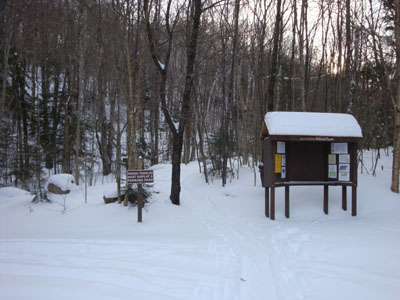
The North Twin Trail at the end of Haystack Road
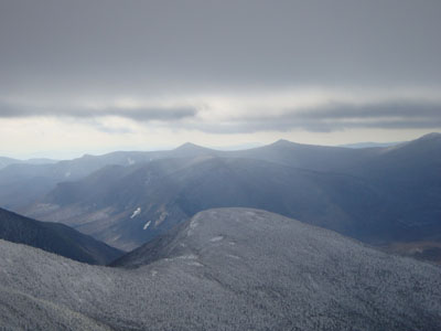
Looking at Galehead and Owl's Head from near the North Twin Mountain summit
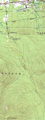

Directions to trailhead: In winter, from Route 302, take Route 3 South into Twin Mountain. Take a left onto Little River Road. About a mile down the road, the 7 Dwarfs Motel will be on the right. The parking fee is 6 dollars and it is asked that dogs be on leash while on the premises. Once parked, walk a hundred or so feet further up Little River Road, then take a right onto an access road marked with two boulders. Cross the bridge, then take an immediate left onto the 11 Corridor Bypass. Continue on this trail, passing the closed bridge on the left and a cellar hole on the right. After passing through an (open) gate and thus reaching Haystack Road, take a left. The North Twin Trail trailhead will be at the end of this road.
Back to North Twin Mountain Profile
|