Home
States
Colorado
Connecticut
Maine
Massachusetts
New Hampshire
New York
Rhode Island
Utah
Vermont
View All
Lists
NE 4,000 Footers
NE 100 Highest
NH 4,000 Footers
NH 100 Highest
NH 52 With A View
NH Belknap Range
NH Ossipee 10
Links
Trail Conditions
Trip Log
Sunrises
Sunsets
About
|
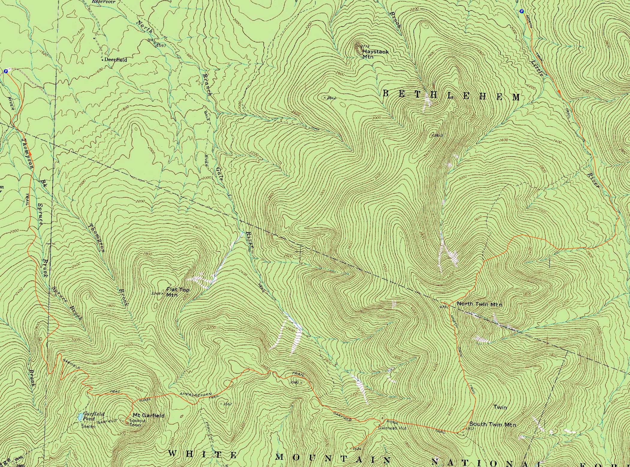
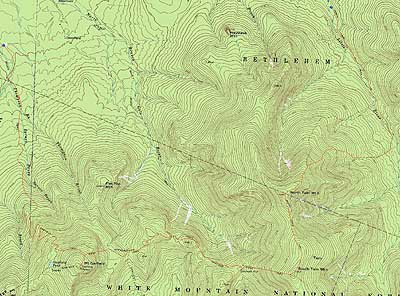
North Twin Mountain, South Twin Mountain, Galehead Mountain, Mt. Garfield
Bethlehem, NH, Franconia, NH
Trailheads, measurements, times, distances, and maps are all approximate and relative to the hike(s) as shown below.
The North Twin Trail
Route: North Twin Trail, herd path, North Twin Trail, view spur path, (North Twin Mountain), view spur path, North Twin Spur, (South Twin Mountain), Twinway, Frost Trail, (Galehead Mountain), Frost Trail, Garfield Ridge Trail, (Mt. Garfield), Garfield Ridge Trail, Garfield Trail
With a promising weather forecast, it looked like a nice day to hike the Twins, Galehead, and Garfield. The forecast called for some morning clearing, as well as clearing in the afternoon. Wrong.
Starting at a busy North Twin Trail trailhead, we headed up the trail, taking the herd path bypass past the first two water crossing. Even with the recent (mild) rain, the third water crossing was rock hopped with relative ease.
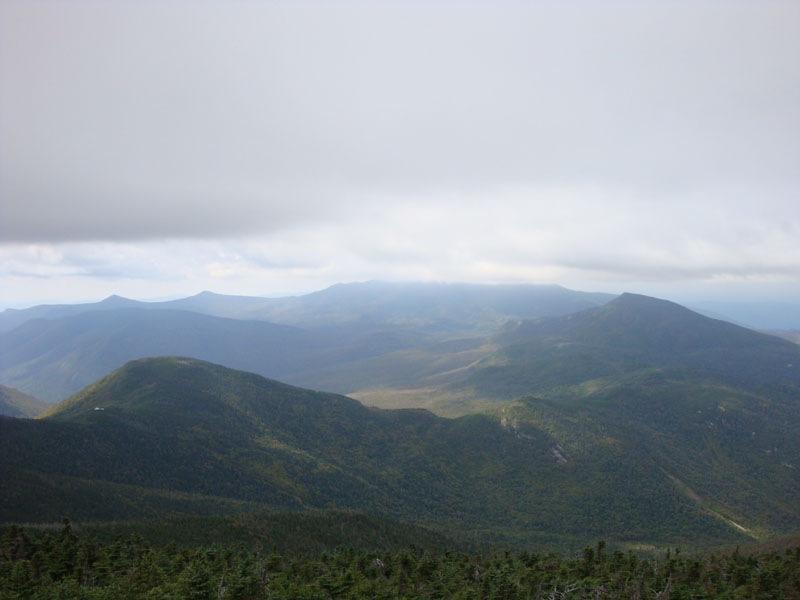
The North Twin Trail was pretty easy going until the steeps - then it was a grind. Reaching the first viewpoint, we were happy to see that the trail corridor had been pruned back - much needed maintenance! Reaching the crowded near-summit vista, we had decent views of Galehead, Owl's Head, and Mt. Garfield - as well as Peak Above the Nubble from a herd path.
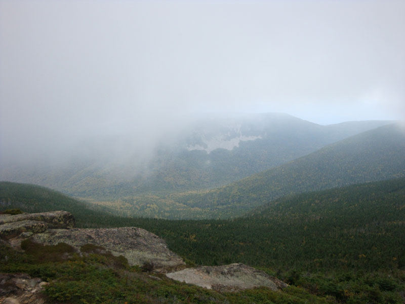
Our next stop was South Twin. Portions of this trail had also been pruned - once again, this was good to see. Reaching the summit, we had a brief view of Zealand Mountain as fog rolled in. Waiting around for awhile, the fog remained in place, resulting in little to no views.
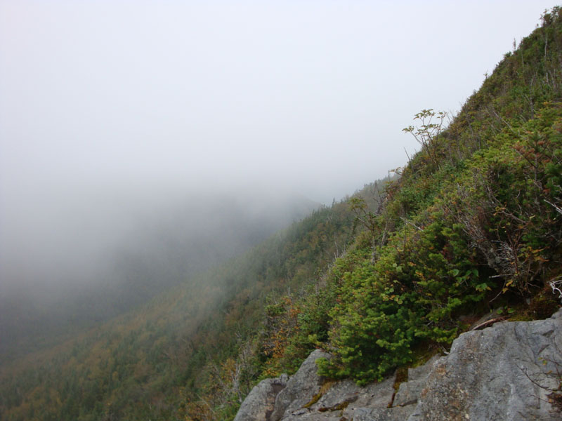
After a steep, rough descent of the Twinway, we worked our way up to Galehead. The views from the summit vista weren't anything particularly great, as the fog continued to roll in and obscure wait remained.
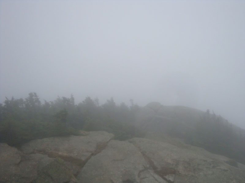
After a leisurely break at the hut for food and hot chocolate, we set foot on the Garfield Ridge Trail. This trail was certainly a butt kicker at the end of the day, with a few ups and downs and a very steep, rough ascent up to the Garfield Trail junction. Reaching the windy summit of Garfield, we once again had no views. Hoping to wait it out and see the afternoon clearing forecasted, an iPhone weather imagery consultation showed that forecast was indeed inaccurate and any waiting would be pointless. Thus, we headed down the Garfield Trail - a welcome, relatively mild descent to end the day.
| Hike Ratings |
|
Getting To Trailhead: |
Moderate |
| Destination: |
North Twin Mountain |
|
Length: |
Moderate |
|
Steepness: |
Difficult |
|
Navigation: |
Easy |
|
Views: |
Excellent |
|
Crowds: |
Heavy |
| Destination: |
South Twin Mountain |
|
Length: |
Difficult |
|
Steepness: |
Difficult |
|
Navigation: |
Easy |
|
Views: |
Moderate (due to weather) |
|
Crowds: |
Moderate |
| Destination: |
Galehead Mountain |
|
Length: |
Difficult |
|
Steepness: |
Difficult |
|
Navigation: |
Easy |
|
Views: |
Moderate (due to weather) |
|
Crowds: |
Moderate |
| Destination: |
Mt. Garfield |
|
Length: |
Difficult |
|
Steepness: |
Difficult |
|
Navigation: |
Easy |
|
Views: |
Minimal (due to weather) |
|
Crowds: |
Minimal |
|
| Hike Stats |
|
Date Hiked: |
Sunday, September 13, 2009 |
| Hike Commenced: |
8:47 AM |
| Parking Elevation: |
1,795' |
| Destination: |
North Twin Mountain |
| Ascent Commenced: |
8:47 AM |
| Summit Reached: |
11:13 AM |
| Time Elapsed: |
02:26 |
| Trailhead Elevation: |
1,800' |
| Summit Elevation: |
4,761' |
| Distance: |
4.3 miles |
| Vertical Gain: |
3,111' |
| Destination: |
South Twin Mountain |
| Ascent Commenced: |
11:20 AM |
| Summit Reached: |
11:56 AM |
| Time Elapsed: |
00:36 |
| Trailhead Elevation: |
4,761' |
| Summit Elevation: |
4,902' |
| Distance: |
1.3 miles |
| Vertical Gain: |
461' |
| Destination: |
Galehead Mountain |
| Ascent Commenced: |
12:06 PM |
| Summit Reached: |
12:58 PM |
| Time Elapsed: |
00:52 |
| Trailhead Elevation: |
4,902' |
| Summit Elevation: |
4,024' |
| Distance: |
1.3 miles |
| Vertical Gain: |
309' |
| Destination: |
Mt. Garfield |
| Ascent Commenced: |
12:58 PM |
| Summit Reached: |
3:36 PM |
| Time Elapsed: |
02:38 |
| Trailhead Elevation: |
4,024' |
| Summit Elevation: |
4,500' |
| Vertical Gain: |
1,245' |
|
|
| Hike Ended: |
6:20 PM |
| Hike Time Elapsed: |
09:33 |
| Hike Vertical Gain: |
5,216' |
|
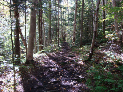
The North Twin Trail at the end of Haystack Road

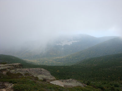
Looking at Galehead and Garfield from near the North Twin summit
The North Twin Spur
Looking at Zealand Mountain as fog overtakes the South Twin summit
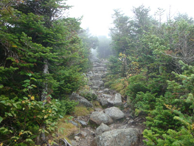
The Twinway between South Twin and Galehead
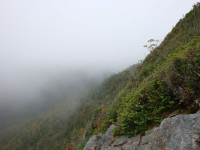
Looking into the fog from the Galehead Mountain vista
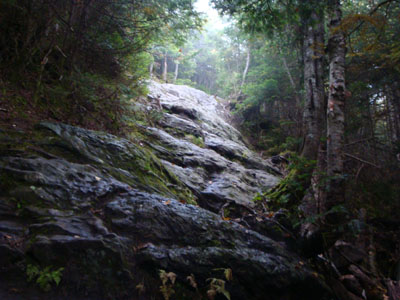
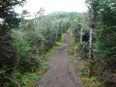
The Garfield Ridge Trail between Galehead and Garfield
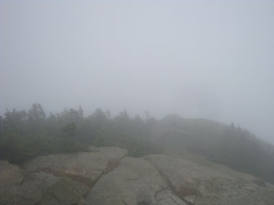
Looking into the fog from the Mt. Garfield summit

Directions to trailhead: From Route 302, take Route 3 South. Almost immediately after the Entering White Mountain National Forest, take a left onto Haystack Road. The WMNF fee parking area is at the end of the road, and the North Twin Trail trailhead is at the back of the lot. To reach the Garfield Trail trailhead, take Route 3 South from Haystack Road. Due to bridges being out on the west end of Gale River Road, take a left onto Gale River Road at the Five Corners junction. Bear left at the first fork, then take a right at the second fork, passing the Gale River Trail parking area. A few minutes later, the Garfield Trail WMNF fee hiker parking area is on the left, just before the Garfield Trail trailhead
Back to North Twin Mountain Profile
Back to South Twin Mountain Profile
Back to Galehead Mountain Profile
Back to Mt. Garfield Profile
|