Home
States
Colorado
Connecticut
Maine
Massachusetts
New Hampshire
New York
Rhode Island
Utah
Vermont
View All
Lists
NE 4,000 Footers
NE 100 Highest
NH 4,000 Footers
NH 100 Highest
NH 52 With A View
NH Belknap Range
NH Ossipee 10
Links
Trail Conditions
Trip Log
Sunrises
Sunsets
About
|
North Twin Mountain, South Twin Mountain, Galehead Mountain
Bethlehem, NH, Franconia, NH
Trailheads, measurements, times, distances, and maps are all approximate and relative to the hike(s) as shown below.
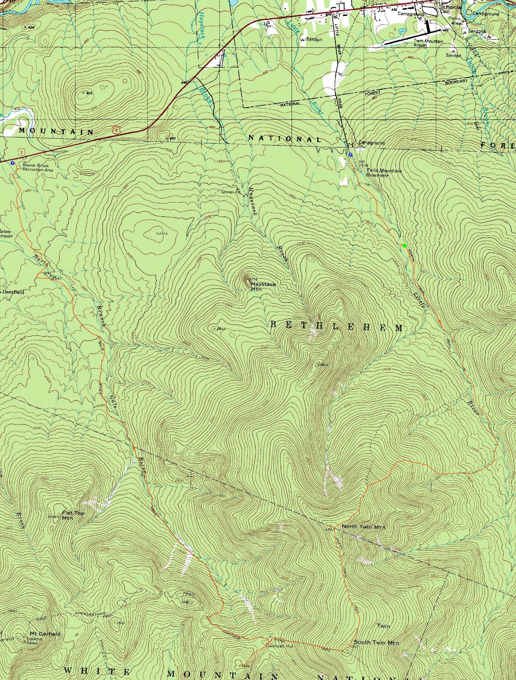
The North Twin Trail
Route: Herd path, Haystack Road, North Twin Trail, herd path, North Twin Trail, view spur path, (North Twin Mountain), view spur path, North Twin Spur, (South Twin Mountain), Twinway, Frost Trail, (Galehead Mountain), Frost Trail, Garfield Ridge Trail, Gale River Trail, Gale River Road, connector trail, Beaver Brook XC Ski Trail
With the weather forecast being poor but bearable, we headed over to the Twins. After spotting vehicles at Beaver Brook off US 3, we parked at the end of Little River Road, crossed the snowmobile bridge, and headed up the herd path to the summer trailhead.
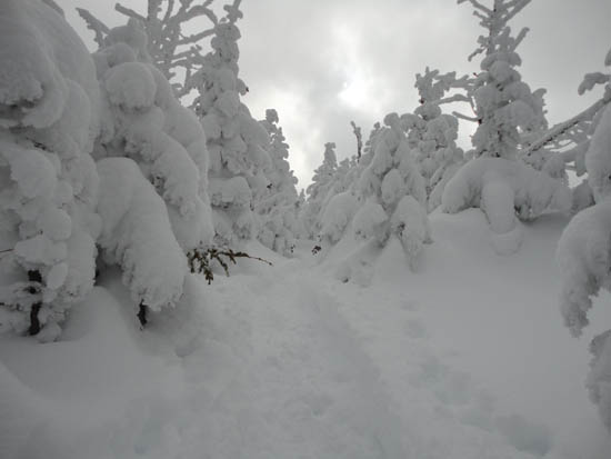
Beyond the entrance to the Firewarden's Trail, the water crossing bypass herd path and North Twin Trail were both previously broken out, but not well packed. With a few inches of fresh powder and the unconsolidated base, some effort was required to get up to North Twin. Fortunately, the Little River crossing was fairly solidly bridged.
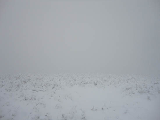
Reaching the summit of North Twin, we were in the clouds. Continuing over to South Twin, we found the North Twin Spur to be much easier to follow than in previous winters, due to trail brushing and blazing. Once again, we had no views on South Twin (but fortunately minimal winds).
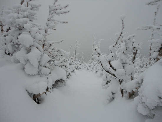
The descent on the Twinway was fairly smooth, as all of the ice was covered in a decent base of snow. Passing by the hut, we took the sidetrip to Galehead Mountain, then regrouped and headed down the Gale River Trail (crossings solidly snowbridged as well).
From the bottom of that, we followed Gale River Road (lots of snowmobile traffic) to the crossover to the Beaver Brook ski trails.
| Hike Ratings |
|
Getting To Trailhead: |
Moderate |
| Destination: |
North Twin Mountain |
|
Length: |
Moderate |
|
Steepness: |
Difficult |
|
Navigation: |
Moderate |
|
Views: |
Minimal (due to weather) |
|
Crowds: |
Minimal |
| Destination: |
South Twin Mountain |
|
Length: |
Difficult |
|
Steepness: |
Difficult |
|
Navigation: |
Moderate |
|
Views: |
Minimal (due to weather) |
|
Crowds: |
Minimal |
| Destination: |
Galehead Mountain |
|
Length: |
Difficult |
|
Steepness: |
Difficult |
|
Navigation: |
Easy |
|
Views: |
Moderate (due to weather) |
|
Crowds: |
Minimal |
|
| Hike Stats |
|
Date Hiked: |
Saturday, January 29, 2011 |
| Hike Commenced: |
7:30 AM |
| Parking Elevation: |
1,620' |
| Destination: |
North Twin Mountain |
| Ascent Commenced: |
7:57 AM |
| Summit Reached: |
11:18 AM |
| Time Elapsed: |
03:21 |
| Trailhead Elevation: |
1,800' |
| Summit Elevation: |
4,761' |
| Distance: |
4.3 miles |
| Vertical Gain: |
3,111' |
| Destination: |
South Twin Mountain |
| Ascent Commenced: |
11:28 AM |
| Summit Reached: |
12:19 PM |
| Time Elapsed: |
00:51 |
| Trailhead Elevation: |
4,761' |
| Summit Elevation: |
4,902' |
| Distance: |
1.3 miles |
| Vertical Gain: |
461' |
| Destination: |
Galehead Mountain |
| Ascent Commenced: |
12:27 PM |
| Summit Reached: |
1:13 PM |
| Time Elapsed: |
00:46 |
| Trailhead Elevation: |
4,902' |
| Summit Elevation: |
4,024' |
| Distance: |
1.3 miles |
| Vertical Gain: |
309' |
|
|
| Hike Ended: |
4:11 PM |
| Hike Time Elapsed: |
8:41 |
| Hike Vertical Gain: |
4,356' |
|
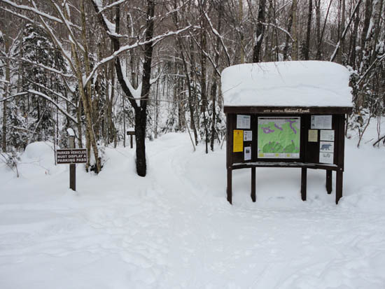
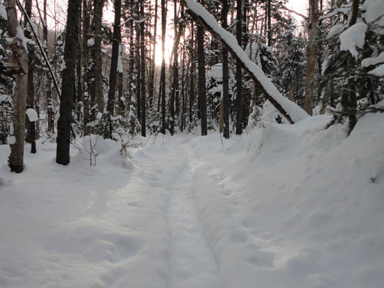
The North Twin Trail trailhead at the end of Haystack Road
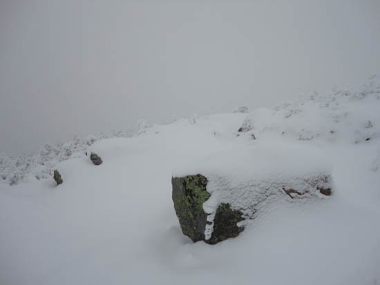
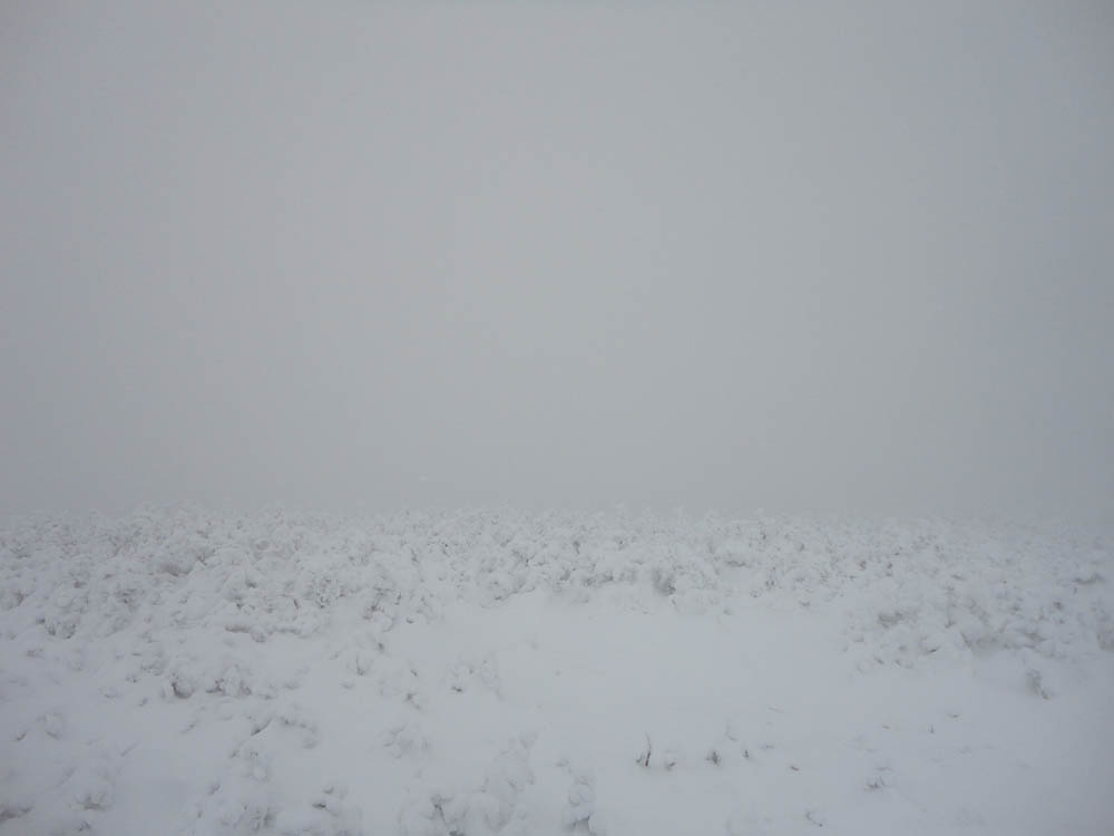
Looking into the clouds from near the North Twin summit
The North Twin Spur near South Twin
Looking at the clouds from the South Twin summit
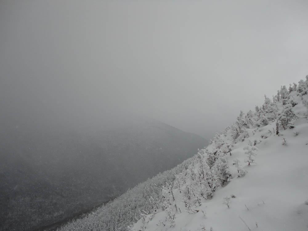
The Frost Trail on the way to Galehead Mountain

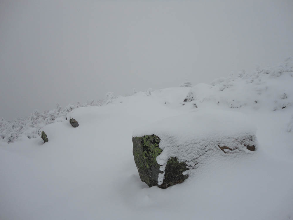
Looking south from the Galehead Mountain vista

Directions to trailhead: In winter 2010-2011, take Route 3 south past Twin Mountain (from Route 302), then take a left into the Beaver Brook WMNF fee parking area, just before the five corners, spotting a car here. Then, go north on Route 3 to Twin Mountain, taking a right onto Little River Road. As of winter 2010-2011, the end of the road had room for limited parking (no parking signs removed - 7 Dwarfs Motel offers alternative fee parking in winter), and the snowmobile bridge across the Little River had been rebuilt and reopened. After crossing this bridge, take an immediate sharp left turn onto a skier path, which then leads to Haystack Road, near the North Twin Trail trailhead.
Back to North Twin Mountain Profile
Back to South Twin Mountain Profile
Back to Galehead Mountain Profile
|