Home
States
Colorado
Connecticut
Maine
Massachusetts
New Hampshire
New York
Rhode Island
Utah
Vermont
View All
Lists
NE 4,000 Footers
NE 100 Highest
NH 4,000 Footers
NH 100 Highest
NH 52 With A View
NH Belknap Range
NH Ossipee 10
Links
Trail Conditions
Trip Log
Sunrises
Sunsets
About
|
North Twin Mountain
Bethlehem, NH, Franconia, NH
Trailheads, measurements, times, distances, and maps are all approximate and relative to the hike(s) as shown below.
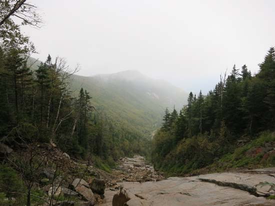
The turn in the North Twin slide
Route: North Twin Trail, bushwhack, logging road, bushwhack, herd path, North Twin Slide, bushwhack, (North Twin Mountain), North Twin Trail
Lower North Twin Trail was mostly dry and in good shape. Some fall foliage colors (quite nice along US 3 near Gale River Road).
After the first North Twin Trail crossing, we bushwhacked southwest and eventually hit the continuation of the logging road that comes in from Haystack Road (still grassy with a herd path worn in). We followed this south briefly to get around a newer stand of trees, then bushwhacked west to the slide drainage. Just prior to reaching the drainage, there appeared to be a herd path on our side of the brook, but it soon petered out. We then dropped into the drainage, which was mediocre walking (some large rocks, some blowdown), but not terrible.
The drainage opened up a bit as it turned due south. We ran into issues at the fork, though. The previously forecasted nice day was actually cloudy with mountain fog, so the slabs on the slide were wet. Left (east) was a non-starter, as it appears to be a large, steep slab. We went right (west), which I think could have been friction-climbable in dry conditions. However, the rock was extremely slippery with even the slightest bit of moisture. As a result, we bushwhacked in mediocre woods to the west of the slide until it started to widen (at which point it's not nearly as slabby). The rock is very unconsolidated, though, so we had to climb the balance of the slide with caution. Unfortunately we had no views up here due to the weather (even saw a small patch of ice!).
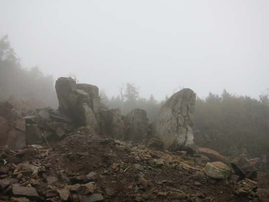
We hopped into the woods above the slide and basically followed the fall line for awhile in so so woods. As things started to level off, though, the woods became quite scrappy and were rather unpleasant due to being very wet (and cold air blowing in with a hearty wind). When the going was particularly thick, it seemed favoring to the left helped. We eventually popped out at the North Twin viewpoint (ie the one you can see Galehead from on days better than today).
From there, we descended a rather crowded (and eroded) North Twin Trail.
| Hike Ratings |
|
Getting To Trailhead: |
Easy |
| Destination: |
North Twin Mountain |
|
Length: |
Difficult |
|
Steepness: |
Very Difficult |
|
Navigation: |
Difficult |
|
Views: |
Minimal (due to weather) |
|
Crowds: |
Moderate |
|
| Hike Stats |
|
Date Hiked: |
Saturday, September 20, 2014 |
| Parking Elevation: |
1,800' |
| Destination: |
North Twin Mountain |
| Time Elapsed: |
05:05 |
| Trailhead Elevation: |
1,800' |
| Summit Elevation: |
4,761' |
| Vertical Gain: |
3,111' |
|
|
| Hike Time Elapsed: |
7:25 |
| Hike Vertical Gain: |
3,261' |
|
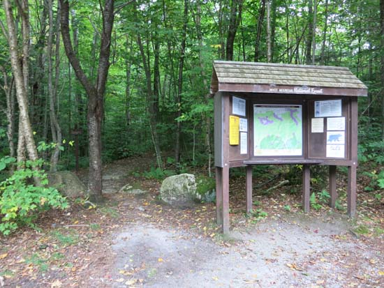
The North Twin Trail trailhead at the end of Haystack Road
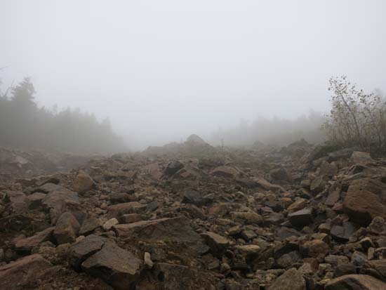
Looking up the North Twin slide
Nearing the top of the North Twin slide
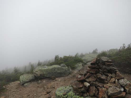
Fog near the North Twin summit
Directions to trailhead: From Route 302, take Route 3 South. Almost immediately after the Entering White Mountain National Forest, take a left onto Haystack Road. The WMNF fee parking area is at the end of the road, and the North Twin Trail trailhead is at the back of the lot.
Back to North Twin Mountain Profile
|

