Home
States
Colorado
Connecticut
Maine
Massachusetts
New Hampshire
New York
Rhode Island
Utah
Vermont
View All
Lists
NE 4,000 Footers
NE 100 Highest
NH 4,000 Footers
NH 100 Highest
NH 52 With A View
NH Belknap Range
NH Ossipee 10
Links
Trail Conditions
Trip Log
Sunrises
Sunsets
About
|
North Uncanoonuc Mountain
Goffstown, NH
Trailheads, measurements, times, distances, and maps are all approximate and relative to the hike(s) as shown below.
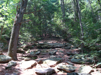
Looking up the White Dot Trail
Route: White Dot Trail
Since the weather wasn't looking that great in the White Mountains, I decided to head south and take advantage of the partly sunny forecast.
While I was concerned that road construction would make the North Uncanoonuc trail trailhead hard to find, the parking area and blazed trail were still fairly easy to find.
The trail started off with an easy to moderate pitch, passing a quasi-cave, before turning and making a steep ascent up the northern slope of the mountain. Though the trail doesn't appear to be official, it features some blazes, some metal discs, and one sign to assist in finding one's way to the top.
The views from the top were decent, with a look at South Uncanoonuc as well as a vista through the trees to points a bit north of the adajcent peak, however there wasn't anything that made me stick around for awhile. Nonetheless, it wasn't a bad little hike.
| Hike Ratings |
|
Getting To Trailhead: |
Easy |
| Destination: |
North Uncanoonuc Mountain |
|
Length: |
Easy |
|
Steepness: |
Difficult |
|
Navigation: |
Easy |
|
Views: |
Moderate |
|
Crowds: |
Moderate |
|
| Hike Stats |
|
Date Hiked: |
Sunday, June 1, 2008 |
| Hike Commenced: |
10:25 AM |
| Parking Elevation: |
625' |
| Destination: |
North Uncanoonuc Mountain |
| Ascent Commenced: |
10:25 AM |
| Summit Reached: |
10:41 AM |
| Time Elapsed: |
00:16 |
| Trailhead Elevation: |
625' |
| Summit Elevation: |
1,324' |
| Distance: |
.6 mile |
| Vertical Gain: |
699' |
|
|
| Hike Ended: |
11:03 AM |
| Hike Time Elapsed: |
00:38 |
| Hike Distance: |
1.2 miles |
| Hike Vertical Gain: |
699' |
|
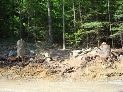
The White Dot Trail trailhead on Mountain Road
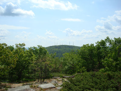
Looking at South Uncanoonuc Mountain from the North Uncanoonuc Mountain summit

Directions to trailhead: From I-89 near Concord, take Route 13 southwest to Goffstown. Take 114 southeast briefly, before going somewhat straight at an intersection onto Mountain Road. Just short of a mile, Mountain Road bears left. The small parking area is about half a mile beyond that turn, on the left side of the road, on a hill. The trailhead is across the road from the parking area, heading up an embankment.
Back to North Uncanoonuc Mountain Profile
|

