Home
States
Colorado
Connecticut
Maine
Massachusetts
New Hampshire
New York
Rhode Island
Utah
Vermont
View All
Lists
NE 4,000 Footers
NE 100 Highest
NH 4,000 Footers
NH 100 Highest
NH 52 With A View
NH Belknap Range
NH Ossipee 10
Links
Trail Conditions
Trip Log
Sunrises
Sunsets
About
|
Peak Above The Nubble
Bethlehem, NH
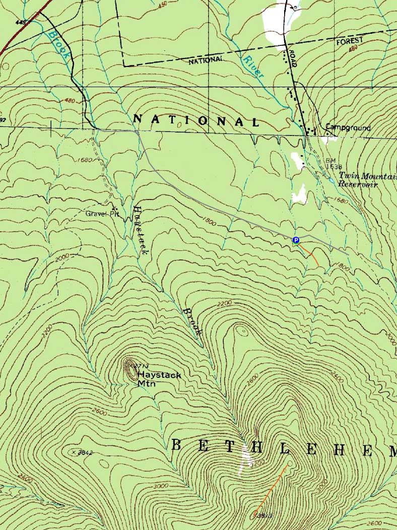
Trailheads, measurements, times, distances, and maps are all approximate and relative to the hike(s) as shown below.
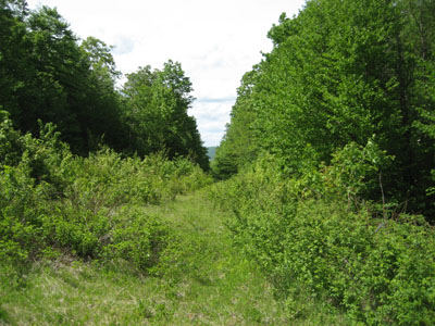
Looking down one of the woods roads on the way to the bushwhack
Route: Forest Road 304A, various logging roads, bushwhack, herd path, (Peak Above The Nubble), herd path, bushwhack, various logging roads, Forest Road 304
With the weather forecast improving, I took the afternoon off and headed up to do Peak Above The Nubble.
After reaching the beginning of Forest Road 304, marked by three boulders on Haystack Road, we soon set foot under cloudy skies. While we beared right correctly in the first two places (the second being adjacent a large sandy slope on the left), we then turned right onto a vague woods road a bit too soon. Realizing our mistake, we returned to the grassy woods road, then followed it to the 'proper' right, leading uphill to a few years-old logging cut.
Pushing through the multi-year growth of prickers, etc., we soon entered the woods and worked our way up the slope, scrambling in places and skirting around ledges in others, sometimes crossing over various herdpaths (human and otherwise).
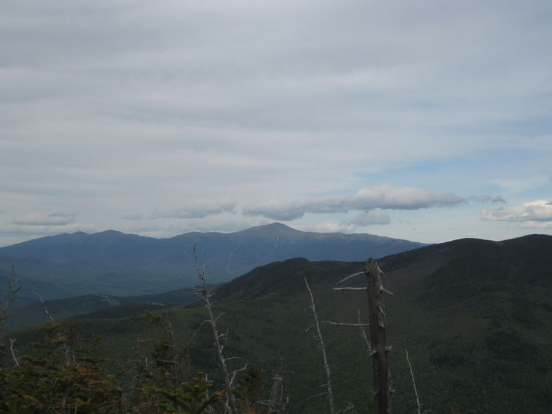
Eventually reaching the ridge, we followed a herd path to the highpoint of the Peak Above The Nubble, marked by a blow-down tree with a canister. A few feet beyond that, we were greeted with a nice viewpoint, ranging from Mt. Washington to North Twin Mountain.
For the descent, we favored the west a bit, soon passing a memorial to a fallen hiker. Continuing downhill, we could see a massive slide though the trees to the west. Working our way downhill, we eventually reached some neat older logging cuts and roads. As we neared the end of the hike, we thought we had stumbled upon the logging cut we crossed through early in the hike - not the case! Though very similar in shape and age, this logging cut was a bit downhill, adjacent to Haystack Road. Nonetheless, the longer route of descent seemed to be easier both in terms of terrain and vegetation.
| Hike Ratings |
|
Getting To Trailhead: |
Moderate |
| Destination: |
Peak Above The Nubble |
|
Length: |
Moderate |
|
Steepness: |
Very Difficult |
|
Navigation: |
Difficult |
|
Views: |
Excellent |
|
Crowds: |
Minimal |
|
| Hike Stats |
|
Date Hiked: |
Wednesday, June 3, 2009 |
| Hike Commenced: |
2:25 PM |
| Parking Elevation: |
1,770' |
| Destination: |
Peak Above The Nubble |
| Ascent Commenced: |
2:25 PM |
| Summit Reached: |
4:58 PM |
| Time Elapsed: |
02:23 |
| Trailhead Elevation: |
1,770' |
| Summit Elevation: |
3,813' |
| Vertical Gain: |
2,103' |
|
|
| Hike Ended: |
7:18 PM |
| Hike Time Elapsed: |
04:53 |
| Hike Vertical Gain: |
2,183' |
|
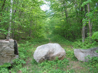
The start of Forest Road 304A on Haystack Road
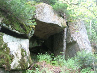
A neat rock formation on the way up to the Peak Above The Nubble
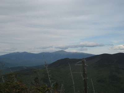
Looking at Mt. Washington from the Peak Above The Nubble
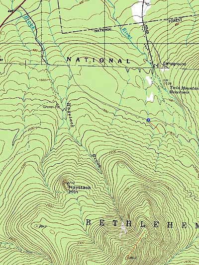

Directions to trailhead: From Route 302, take Route 3 South. Almost immediately after the Entering White Mountain National Forest sign, take a left onto Haystack Road. Forest Road eventually 304A forks off to the right from this road in about 1 3/4 miles, blocked by three large boulders.
Back to Peak Above The Nubble Profile
|