Home
States
Colorado
Connecticut
Maine
Massachusetts
New Hampshire
New York
Rhode Island
Utah
Vermont
View All
Lists
NE 4,000 Footers
NE 100 Highest
NH 4,000 Footers
NH 100 Highest
NH 52 With A View
NH Belknap Range
NH Ossipee 10
Links
Trail Conditions
Trip Log
Sunrises
Sunsets
About
|
Peak Above The Nubble
Bethlehem, NH
Trailheads, measurements, times, distances, and maps are all approximate and relative to the hike(s) as shown below.
Birch glades off Forest Road 304A
Route: Forest Road 304A, various logging roads, bushwhack, herd path, (Peak Above The Nubble), herd path, bushwhack, various logging roads, Forest Road 304
With a nice forecast and some time available to hike on Veteran's Day, we opted to do a somewhat fitting bushwhack - one could compare the pronunciation of the abbreviation of Peak Above The Nubble ("Patn") with Patton - as in General Patton.
Starting at Forest Road 304A (blocked by three boulders off Haystack Road), we headed down the grassy road for awhile, eventually getting a decent line of sight on the ridge via an old logging road. Not wanting to overshoot the approach to the base of the climb, we opted to start heading up to the ridge, going through two pricker filled clear cuts and ending up in some nice birch glades for a bit, prior to reaching some ledgy areas.
Doing some skirting around a few larger cliffs, we eventually stumbled upon a fairly obvious herd path up through some more cliffs. Since there wasn't much of a choice due to the surrounding topography (in a previous descent, we found some less gnarly topography a bit north and west of this area), we followed the path and very soon reached the ridge, followed by another steep ascent to the summit area.
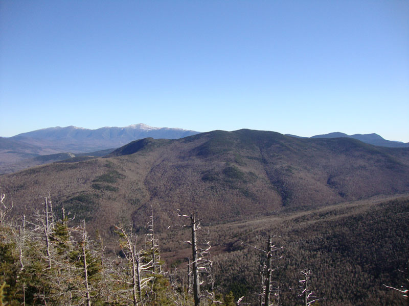
After signing in at the register (where there is a laminated tribute to the late Ray Loring, who lost his life on this peak in September of 2008), we took an extended break at the viewpoint, from where we had excellent views of the Presidentials, Mt. Hale, and North Twin.
We took our time on the descent, as there was black ice and a trace of snow to deal with in the upper elevations. Nonetheless, with sunny skies, mild temperatures, and no bugs, it was fairly smooth sailing.
| Hike Ratings |
|
Getting To Trailhead: |
Moderate |
| Destination: |
Peak Above The Nubble |
|
Length: |
Moderate |
|
Steepness: |
Very Difficult |
|
Navigation: |
Difficult |
|
Views: |
Excellent |
|
Crowds: |
Minimal |
|
| Hike Stats |
|
Date Hiked: |
Thursday, November 11, 2010 |
| Hike Commenced: |
9:01 AM |
| Parking Elevation: |
1,770' |
| Destination: |
Peak Above The Nubble |
| Ascent Commenced: |
9:01 AM |
| Summit Reached: |
11:40 AM |
| Time Elapsed: |
02:39 |
| Trailhead Elevation: |
1,770' |
| Summit Elevation: |
3,813' |
| Vertical Gain: |
2,103' |
|
|
| Hike Ended: |
2:23 PM |
| Hike Time Elapsed: |
05:22 |
| Hike Vertical Gain: |
2,163' |
|
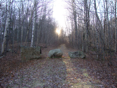
The start of Forest Road 304A on Haystack Road
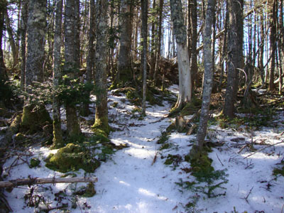
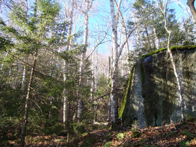
The herd path near the summit of Peak Above The Nubble
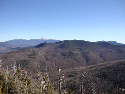
Looking at the Presidentials, Mt. Hale, and the Willey Range from the Peak Above The Nubble
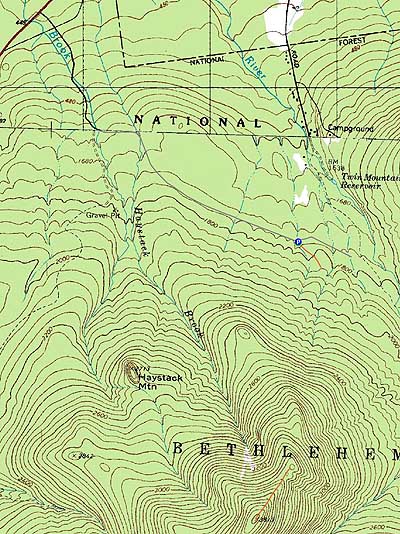

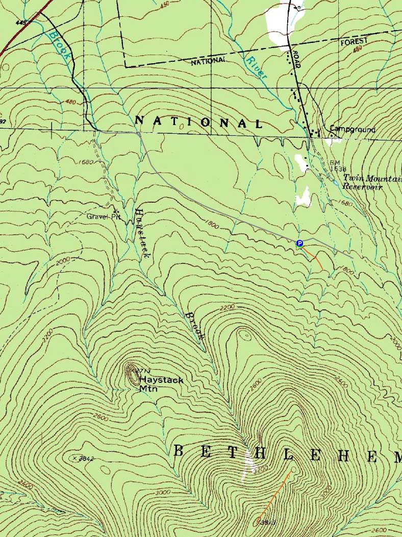
Directions to trailhead: From Route 302, take Route 3 South. Almost immediately after the Entering White Mountain National Forest sign, take a left onto Haystack Road. Forest Road eventually 304A forks off to the right from this road in about 1 3/4 miles, blocked by three large boulders.
Back to Peak Above The Nubble Profile
|