Home
States
Colorado
Connecticut
Maine
Massachusetts
New Hampshire
New York
Rhode Island
Utah
Vermont
View All
Lists
NE 4,000 Footers
NE 100 Highest
NH 4,000 Footers
NH 100 Highest
NH 52 With A View
NH Belknap Range
NH Ossipee 10
Links
Trail Conditions
Trip Log
Sunrises
Sunsets
About
|
Peaked Mountain
Conway, NH
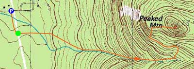
Trailheads, measurements, times, distances, and maps are all approximate and relative to the hike(s) as shown below.
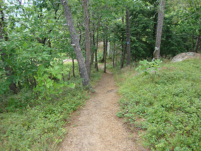
Looking down the Peaked Mountain Trail
Route: Middle Mountain Trail, Peaked Mountain Trail, (Peaked Mountain), Peaked Mountain Trail, Middle Mountain Trail
With thunderstorms threatening the area on a hot day, I decided to stay low and head up Peaked Mountain.
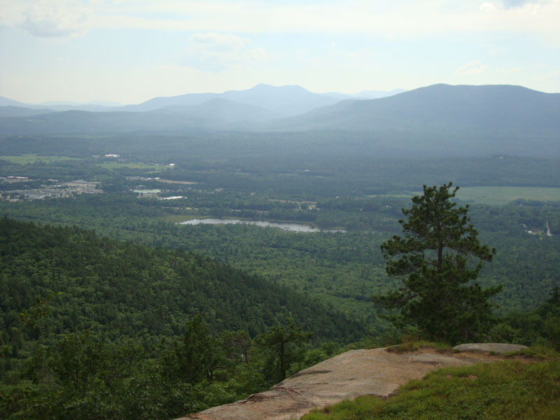
While I was able to jog much of the way up, the heat and a lack of conditioning resulted in walking the steeper portions up high. Reaching the summit, I had hazy, but decent, views of the Moats, Chocorua, Ossipees, et al.
After having some fresh blueberries, I headed back down. Fortunately, the bugs weren't as bad here as they had been on nearby Hurricane Mountain a week earlier.
| Hike Ratings |
|
Getting To Trailhead: |
Easy |
| Destination: |
Peaked Mountain |
|
Length: |
Moderate |
|
Steepness: |
Moderate |
|
Navigation: |
Easy |
|
Views: |
Excellent |
|
Crowds: |
Minimal |
|
| Hike Stats |
|
Date Hiked: |
July 12, 2010 |
| Hike Commenced: |
3:53 PM |
| Parking Elevation: |
535' |
| Destination: |
Peaked Mountain |
| Ascent Commenced: |
3:56 PM |
| Summit Reached: |
4:21 PM |
| Time Elapsed: |
00:25 |
| Trailhead Elevation: |
545' |
| Summit Elevation: |
1,739' |
| Vertical Gain: |
1,244' |
|
|
| Hike Ended: |
4:53 PM |
| Hike Time Elapsed: |
01:00 |
| Hike Vertical Gain: |
1,359' |
|
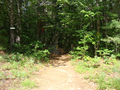
Middle Mountain Trail trailhead under the power lines

Looking at Mt. Chocorua and South Moat Mountain from Peaked Mountain

Directions to trailhead: From Routes 16/302 in North Conway, take Artist Falls Road past the railroad tracks. Take a right onto Thompson Road. A small Town of Conway/Pudding Pond Conservation Area signed parking lot will be on the right shortly thereafter.
Back to Peaked Mountain Profile
|