Home
States
Colorado
Connecticut
Maine
Massachusetts
New Hampshire
New York
Rhode Island
Utah
Vermont
View All
Lists
NE 4,000 Footers
NE 100 Highest
NH 4,000 Footers
NH 100 Highest
NH 52 With A View
NH Belknap Range
NH Ossipee 10
Links
Trail Conditions
Trip Log
Sunrises
Sunsets
About
|
Pine Mountain
Alton, NH
Trailheads, measurements, times, distances, and maps are all approximate and relative to the hike(s) as shown below.
The Arlene Frances Morse Trail
Route: Arlene Frances Morse Trail
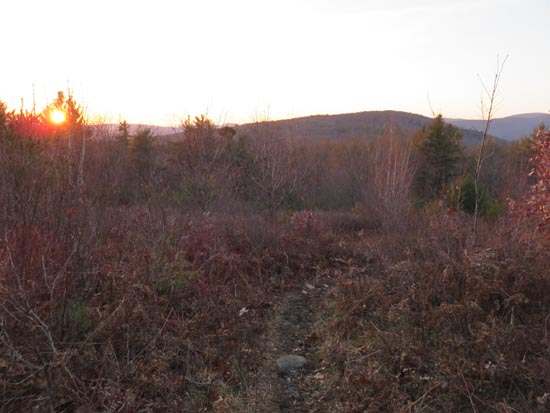
Trail was generally dry with some minor mud from frost and a few avoidable patches of ice. Nice sunset from the top.
| Hike Ratings |
|
Getting To Trailhead: |
Easy |
| Destination: |
Pine Mountain |
|
Length: |
Easy |
|
Steepness: |
Easy |
|
Navigation: |
Easy |
|
Views: |
Excellent |
|
Crowds: |
Moderate |
|
| Hike Stats |
|
Date Hiked: |
Wednesday, November 25, 2015 |
| Parking Elevation: |
1,090' |
| Destination: |
Pine Mountain |
| Time Elapsed: |
00:08 |
| Trailhead Elevation: |
1,100' |
| Summit Elevation: |
1,410' |
| Vertical Gain: |
310' |
|
|
| Hike Time Elapsed: |
00:32 |
| Hike Vertical Gain: |
310' |
|
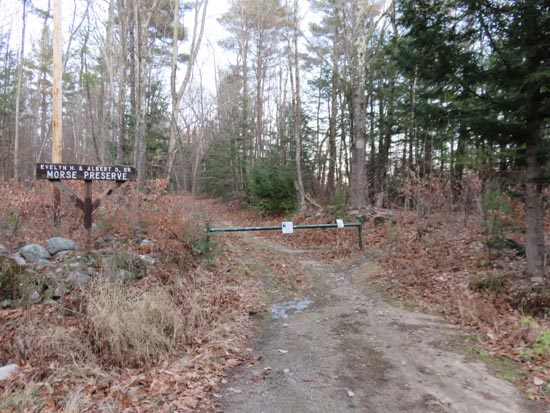
The Arlene Frances Morse Trail trailhead
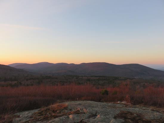
Looking at Belknaps from Pine Mountain

The sunset from Pine Mountain
Directions to trailhead: From the Route 11 in Alton, take Rand Hill Road, then take a left onto Alton Mountain Road, then take a left onto Avery Hill Road. The Mike Burke Trail parking lot will soon be on the right. The Arlene Frances Morse Trail trailhead is diagonally across the street.
Back to Pine Mountain Profile
|


