Home
States
Colorado
Connecticut
Maine
Massachusetts
New Hampshire
New York
Rhode Island
Utah
Vermont
View All
Lists
NE 4,000 Footers
NE 100 Highest
NH 4,000 Footers
NH 100 Highest
NH 52 With A View
NH Belknap Range
NH Ossipee 10
Links
Trail Conditions
Trip Log
Sunrises
Sunsets
About
|
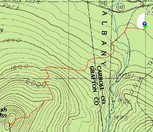
Potash Mountain
Albany, NH, Waterville Valley, NH
Trailheads, measurements, times, distances, and maps are all approximate and relative to the hike(s) as shown below.
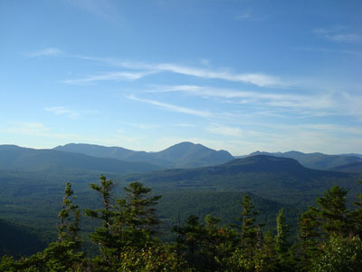
Looking up the Mt. Potash Trail near the summit of Potash Mountain
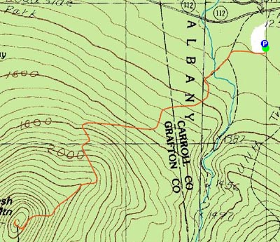
Route: Downes Brook Trail, Mt. Potash Trail, (Potash Mountain), Mt. Potash Trail, Downes Brook Trail
With a Red Sox-Yankees game quickly approaching, I only had limited time to enjoy a really nice summer day. As a result, I decided to try something in the 2 mile range (one way) - Potash Mountain was the answer.
It should be noted off the bat that the trailhead is accessed via the same parking lot as the UNH Trail for Hedgehog, not a bit further down the Kanc as shown on the topographic maps.
I started on the essentially flat portion of the Downes Brook Trail, before stopping to DEET up - the mosquitoes were biting!
Shortly thereafter, the old Downes Brook Trail merges from the right, and then the Mt. Potash Trail breaks off to the right a bit further up.
The Downes Brook crossing confused me at first - I saw herd paths going straight and couldn't see an obvious crossing. After looking around for a minute or two, I saw a brown arrow sign up in a tree pointing across the brook - while not that big, it seems as big as some rivers I've seen before - I'd hate to have to go across this in the spring!
The Mt. Potash trail continues a fairly tame ascent for awhile longer, crossing a well defined logging road (for a second I thought it was a power line cut, that's just how wide and straight it is), along the way. Then, under some evergreens, the trail turns and starts up Mt. Potash - steep and rooty.
After a few minutes of this steep ascent, the trail levels out and goes along an open ledge with nice views of Hedgehog Mountain and Mt. Passaconaway, before ducking into the woods again. The trail continues along the side of Potash Mountain, before turning and heading straight up some somewhat steep ledges to the summit.
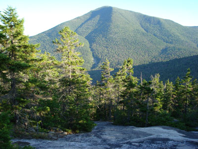
The views from the top were great - Mt. Carrigain standing out to the northwest and Mt. Passaconaway dominating the southeast.
Though I was somewhat tempted to see the sunset, I was much more interested in seeing the Red Sox game, so it was time to go. The soundtrack of the descent was R.E.M.'s Up.
All in all a good hike, very quiet too - though there were a few cars in the parking lot, I did not see a single person the entire time.
| Hike Ratings |
|
Getting To Trailhead: |
Easy |
| Destination: |
Potash Mountain |
|
Length: |
Moderate |
|
Steepness: |
Difficult |
|
Navigation: |
Moderate |
|
Views: |
Excellent |
|
Crowds: |
Minimal |
|
| Hike Stats |
|
Date Hiked: |
Tuesday, August 28, 2007 |
| Hike Commenced: |
5:07 PM |
| Parking Elevation: |
1,265' |
| Destination: |
Potash Mountain |
| Ascent Commenced: |
5:08 PM |
| Summit Reached: |
6:08 PM |
| Time Elapsed: |
01:00 |
| Trailhead Elevation: |
1,270' |
| Summit Elevation: |
2,680' |
| Distance: |
2.1 miles |
| Vertical Gain: |
1,480' |
|
|
| Hike Ended: |
7:21 PM |
| Hike Time Elapsed: |
02:14 |
| Hike Distance: |
4.2 miles |
| Hike Vertical Gain: |
1,555' |
|
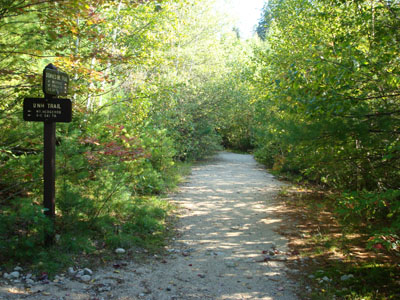
Downes Brook Trail trailhead
Looking northwest from the Potash Mountain summit at Mt. Carrigain

Directions to trailhead: Take Route 112 West from Conway. A bit after Bear Notch Road, look for the sign for the entrance to the UNH Trail (amongst others) Parking on the left. WMNF fee parking area.
Back to Potash Mountain Profile
|