Home
States
Colorado
Connecticut
Maine
Massachusetts
New Hampshire
New York
Rhode Island
Utah
Vermont
View All
Lists
NE 4,000 Footers
NE 100 Highest
NH 4,000 Footers
NH 100 Highest
NH 52 With A View
NH Belknap Range
NH Ossipee 10
Links
Trail Conditions
Trip Log
Sunrises
Sunsets
About
|
Potash Mountain
Albany, NH, Waterville Valley, NH
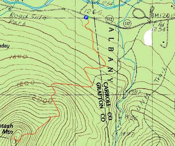
Trailheads, measurements, times, distances, and maps are all approximate and relative to the hike(s) as shown below.
Looking up the Mt. Potash Trail at the first set of ledges
Route: Logging road, Mt. Potash Trail, (Potash Mountain), Mt. Potash Trail, logging road
While I was pondering doing Potash Mountain for a sunset hike, a combination of making better time to the trailhead than expected, along with seeing thick clouds to the west, made me reconsider. Thus, it seemed to make more sense to get up and down prior to dark, rather than wait around for potentially nothing.
Instead of taking the Downes Brook Trail to the Mt. Potash Trail, I decided to take a nearby logging road to the trail and thus bypass the tricky water crossing. The logging road ended up being a fairly pleasant walk in the woods - the Mt. Potash Trail crossing was fairly obvious, due to the worn footpath across the grassy road.
Starting a few hundred vertical feet up, I encountered patchy traces of snow. The ledges, fortunately, were bare - I would not want to have to deal with these in icy or wet situations, as they angle downward for awhile with potentially disasterous results.
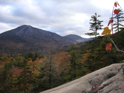
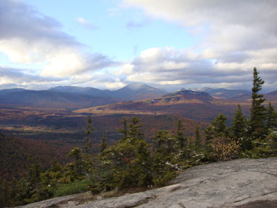
Reaching the summit, I had excellent views, despite the clouds and lack of sunrays. The valleys were still filled with some foliage while the higher peaks were white.
Despite slipping and falling twice on the descent, it was fairly non-eventful.
| Hike Ratings |
|
Getting To Trailhead: |
Easy |
| Destination: |
Potash Mountain |
|
Length: |
Moderate |
|
Steepness: |
Difficult |
|
Navigation: |
Moderate |
|
Views: |
Excellent |
|
Crowds: |
Minimal |
|
| Hike Stats |
|
Date Hiked: |
Wednesday, October 14, 2009 |
| Hike Commenced: |
4:03 PM |
| Parking Elevation: |
1,260' |
| Destination: |
Potash Mountain |
| Ascent Commenced: |
4:03 PM |
| Summit Reached: |
4:56 PM |
| Time Elapsed: |
00:53 |
| Trailhead Elevation: |
1,260' |
| Summit Elevation: |
2,680' |
| Vertical Gain: |
1,480' |
|
|
| Hike Ended: |
6:06 PM |
| Hike Time Elapsed: |
02:03 |
| Hike Vertical Gain: |
1,540' |
|
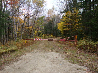
The beginning of the logging road to the Mt. Potash Trail
Looking at the Hancocks, Captain, Carrigain, and Carrigain Notch from Potash Mountain
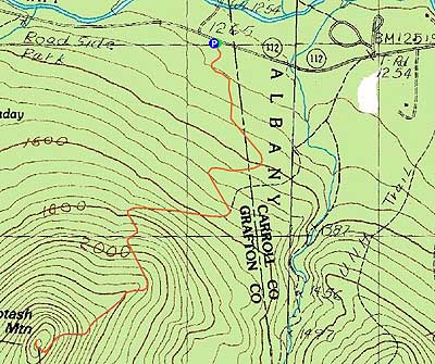

Directions to trailhead: Take Route 112 West from Conway. Shortly after passing Bear Notch Road and then entrance to the UNH and Downes Brook Trails, there will be a gated logging road on the left. There is room for a few vehicles to park off Route 112 without blocking the gate.
Back to Potash Mountain Profile
|