Home
States
Colorado
Connecticut
Maine
Massachusetts
New Hampshire
New York
Rhode Island
Utah
Vermont
View All
Lists
NE 4,000 Footers
NE 100 Highest
NH 4,000 Footers
NH 100 Highest
NH 52 With A View
NH Belknap Range
NH Ossipee 10
Links
Trail Conditions
Trip Log
Sunrises
Sunsets
About
|
Sable Mountain
Jackson, NH, Chatham, NH
Trailheads, measurements, times, distances, and maps are all approximate and relative to the hike(s) as shown below.
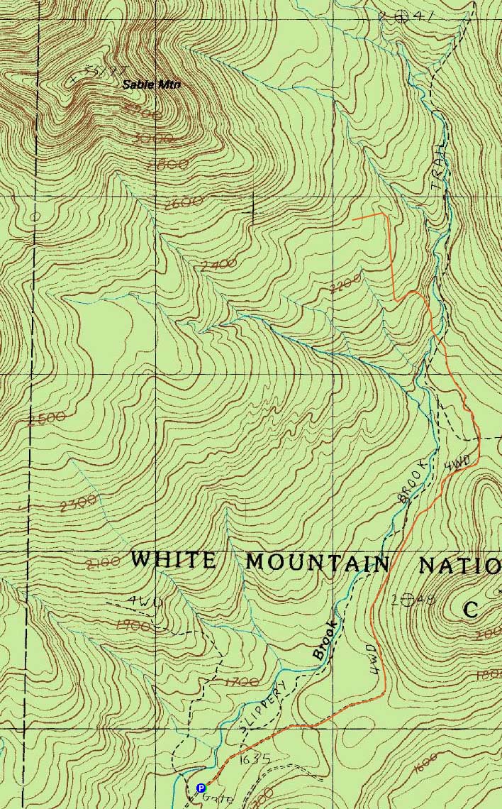
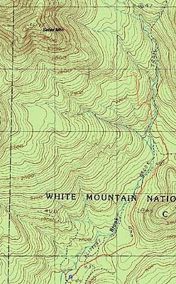
The Slippery Brook Trail
Route: Slippery Brook Trail, logging road, bushwhack, (Sable Mountain), bushwhack, logging road, Slippery Brook Trail
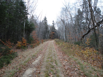
With a chance of rain in the afternoon and clouds all day, I decided to do something on the shorter and less scenic side. Starting on the Slippery Brook Trail, I was able to make decent time due to the gradual, smooth nature of the grassy logging road (though the deep waterbars were vexing). Once the Slippery Brook Trail finally turned off the road (right), I went straight, crossed the brook, then proceeded on the logging road. Reaching a landing, I went toward the back, then took a right uphill to stay on the logging road, bearing left at a junction. Near a height of land, I found an old logging road and followed it to an awesome open meadow.
From there, I bushwhacked through mostly hardwoods (some pricker bushes) over increasingly steep terrain, favoring left on a ridge to get around some higher elevation spruce. I found perhaps the old Sable Mountain Trail in a maze of moose paths and followed it up to the recognized highpoint. Not too far from the highpoint, I found a decent viewpoint about 10 vertical feet off the summit ridge, looking at Kearsarge North, Mountain Pond, and Pleasant Mountain.
For the return trip, I followed a slightly more northern course and went through open woods back to the meadow and then to the Slippery Brook Trail. While I was tempted to head up to Eastman, the rain started on cue, so I headed down the Slippery Brook Trail for an early end to the day.
| Hike Ratings |
|
Getting To Trailhead: |
Easy |
| Destination: |
Sable Mountain |
|
Length: |
Moderate |
|
Steepness: |
Difficult |
|
Navigation: |
Difficult |
|
Views: |
Excellent |
|
Crowds: |
Minimal |
|
| Hike Stats |
|
Date Hiked: |
Sunday, October 24, 2010 |
| Hike Commenced: |
8:11 AM |
| Parking Elevation: |
1,610' |
| Destination: |
Sable Mountain |
| Ascent Commenced: |
8:11 AM |
| Summit Reached: |
10:30 AM |
| Time Elapsed: |
02:19 |
| Trailhead Elevation: |
1,610' |
| Summit Elevation: |
3,519' |
| Vertical Gain: |
2,009' |
|
|
| Hike Ended: |
1:01 PM |
| Hike Time Elapsed: |
04:50 |
| Hike Vertical Gain: |
2,109' |
|
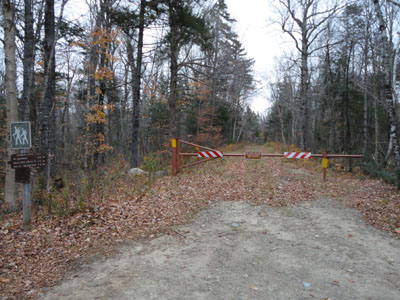
The Slippery Brook Trail trailhead
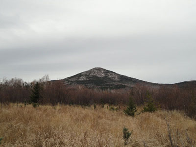
South Baldface as seen from a clearing at the foot of Sable Mountain
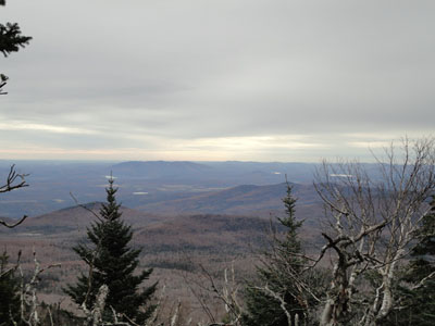
Looking at Pleasant Mountain from near the summit of Sable Mountain
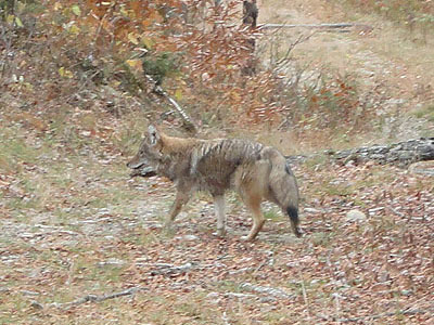
A coyote on the Slippery Brook Trail

Directions to trailhead: Take Route 16 North from North Conway, then take a right onto Town Hall Road. Continue straight past Route 16A. At a fork in the road, bear left. The Slippery Brook Trail trailhead will be at the end of this dirt road, a few minutes after the Mountain Pond trailhead. There is limited room for parking adjacent to the gate.
Back to Sable Mountain Profile
|