Home
States
Colorado
Connecticut
Maine
Massachusetts
New Hampshire
New York
Rhode Island
Utah
Vermont
View All
Lists
NE 4,000 Footers
NE 100 Highest
NH 4,000 Footers
NH 100 Highest
NH 52 With A View
NH Belknap Range
NH Ossipee 10
Links
Trail Conditions
Trip Log
Sunrises
Sunsets
About
|
Sentinel Mountain
Ossipee, NH, Tuftonboro, NH
Trailheads, measurements, times, distances, and maps are all approximate and relative to the hike(s) as shown below.
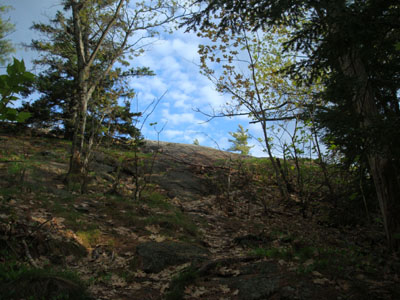
Looking up Mountain Trail near the summit of Sentinel Mountain
Route: Mountain Trail, unknown logging road, Mountain Trail, (Sentinel Mountain), Mountain Trail, unknown logging road, Moutain Trail
Since being given a great digital map of the Ossipees, I had been interested in checking out a few trails that looked new to me. Sentinel Mountain had one of these trails.
Once the clouds started to clear, I headed down to Ossipee and followed the maze of roads to the Terrace Pines Campground entrance.
The Mountain Trail, as it's signed, was pretty easy to follow. There were multiple wooden "Mt. Trail" signs, as well as plenty of blazes and ribbons.
A few minutes into the hike, I decided I needed to get some DEET on, as the black flies were quite annoying. Not wanting to stop, I juggled my backpack, hat, and bottle of DEET as I headed up the trail. After a moment, I noticed a noise that wasn't in fact me - I quickly looked to my right and saw a small bear literally sliding about 20 feet down a tree, like a fireman down a pole. That was all I needed to see - with no clue if there was a mama bear nearby, I quickly headed back down the trail and reassessed the situation. Knowing there was a network of logging rounds in this area, I decided to head up an adjacent one, then follow another one back over to the trail. This worked, and I ended up a bit above the bear zone.
From there, the trail was a fairly gradual logging road for some time. After a few minutes, the trail took a sharp left and headed into the woods. As it entered a softwood stand, it suddenly became steep as it climbed the last few hundred vertical feet of the mountain.
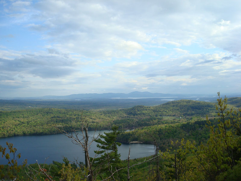
The views from the top, despite the clouds, were excellent - Dan Hole Pond was practically a rock throw away, Winnipesaukee in the distance, and many other sights. In addition, there were some limited glimpses up at Mt. Shaw and, through the trees, at Mt. Chocorua.
Since the bugs were a bit much and I wanted dinner, I didn't spend too much time on the summit. I ended up following the same route down, bypassing the bear zone, just in case.
After this edition of bug season, I think I'll be back.
| Hike Ratings |
|
Getting To Trailhead: |
Easy |
| Destination: |
Sentinel Mountain |
|
Length: |
Moderate |
|
Steepness: |
Difficult |
|
Navigation: |
Easy |
|
Views: |
Excellent |
|
Crowds: |
Minimal |
|
| Hike Stats |
|
Date Hiked: |
Thursday, May 15, 2008 |
| Hike Commenced: |
5:38 PM |
| Parking Elevation: |
885' |
| Destination: |
Sentinel Mountain |
| Ascent Commenced: |
5:39 PM |
| Summit Reached: |
6:08 PM |
| Time Elapsed: |
00:29 |
| Trailhead Elevation: |
890' |
| Summit Elevation: |
1,680' |
| Vertical Gain: |
880' |
|
|
| Hike Ended: |
6:41 PM |
| Hike Time Elapsed: |
01:03 |
| Hike Vertical Gain: |
915' |
|
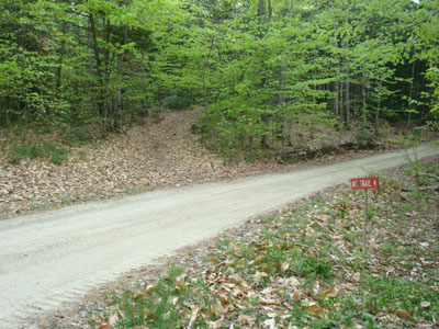
The Mountain Trail trailhead

Looking southwest at the Belknap Range from the ledges of Sentinel Mountain
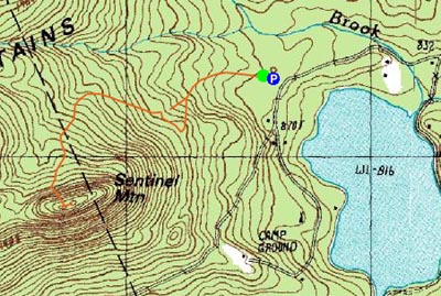

Directions to trailhead: From Route 16 South in West Ossipee, take a left onto Old NH 16. After crossing under Route 16, take a right onto Folsom Road. Once in Center Ossipee, take a right onto Moultonville Road. A few minutes later, take a right onto Valley Road. Look for the entrance to Terrace Pines Campground, which will be on the right when Valley Road forks. Shortly down this road, take a right (immediately before a sign for the office). There is limited room for parking in front of the gate - do not block the gate. The Mountain Trail starts a few dozen feet beyond the gate, on the left.
Back to Sentinel Mountain Profile
|