Home
States
Colorado
Connecticut
Maine
Massachusetts
New Hampshire
New York
Rhode Island
Utah
Vermont
View All
Lists
NE 4,000 Footers
NE 100 Highest
NH 4,000 Footers
NH 100 Highest
NH 52 With A View
NH Belknap Range
NH Ossipee 10
Links
Trail Conditions
Trip Log
Sunrises
Sunsets
About
|
Sentinel Mountain
Ossipee, NH, Tuftonboro, NH
Trailheads, measurements, times, distances, and maps are all approximate and relative to the hike(s) as shown below.
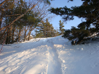
Looking up Mountain Trail
Route: Mountain Trail
Needing some fresh air, I decided to head down to Sentinel Mountain. Having only hiked this peak in the warmer months, I was curious to see what it was lke with snow on the ground.
Nearing the Terrace Pines Campground area, I noted the road where I usually park wasn't plowed. Fortunately, the town had done some recent snow pushing, so I was able to park just before the entrance to the unplowed road. While there was some evidence of a tracked vehicle heading up that unplowed road, I could tell I would be breaking trail all the way to the summit of Sentinel Mountain.
The snow was a bit wet and sticky - thus the snowshoeing dragged on as I sank 6-12" with each heavy step. I was glad to see that the area that had been logged in the fall was currently inactive - I was a bit concerned that I'd hit an active mudpit of some sort.
The steeps were a bit of a work out, as I needed to traverse back and forth in order to ensure a somewhat safe descent.
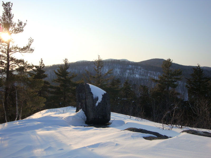
Though things were a bit hazy, the views from the summit were nonetheless nice.
The descent was much smoother, as the now-broken-out-trail reduced the amount of snow-sticking-on-snowshoes, though it did nothing to reduce excessive-hyphen-usage.
| Hike Ratings |
|
Getting To Trailhead: |
Moderate |
| Destination: |
Sentinel Mountain |
|
Length: |
Moderate |
|
Steepness: |
Difficult |
|
Navigation: |
Moderate |
|
Views: |
Excellent |
|
Crowds: |
Minimal |
|
| Hike Stats |
|
Date Hiked: |
Thursday, February 26, 2009 |
| Hike Commenced: |
3:36 PM |
| Parking Elevation: |
880' |
| Destination: |
Sentinel Mountain |
| Ascent Commenced: |
3:38 PM |
| Summit Reached: |
4:22 PM |
| Time Elapsed: |
00:44 |
| Trailhead Elevation: |
890' |
| Summit Elevation: |
1,680' |
| Vertical Gain: |
805' |
|
|
| Hike Ended: |
5:02 PM |
| Hike Time Elapsed: |
01:24 |
| Hike Vertical Gain: |
830' |
|
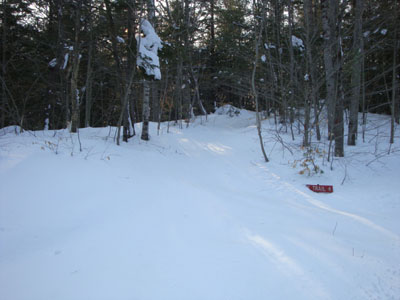
The Mountain Trail trailhead

Looking at Canaan Mountain and Mt. Shaw from near the summit of Sentinel Mountain
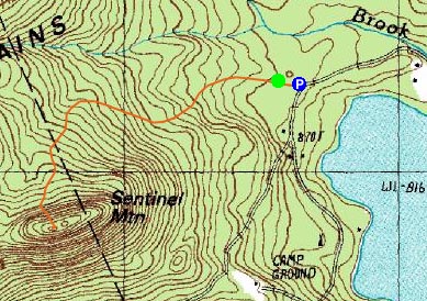

Directions to trailhead: From Route 16 South in West Ossipee, take a left onto Old NH 16. After crossing under Route 16, take a right onto Folsom Road. Once in Center Ossipee, take a right onto Moultonville Road. A few minutes later, take a right onto Valley Road. Look for the entrance to Terrace Pines Campground, which will be on the right when Valley Road forks. In winter, there may be some room to park along the road, near where an unplowed road branches off to the right. The Mountain Trail starts a few dozen feet beyond a gate on that unplowed road, on the left.
Back to Sentinel Mountain Profile
|