Home
States
Colorado
Connecticut
Maine
Massachusetts
New Hampshire
New York
Rhode Island
Utah
Vermont
View All
Lists
NE 4,000 Footers
NE 100 Highest
NH 4,000 Footers
NH 100 Highest
NH 52 With A View
NH Belknap Range
NH Ossipee 10
Links
Trail Conditions
Trip Log
Sunrises
Sunsets
About
|
Sentinel Mountain
Ossipee, NH, Tuftonboro, NH
Trailheads, measurements, times, distances, and maps are all approximate and relative to the hike(s) as shown below.
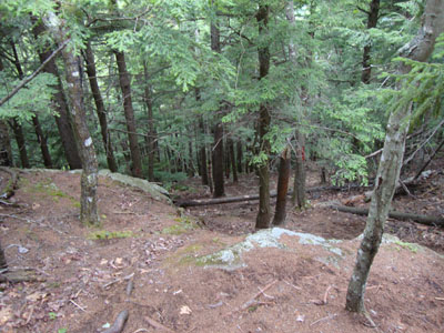
Looking down Mountain Trail
Route: Mountain Trail
It wasn't looking like a great day weatherwise, so I decided to stay local and hike Sentinel for the first time in awhile.
The trail was generally dry, with the exception of the muddy area just prior to the newer logging road. The last stretch was just as steep as I remember it - perhaps one of the steepest non-ledge trails in the region - steep enough to change my jogging pace to a walking pace.
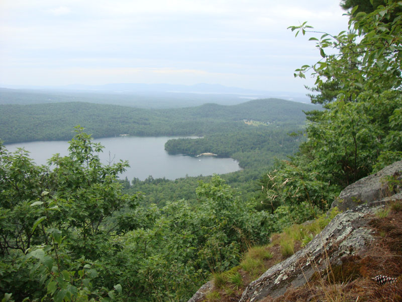
The views seemed to be better than I recalled, with a herd path leading to a nice view not too far from the highpoint.
| Hike Ratings |
|
Getting To Trailhead: |
Moderate |
| Destination: |
Sentinel Mountain |
|
Length: |
Moderate |
|
Steepness: |
Difficult |
|
Navigation: |
Moderate |
|
Views: |
Excellent |
|
Crowds: |
Minimal |
|
| Hike Stats |
|
Date Hiked: |
Friday, July 23, 2010 |
| Hike Commenced: |
3:33 PM |
| Parking Elevation: |
880' |
| Destination: |
Sentinel Mountain |
| Ascent Commenced: |
3:35 PM |
| Summit Reached: |
3:52 PM |
| Time Elapsed: |
00:17 |
| Trailhead Elevation: |
890' |
| Summit Elevation: |
1,680' |
| Vertical Gain: |
805' |
|
|
| Hike Ended: |
4:16 PM |
| Hike Time Elapsed: |
00:43 |
| Hike Vertical Gain: |
830' |
|
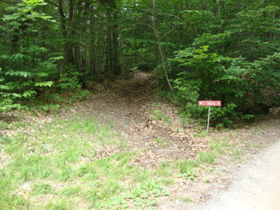
The Mountain Trail trailhead

Looking over Dan Hole Pond out to the Belknaps from near the summit of Sentinel Mountain
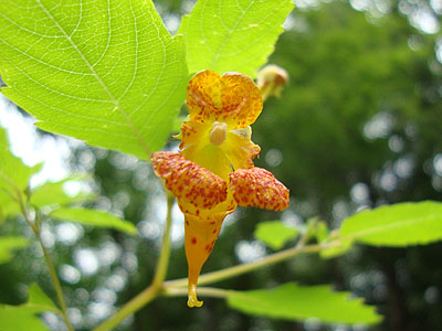
Spotted touch-me-not near the trailhead
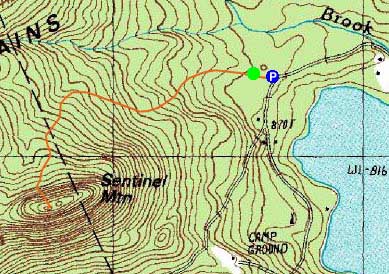

Directions to trailhead: From Route 16 South in West Ossipee, take a left onto Old NH 16. After crossing under Route 16, take a right onto Folsom Road. Once in Center Ossipee, take a right onto Moultonville Road. A few minutes later, take a right onto Valley Road. Look for the entrance to Terrace Pines Campground, which will be on the right when Valley Road forks. Shortly down this road, take a right (immediately before a sign for the office). There is limited room for parking in front of the gate - do not block the gate. The Mountain Trail starts a few dozen feet beyond the gate, on the left.
Back to Sentinel Mountain Profile
|