Home
States
Colorado
Connecticut
Maine
Massachusetts
New Hampshire
New York
Rhode Island
Utah
Vermont
View All
Lists
NE 4,000 Footers
NE 100 Highest
NH 4,000 Footers
NH 100 Highest
NH 52 With A View
NH Belknap Range
NH Ossipee 10
Links
Trail Conditions
Trip Log
Sunrises
Sunsets
About
|
Sentinel Mountain
Ossipee, NH, Tuftonboro, NH
Trailheads, measurements, times, distances, and maps are all approximate and relative to the hike(s) as shown below.
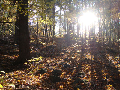
Looking up Mountain Trail
Route: Mountain Trail
With not too much time available, I headed down to Sentinel Mountain for a quick jog.
Starting at the trailhead, there was nice foliage. Reaching steeps in the softwood area, my place slowed to a walk.
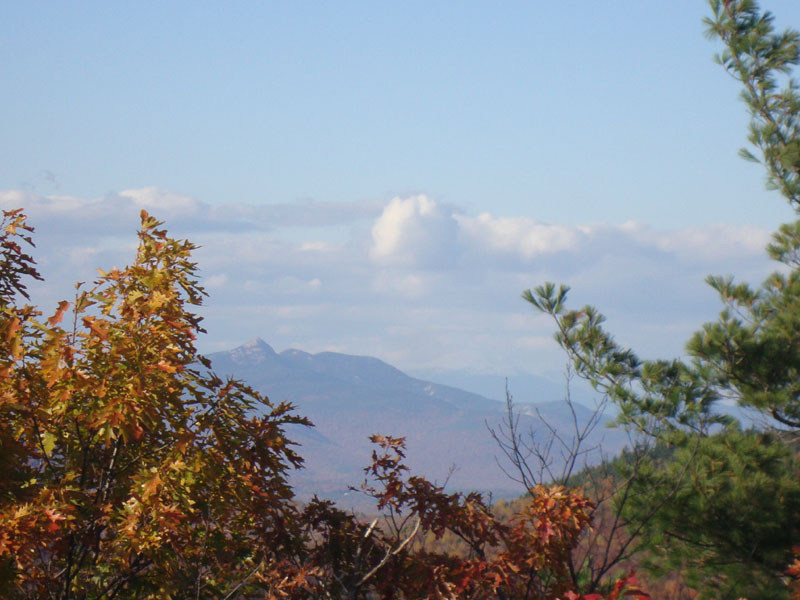
The viewpoints near the summit provided great scenery to the south. Hopping on the big boulder, I was able to see through the trees a snow covered Mt. Washington to the right of Mt. Chocorua.
| Hike Ratings |
|
Getting To Trailhead: |
Moderate |
| Destination: |
Sentinel Mountain |
|
Length: |
Moderate |
|
Steepness: |
Difficult |
|
Navigation: |
Moderate |
|
Views: |
Excellent |
|
Crowds: |
Minimal |
|
| Hike Stats |
|
Date Hiked: |
Wednesday, October 20, 2010 |
| Hike Commenced: |
3:29 PM |
| Parking Elevation: |
880' |
| Destination: |
Sentinel Mountain |
| Ascent Commenced: |
3:30 PM |
| Summit Reached: |
3:44 PM |
| Time Elapsed: |
00:14 |
| Trailhead Elevation: |
890' |
| Summit Elevation: |
1,680' |
| Vertical Gain: |
805' |
|
|
| Hike Ended: |
4:09 PM |
| Hike Time Elapsed: |
00:40 |
| Hike Vertical Gain: |
830' |
|
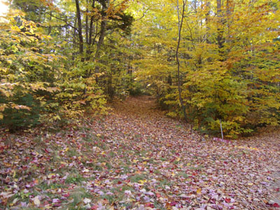
The Mountain Trail trailhead

Looking at Mt. Chocorua and Mt. Washington from the boulder near the summit of Sentinel Mountain
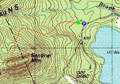

Directions to trailhead: From Route 16 South in West Ossipee, take a left onto Old NH 16. After crossing under Route 16, take a right onto Folsom Road. Once in Center Ossipee, take a right onto Moultonville Road. A few minutes later, take a right onto Valley Road. Look for the entrance to Terrace Pines Campground, which will be on the right when Valley Road forks. Shortly down this road, take a right (immediately before a sign for the office). There is limited room for parking in front of the gate - do not block the gate. The Mountain Trail starts a few dozen feet beyond the gate, on the left.
Back to Sentinel Mountain Profile
|