Home
States
Colorado
Connecticut
Maine
Massachusetts
New Hampshire
New York
Rhode Island
Utah
Vermont
View All
Lists
NE 4,000 Footers
NE 100 Highest
NH 4,000 Footers
NH 100 Highest
NH 52 With A View
NH Belknap Range
NH Ossipee 10
Links
Trail Conditions
Trip Log
Sunrises
Sunsets
About
|
Shelburne Moriah Mountain, Howe Peak
Shelburne, NH
Trailheads, measurements, times, distances, and maps are all approximate and relative to the hike(s) as shown below.
The Kenduskeag Trail
Route: FR 95, Shelburne Trail, Kenduskeag Trail, bushwhack
Roadwalk portions were extremely tedious, due to a breakable crust on top of spring snow that had lost some density. Essentially random trailbreaking both ways. Pretty close to 6.5 miles of roadwalking roundtrip, including the 2.1 each way signed as the Shelburne Trail. Snowpack was probably 6-10". Snowshoes needed.
Once on the trailed portion of the Shelburne, conditions improved, as the snowpack had set up a bit more. Nonetheless, there were a few minor mud areas to skirt around. Once again, snowshoes a must. Snowpack generally one to two feet.
Surface conditions on Kenduskeag Trail were ideal, as the snow had set up well and thus we barely sank in. Virtually all of the ledges were well covered with snow base. Navigation was difficult in places, though, as the corridor was filled with blowdowns, bend overs, and low branches. Blazing is also almost non existent (occasional faded blue blazes). A few ledgy areas are pretty open with minimal clues as to where to get back in the scrub. With sunny skies, mild temperatures, and no wind, it wasn't an issue taking time to look around the ledges. Nice views from Shelburne Moriah, but perhaps better views from the various ledges east of it (including the neat little dome ledge just south of the trail, maybe a mile east of the summit). Snowpack was generally around 2 feet, deeper in other places. Some scrubby areas had filled in nicely, making for good view exploration.
Back in the col, we bushwhacked to Howe Peak. Generally better woods if sticking to the southern end of the ridge with some scrubby stuff further north. Occasionally meandered into the abandoned trail corridor. Lots of nice views from the ledges on top.
Long day, decent miles and vertical. Factoring in distance, cumulative vertical, and trail finding, it was more challenging than most of the standard winter NH 4K ascents.
| Hike Ratings |
|
Getting To Trailhead: |
Difficult |
| Destination: |
Howe Peak |
|
Length: |
Difficult |
|
Steepness: |
Difficult |
|
Navigation: |
Difficult |
|
Views: |
Excellent |
|
Crowds: |
Minimal |
| Destination: |
Howe Peak |
|
Length: |
Difficult |
|
Steepness: |
Difficult |
|
Navigation: |
Difficult |
|
Views: |
Excellent |
|
Crowds: |
Minimal |
|
| Hike Stats |
|
Date Hiked: |
Saturday, December 27, 2014 |
| Parking Elevation: |
710' |
| Time to Trailhead: |
00:28 |
| Destination: |
Shelburne Moriah Mountain |
| Time Elapsed: |
03:38 |
| Trailhead Elevation: |
850' |
| Summit Elevation: |
3,735' |
| Vertical Gain: |
3,135' |
| Destination: |
Howe Peak |
| Time Elapsed: |
01:42 |
| Trailhead Elevation: |
3,735' |
| Summit Elevation: |
2,966' |
| Vertical Gain: |
366' |
|
|
| Hike Time Elapsed: |
08:43 |
| Hike Vertical Gain: |
3,891' |
|
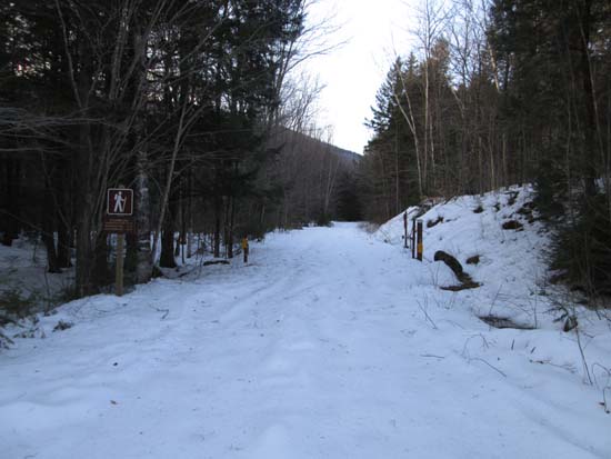
The Shelburne Trail trailhead
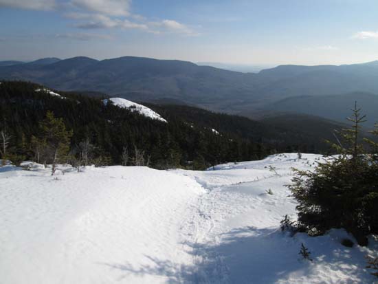
The Kenduskeag Trail
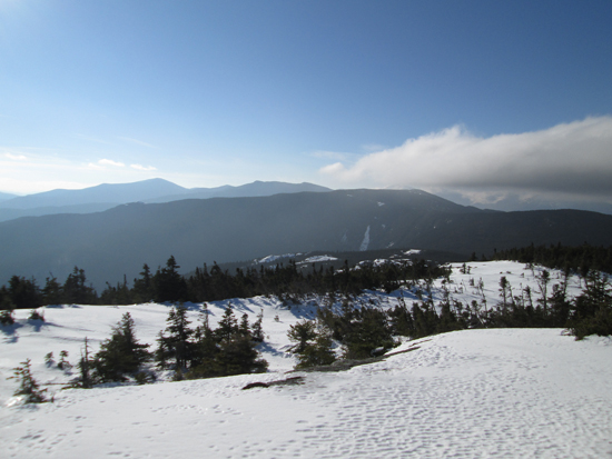
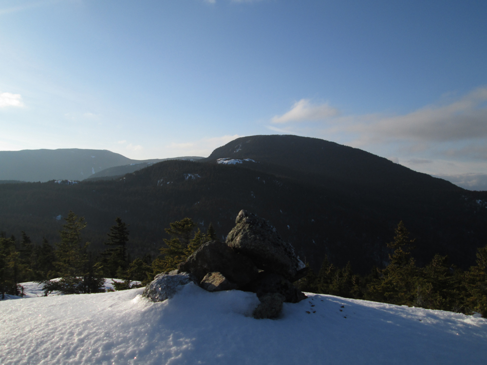
Looking at the Carters and Moriah from Shelburne Moriah
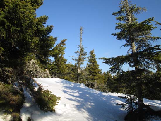
Bushwhacking to Howe Peak

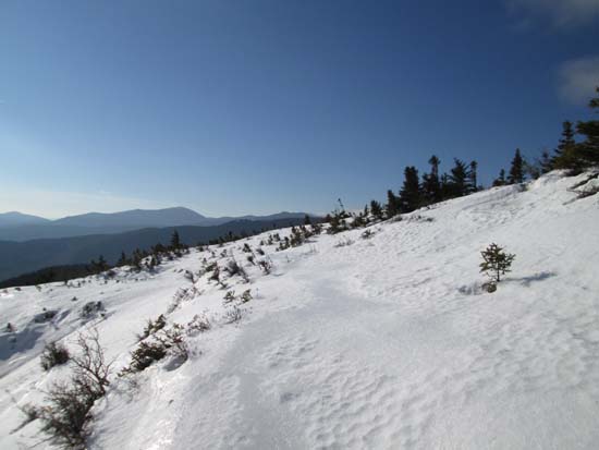
Looking at Shelburne Moriah from near the summit of Howe Peak


Directions to trailhead: Take US 2 east from Gorham and the Appalachian Trail. The forest road leading to the Shelburne Trail will eventually be on the right with a hiker sign. In winter, this road is not plowed. There may be a plowed lot shortly thereafter on the right. From the back right of the parking lot, one can proceed on foot to a road to FR 95, then up FR 95 to the summer trailhead.
Back to Shelburne Moriah Mountain Profile
Back to Howe Peak Profile
|