Home
States
Colorado
Connecticut
Maine
Massachusetts
New Hampshire
New York
Rhode Island
Utah
Vermont
View All
Lists
NE 4,000 Footers
NE 100 Highest
NH 4,000 Footers
NH 100 Highest
NH 52 With A View
NH Belknap Range
NH Ossipee 10
Links
Trail Conditions
Trip Log
Sunrises
Sunsets
About
|
South Baldface, North Baldface, Eagle Crag
Chatham, NH, Bean's Purchase, NH
Trailheads, measurements, times, distances, and maps are all approximate and relative to the hike(s) as shown below.
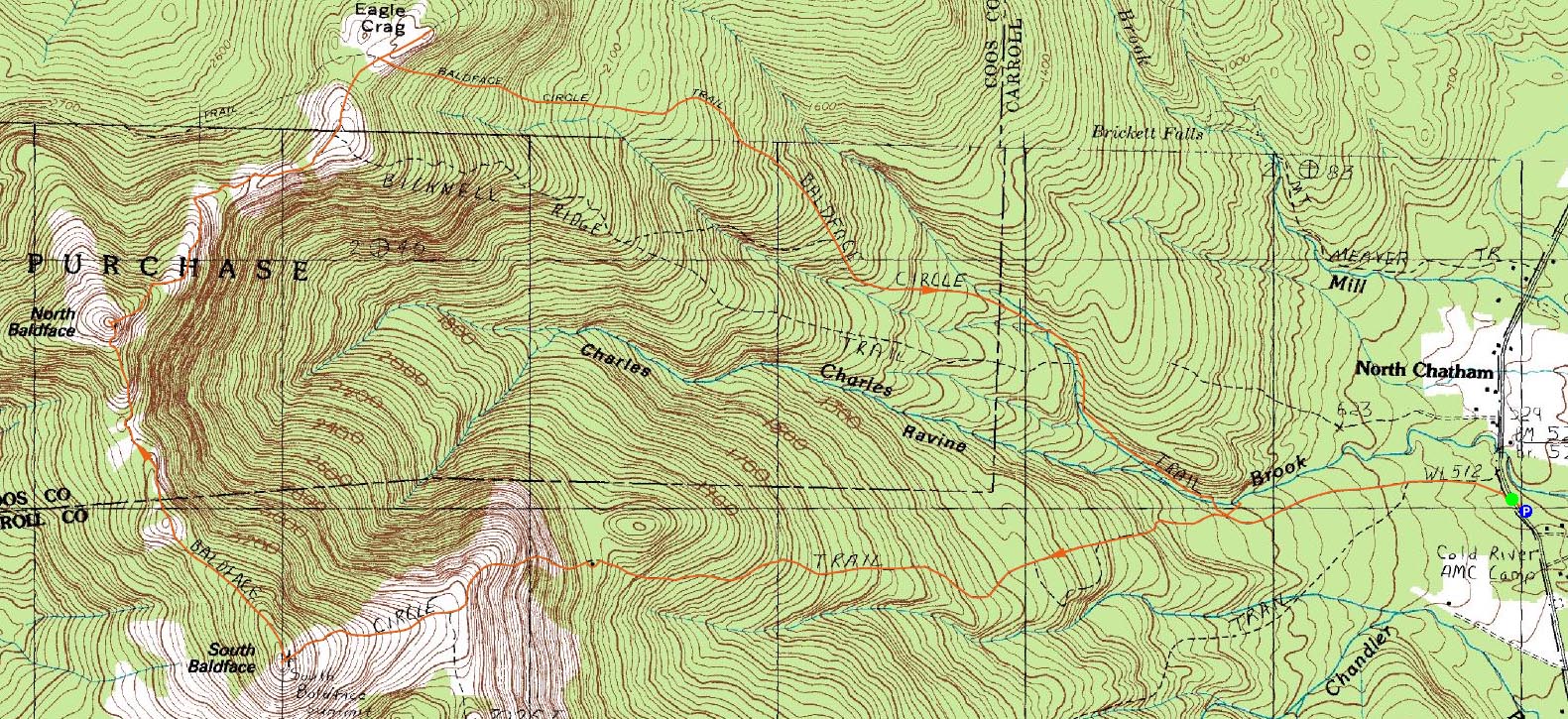
The Baldface Circle Trail to South Baldface
Route: Baldface Circle Trail, (South Baldface), Baldface Circle Trail, (North Baldface), Baldface Circle Trail, Meader Ridge Trail, (Eagle Crag), Meader Ridge Trail, Baldface Circle Trail, Emerald Pool spur trail, (Emerald Pool), Emerald Pool spur trail, Baldface Circle Trail
With lots of junk weather in sight for days, I decided to take some comp time and do an afternoon hike. Though tempted to work on the NH 4,000 footer list, I decided to go for a hike I had been looking to do for some time now - the Baldfaces.
Starting just after noon, I left the parking lot and walked north on the road for a few dozen feet, before ascending the rock stairway and starting the gentle first portion of the trail. Up until the Emerald Pool/South Baldface intersection, it's very easy going.
After the Slippery Brook Trail slides off the South Baldface Baldface Circle Trail, things become moderately steep for quite awhile - all the way to the leanto. From here, the real fun starts.
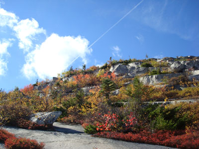
Up until this point, the leaves were still green. Starting at the hut, the trail climbed up ledges surrounded by excellent fall colours. The views very quickly stretched up Evans Notch and beyond. There's a lot of fun scrambling - wouldn't want to be here when its wet!
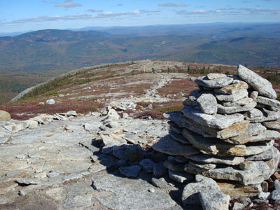
After probably a good 1,000 feet filled with fun scrambles, the trail levels off a bit and heads up to a knob with great views. From here, I continued up the Baldface Circle Trail to the South Baldface summit.
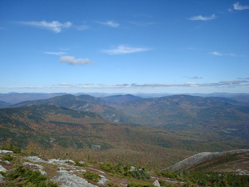
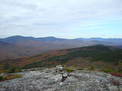
I had this panoramic viewpoint all to myself - something I likely would not have had if I were doing a 4,000 footer. The views stretched way north towards Rangeley, Maine, out to the colourful Carter Ridge, a cloud covered Mt. Washington, the Sandwich Range, Pleasant Mountain, and beyond.
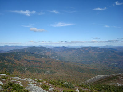
After having a snack, I continued to the slightly higher North Baldface. The trail between the two crosses many bare ledges and involves a few scrambles.
The views from North Baldface weren't quite as good, due to quickly approaching clouds from the west. Nonetheless, they were still excellent. After chatting with another hiker for a bit, I continued with the loop.
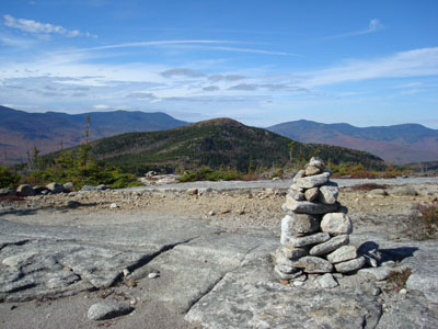
My next stop was Eagle Crag - just a bit north of the Baldface Circle Trail. The trail has multiple dips along the way, as well as multiple view points. Eagle Crag had impressive views, though nowhere nearly as good as the Baldfaces.
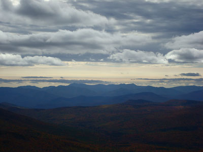
The descent was very steep at first from there - a decent amount of scramble coupled with some nice views. Upon reaching the flats, I listened to Pink Floyd's Atom Heart Mother. I made on stop along the way - checking out the neat Emerald Pool. Yes, it indeed has an emerald coloured tint to it.
What a great hike - to date I've hiked a bit over 40 4,000 footers in New England and I must say, despite being almost half a grand short, the Baldfaces are more enjoyable than most of the peaks on that list that I've climbed. Between the fun trail, neat topography, minimal crowds, and excellent views, there aren't many peaks I've been to that top these.
| Hike Ratings |
|
Getting To Trailhead: |
Easy |
| Destination: |
South Baldface |
|
Length: |
Moderate |
|
Steepness: |
Very Difficult |
|
Navigation: |
Moderate |
|
Views: |
Excellent |
|
Crowds: |
Minimal |
| Destination: |
North Baldface |
|
Length: |
Moderate |
|
Steepness: |
Very Difficult |
|
Navigation: |
Easy |
|
Views: |
Excellent |
|
Crowds: |
Minimal |
| Destination: |
Eagle Crag |
|
Length: |
Moderate |
|
Steepness: |
Very Difficult |
|
Navigation: |
Easy |
|
Views: |
Excellent |
|
Crowds: |
Minimal |
|
| Hike Stats |
|
Date Hiked: |
Tuesday, October 9, 2007 |
| Hike Commenced: |
12:10 PM |
| Parking Elevation: |
505' |
| Destination: |
South Baldface |
| Ascent Commenced: |
12:11 PM |
| Summit Reached: |
2:00 PM |
| Time Elapsed: |
01:49 |
| Trailhead Elevation: |
500' |
| Summit Elevation: |
3,570' |
| Distance: |
3.7 miles |
| Vertical Gain: |
3,130' |
| Destination: |
North Baldface |
| Ascent Commenced: |
2:08 PM |
| Summit Reached: |
2:41 PM |
| Time Elapsed: |
00:33 |
| Trailhead Elevation: |
3,570' |
| Summit Elevation: |
3,610' |
| Distance: |
1.2 miles |
| Vertical Gain: |
470' |
| Destination: |
Eagle Crag |
| Ascent Commenced: |
3:06 PM |
| Summit Reached: |
3:45 PM |
| Time Elapsed: |
00:39 |
| Trailhead Elevation: |
3,610' |
| Summit Elevation: |
3,020' |
| Distance: |
1.2 miles |
| Vertical Gain: |
260' |
|
|
| Hike Ended: |
5:33 PM |
| Hike Time Elapsed: |
05:22 |
| Hike Vertical Gain: |
3,965' |
|
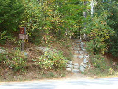
The Baldface Circle Trail trailhead on Route 113
The Baldface Circle Trail to South Baldface
Looking up Evans Notch from the South Baldface summit
The Baldface Circle Trail to North Baldface
Looking at the Sandwich Range from the North Baldface summit
Looking down the Baldface Circle Trail on the way to Eagle Crag
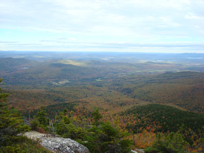
Looking southeast from Eagle Crag

Directions to trailhead: From US 302 in Maine, take 113 North towards Evans Notch. The Baldface parking lot is on the right side of the road. The trailhead is just north of the parking lot on 113.
Back to South Baldface Profile
Back to North Baldface Profile
Back to Eagle Crag Profile
|