Home
States
Colorado
Connecticut
Maine
Massachusetts
New Hampshire
New York
Rhode Island
Utah
Vermont
View All
Lists
NE 4,000 Footers
NE 100 Highest
NH 4,000 Footers
NH 100 Highest
NH 52 With A View
NH Belknap Range
NH Ossipee 10
Links
Trail Conditions
Trip Log
Sunrises
Sunsets
About
|
South Baldface, North Baldface
Chatham, NH, Bean's Purchase, NH
Trailheads, measurements, times, distances, and maps are all approximate and relative to the hike(s) as shown below.
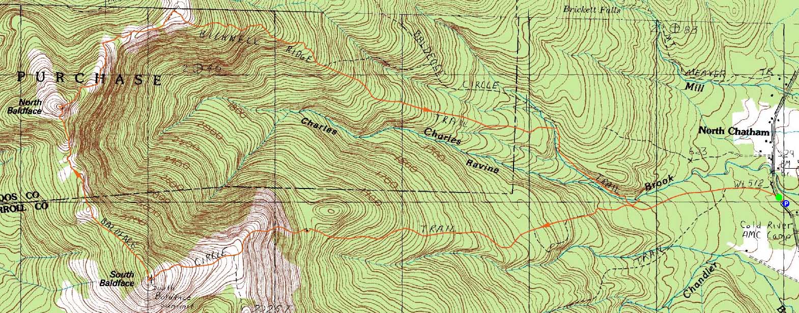
The Baldface Circle Trail to South Baldface
Route: Baldface Circle Trail, (South Baldface), Baldface Circle Trail, (North Baldface), Baldface Circle Trail, Bicknell Ridge Trail, Baldface Circle Trail, Emerald Pool spur trail, (Emerald Pool), Emerald Pool spur trail, Baldface Circle Trail
As literally a last minute decision, I decided to head up to Evans Notch for a Baldfaces hike.
The weather was great - reasonable temperatures, sunny skies, decent visibility. The lower portion of the hike went by quickly as we worked our way up to the Baldface shelter.
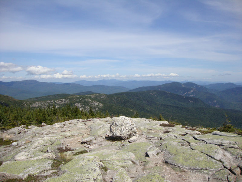
Above the shelter, the ledge scrambles were once again a lot of fun. The views up Evans Notch were terrific and, in the distance, Mt. Blue was easily seen.
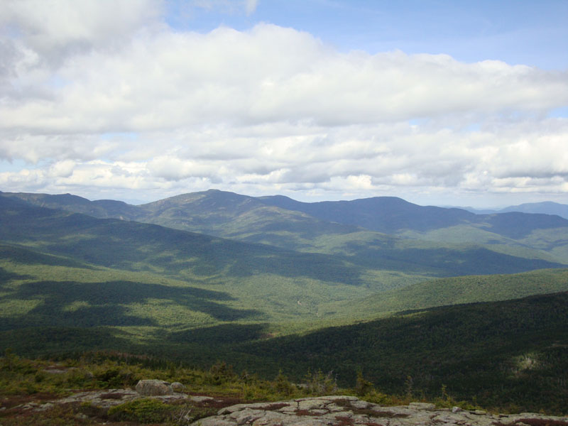
Only my second time visiting North Baldface, I was surprised to see how steep the trail was in parts - I forgot about a few of those scrambles! As was the case in my previous visit, some clouds rolled in as I reached the summit. Nonetheless, the views were great.
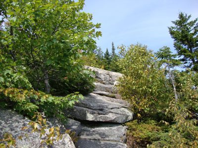
For the descent, we tried the Bicknell Ridge Trail. I found this to be a much better alternative to the Baldface Circle descent - lots more views, a bit more gradual, and better footing.
After a stop at the Emerald Pool, we called it a day. Yet another nice hike in Evans Notch.
| Hike Ratings |
|
Getting To Trailhead: |
Easy |
| Destination: |
South Baldface |
|
Length: |
Moderate |
|
Steepness: |
Very Difficult |
|
Navigation: |
Moderate |
|
Views: |
Excellent |
|
Crowds: |
Heavy |
| Destination: |
North Baldface |
|
Length: |
Moderate |
|
Steepness: |
Very Difficult |
|
Navigation: |
Easy |
|
Views: |
Excellent |
|
Crowds: |
Heavy |
|
| Hike Stats |
|
Date Hiked: |
Monday, September 7, 2009 |
| Hike Commenced: |
9:08 AM |
| Parking Elevation: |
505' |
| Destination: |
South Baldface |
| Ascent Commenced: |
9:10 AM |
| Summit Reached: |
12:01 PM |
| Time Elapsed: |
02:49 |
| Trailhead Elevation: |
500' |
| Summit Elevation: |
3,570' |
| Distance: |
3.7 miles |
| Vertical Gain: |
3,130' |
| Destination: |
North Baldface |
| Ascent Commenced: |
12:21 PM |
| Summit Reached: |
1:01 PM |
| Time Elapsed: |
00:40 |
| Trailhead Elevation: |
3,570' |
| Summit Elevation: |
3,610' |
| Distance: |
1.2 miles |
| Vertical Gain: |
470' |
|
|
| Hike Ended: |
4:31 PM |
| Hike Time Elapsed: |
07:23 |
| Hike Vertical Gain: |
3,705' |
|
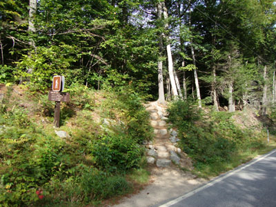
The Baldface Circle Trail trailhead on Route 113
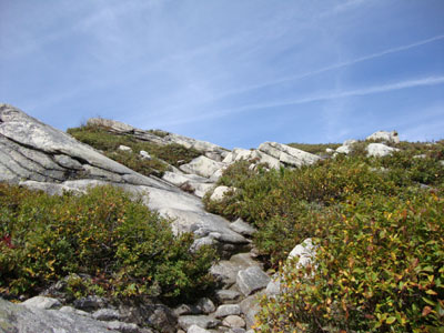
The Baldface Circle Trail to South Baldface
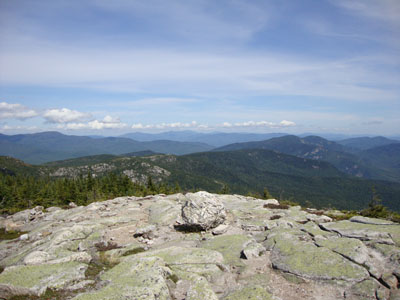
Looking at Eagle Crag and the Royces from South Baldface
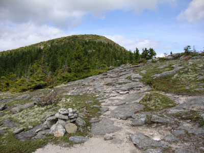
The Baldface Circle Trail to North Baldface

Looking at the Moriahs from North Baldface
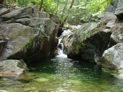
The Emerald Pool
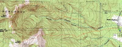

Directions to trailhead: From US 302 in Maine, take 113 North towards Evans Notch. The Baldface parking lot is on the right side of the road. The trailhead is just north of the parking lot on 113.
Back to South Baldface Profile
Back to North Baldface Profile
|