Home
States
Colorado
Connecticut
Maine
Massachusetts
New Hampshire
New York
Rhode Island
Utah
Vermont
View All
Lists
NE 4,000 Footers
NE 100 Highest
NH 4,000 Footers
NH 100 Highest
NH 52 With A View
NH Belknap Range
NH Ossipee 10
Links
Trail Conditions
Trip Log
Sunrises
Sunsets
About
|
South Doublehead
Jackson, NH
Trailheads, measurements, times, distances, and maps are all approximate and relative to the hike(s) as shown below.
Looking up the New Path
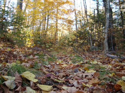
With the days continuing to get shorter (and the afternoons about to get one hour shorter), my options continue to dwindle. Wanting to do a sunset hike with some sort of workout, I opted to ascend South Doublehead and try a new-to-me trail.
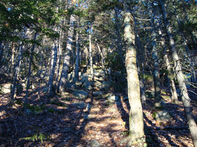
The first part of the New Path was a bit muddy (from the weekend monsoon). After a small water crossing, I soon reached some ledges covered in running water. Not too long after that, the trail suddenly became very steep - and stayed that way for the balance of the hike. With my sore knee, I would have opted for something a bit more gentle, had I realized how steep and rough the New Path is - it reminded me a lot of the northern branch of the Hancock Loop in terms of steepness, footing, and length.
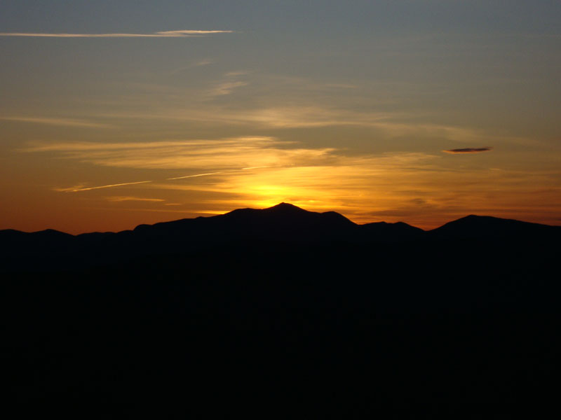
Finally reaching the summit, I checked out the near-summit viewpoint, prior to rushing down to the south to check out the other vistas. Unfortunately, I didn't make it back to my sunset perch until just after the sun had disappeared behind Mt. Carrigain. Nonetheless, it was a nice display of colors, complemented with decent temperatures.
The descent was rough - I'm not sure I'd ever want to descend this trail again, nevermind in the dark!
| Hike Ratings |
|
Getting To Trailhead: |
Easy |
| Destination: |
South Doublehead |
|
Length: |
Moderate |
|
Steepness: |
Very Difficult |
|
Navigation: |
Easy |
|
Views: |
Excellent |
|
Crowds: |
Minimal |
|
| Hike Stats |
|
Date Hiked: |
Monday, October 26, 2009 |
| Hike Commenced: |
4:49 PM |
| Parking Elevation: |
1,593' |
| Destination: |
South Doublehead |
| Ascent Commenced: |
4:49 PM |
| Summit Reached: |
5:26 PM |
| Time Elapsed: |
00:37 |
| Trailhead Elevation: |
1,593' |
| Summit Elevation: |
2,939' |
| Vertical Gain: |
1,386' |
|
|
| Hike Ended: |
6:41 PM |
| Hike Time Elapsed: |
01:52 |
| Hike Vertical Gain: |
1,516' |
|
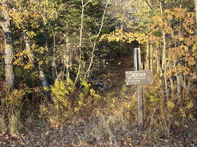
The New Path trailhead on Dundee Road
Looking up the New Path
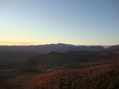
The Presidentials as seen from South Doublehead
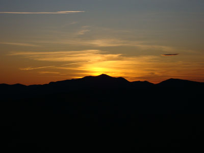
The sun setting behind Mt. Carrigain as seen from South Doublehead
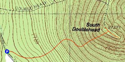

Directions to trailhead: Take Route 16 North to Jackson, then take 16A past Black Mountain Ski Area. Just after the ski area, take a right onto Dundee Road. Shortly after passing the Doublehead Ski Trail trailhead, and just before reaching a gate, the New Path trailhead will be on the left. There is limited room to park on the side of the road.
Back to South Doublehead Profile
|