Home
States
Colorado
Connecticut
Maine
Massachusetts
New Hampshire
New York
Rhode Island
Utah
Vermont
View All
Lists
NE 4,000 Footers
NE 100 Highest
NH 4,000 Footers
NH 100 Highest
NH 52 With A View
NH Belknap Range
NH Ossipee 10
Links
Trail Conditions
Trip Log
Sunrises
Sunsets
About
|
South Doublehead, North Doublehead
Jackson, NH
Trailheads, measurements, times, distances, and maps are all approximate and relative to the hike(s) as shown below.
Looking up the Old Path on the way to South Doublehead
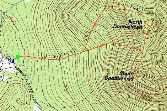
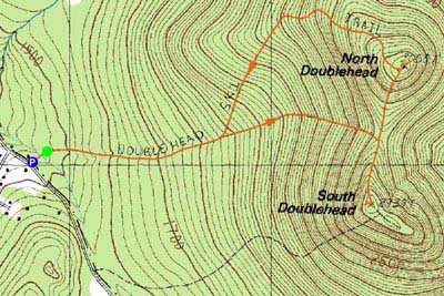
Route: Doublehead Ski Trail, Old Path, New Path, (South Doublehead), New Path, (North Doublehead), Doublehead Ski Trail
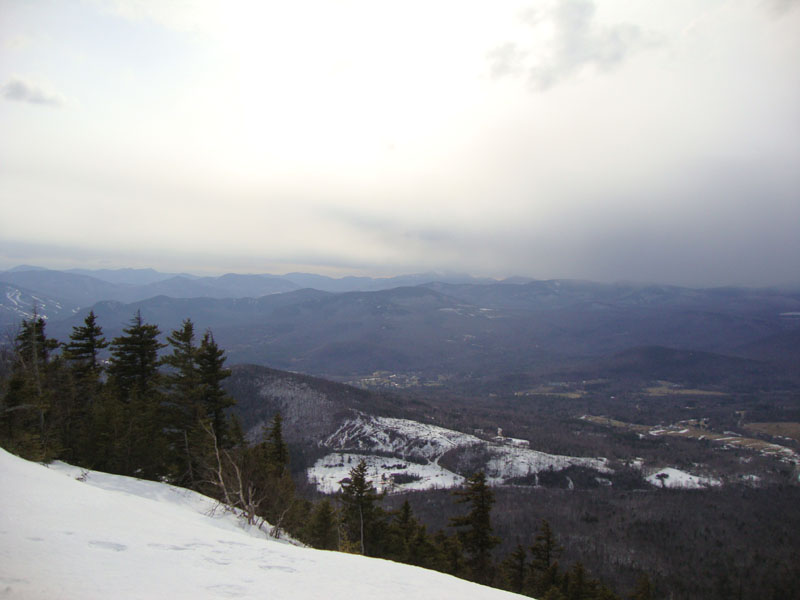
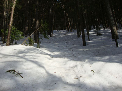
After rain had left the region, I opted to head to a slightly higher base elevation. Starting at the Doublehead Ski Trail trailhead, there was a good foot or more of snowpack - and plenty of minor blowdowns. Hopping onto the Old Path, I worked my way up the steep mountainside in decent spring snow conditions, taking a right and heading to South Doublehead. Though good, the views weren't spectacular, as clouds were moving in, obscuring the high peaks.
Back in the col, I headed up to North Doublehead. My first stop at the summit was to the eastern viewpoint, were I had a nice look at the Maine peaks and Mountain Pond.
Having heard of (and having seen) ledges on the southwest side of the peak, I looked around for a spur path, but found none. After doing some bushwhacking, I found myself on the ledges, with a slightly different perspective than the main viewpoint at South Doublehead. This viewpoint reached further south (though it lacked the northern view). I particularly liked the view of the old Tyrol ski area. Certainly worth a return trip.
Back on the ski trail, I took the time to remove a bunch of small blowdowns, hopefully rendering the trail a bit more skiable. While the lower waterbars and minor brooks were open, they were still fairly easily crossed.
| Hike Ratings |
|
Getting To Trailhead: |
Easy |
| Destination: |
South Doublehead |
|
Length: |
Moderate |
|
Steepness: |
Difficult |
|
Navigation: |
Easy |
|
Views: |
Excellent |
|
Crowds: |
Minimal |
| Destination: |
North Doublehead |
|
Length: |
Moderate |
|
Steepness: |
Difficult |
|
Navigation: |
Moderate |
|
Views: |
Excellent |
|
Crowds: |
Minimal |
|
| Hike Stats |
|
Date Hiked: |
Thursday, March 25, 2010 |
| Hike Commenced: |
3:54 PM |
| Parking Elevation: |
1,480' |
| Destination: |
South Doublehead |
| Ascent Commenced: |
3:57 PM |
| Summit Reached: |
4:42 PM |
| Time Elapsed: |
00:45 |
| Trailhead Elevation: |
1,480' |
| Summit Elevation: |
2,939' |
| Vertical Gain: |
1,459' |
| Destination: |
North Doublehead |
| Ascent Commenced: |
4:46 PM |
| Summit Reached: |
5:02 PM |
| Time Elapsed: |
00:16 |
| Trailhead Elevation: |
2,939' |
| Summit Elevation: |
3,053' |
| Vertical Gain: |
353' |
|
|
| Hike Ended: |
6:38 PM |
| Hike Time Elapsed: |
02:44 |
| Hike Vertical Gain: |
1,842' |
|
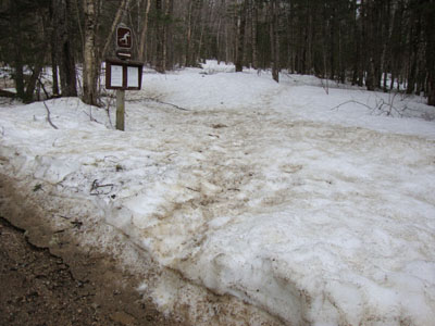
The Doublehead Ski Trail trailhead
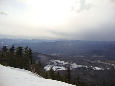
Looking over Tin Mountain toward Mt. Carrigain from the ledge near the South Doublehead summit
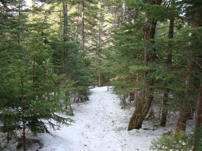
The New Path to North Doublehead
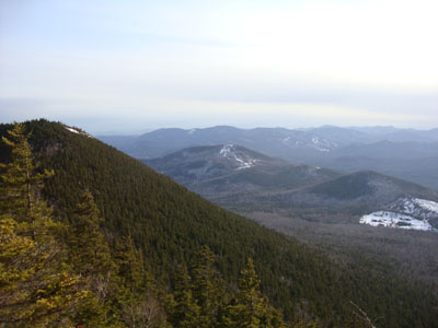
Looking at Thorn Mountain from near the summit of North Doublehead

Directions to trailhead: Take Route 16 North to Jackson, then take 16A past Black Mountain Ski Area. Just after the ski area, take a right onto Dundee Road. A small parking lot and the trailhead are both located on the left side of the road, on a private drive (the trailhead is a few hundred feet down the private drive on the right).
Back to South Doublehead Profile
Back to North Doublehead Profile
|