Home
States
Colorado
Connecticut
Maine
Massachusetts
New Hampshire
New York
Rhode Island
Utah
Vermont
View All
Lists
NE 4,000 Footers
NE 100 Highest
NH 4,000 Footers
NH 100 Highest
NH 52 With A View
NH Belknap Range
NH Ossipee 10
Links
Trail Conditions
Trip Log
Sunrises
Sunsets
About
|
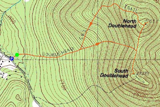
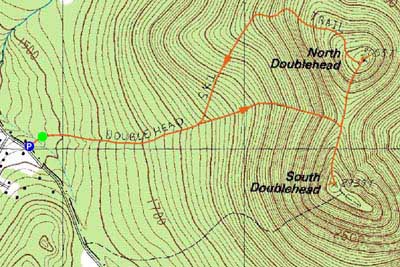
South Doublehead, North Doublehead
Jackson, NH
Trailheads, measurements, times, distances, and maps are all approximate and relative to the hike(s) as shown below.
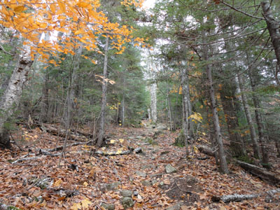
Looking up the Old Path on the way to South Doublehead
Route: Doublehead Ski Trail, Old Path, New Path, (South Doublehead), New Path, (North Doublehead), Doublehead Ski Trail
While I had originally intended to hike to North Doublehead for the sunset, some thick clouds were building in earlier than forecasted. Thus, I decided to get the loop done in daylight.
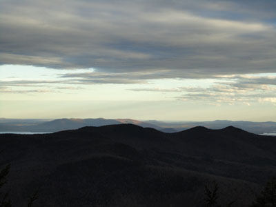
Starting at the trailhead, I jogged and hiked my way up the ski trail, which was muddy in the flat places. I then generally hiked up the steep Old Path, then worked my way over to South Doublehead. Though dark due to the clouds, the views from the northern ledge were nonetheless decent with some interesting sunrays breaking the southern clouds.
I then jogged my way to the foot of North Doublehead and then hiked up the short, but somewhat steep trail to the summit. While I had originally intended to go to the southwest ledges (via spur path just before the summit), I decided to just visit the eastern viewpoint, from where I had decent views into Maine.
For the descent, I generally walked the upper portion of the ski trail, as the leaves were slippery and concealing of rocks underneath.
| Hike Ratings |
|
Getting To Trailhead: |
Easy |
| Destination: |
South Doublehead |
|
Length: |
Moderate |
|
Steepness: |
Difficult |
|
Navigation: |
Easy |
|
Views: |
Excellent |
|
Crowds: |
Minimal |
| Destination: |
North Doublehead |
|
Length: |
Moderate |
|
Steepness: |
Difficult |
|
Navigation: |
Easy |
|
Views: |
Excellent |
|
Crowds: |
Minimal |
|
| Hike Stats |
|
Date Hiked: |
Thursday, October 28, 2010 |
| Hike Commenced: |
3:51 PM |
| Parking Elevation: |
1,480' |
| Destination: |
South Doublehead |
| Ascent Commenced: |
3:52 PM |
| Summit Reached: |
4:26 PM |
| Time Elapsed: |
00:34 |
| Trailhead Elevation: |
1,480' |
| Summit Elevation: |
2,939' |
| Vertical Gain: |
1,459' |
| Destination: |
North Doublehead |
| Ascent Commenced: |
4:31 PM |
| Summit Reached: |
4:43 PM |
| Time Elapsed: |
00:12 |
| Trailhead Elevation: |
2,939' |
| Summit Elevation: |
3,053' |
| Vertical Gain: |
353' |
|
|
| Hike Ended: |
5:27 PM |
| Hike Time Elapsed: |
01:35 |
| Hike Vertical Gain: |
1,842' |
|
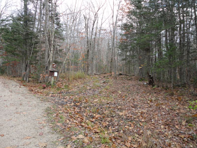
The Doublehead Ski Trail trailhead

Looking southwest from the ledge near the South Doublehead summit
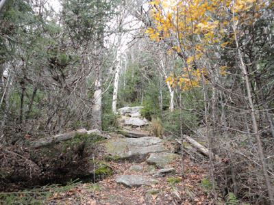
The New Path to North Doublehead
Looking at Pleasant Mountain from near the summit of North Doublehead

Directions to trailhead: Take Route 16 North to Jackson, then take 16A past Black Mountain Ski Area. Just after the ski area, take a right onto Dundee Road. A small parking lot and the trailhead are both located on the left side of the road, on a private drive (the trailhead is a few hundred feet down the private drive on the right).
Back to South Doublehead Profile
Back to North Doublehead Profile
|