Home
States
Colorado
Connecticut
Maine
Massachusetts
New Hampshire
New York
Rhode Island
Utah
Vermont
View All
Lists
NE 4,000 Footers
NE 100 Highest
NH 4,000 Footers
NH 100 Highest
NH 52 With A View
NH Belknap Range
NH Ossipee 10
Links
Trail Conditions
Trip Log
Sunrises
Sunsets
About
|
South Moat Mountain
Albany, NH
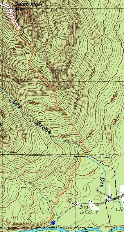
Trailheads, measurements, times, distances, and maps are all approximate and relative to the hike(s) as shown below.
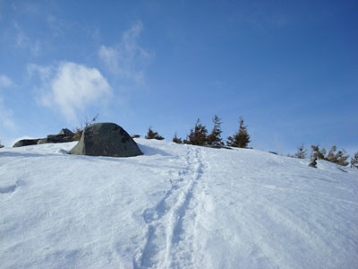
Looking up the Moat Mountain Trail near the South Moat Mountain summit
Route: Moat Mountain Trail
Earlier in the week, the weekend forecast looked strong - 'clear' if I recall. As the weekend neared, the forecasters John Kerry-ed it. Saturday turned into party sunny, and then to rain, while Sunday went from clear to mostly sunny to partly sunny to mostly cloudy.
Playing my odds the day of, I waited out the rain and clouds and departed once I saw some blue sky. My original plan was to do Caridgan, which then changed to Middle Sister, then to Wildcat, and then, once on West Side Road, South Moat.
Arriving at the trailhead, I was the the first hiker of the day, despite the later hour.
As I set off on my snowshoes in the spring snow, I noticed some very fresh deer tracks. Sure enough, between the two water crossings, I saw half a dozen deer about 50 years in front of me. Unfortunately, I was unable to get an unobstructed photo of them. As I neared, they heard my snowshoes and took off down the trail. Had it been earlier in the day, I would have considered pursuing their tracks (once they departed from the trail), however I knew I had a limited window of partly sunny weather.
The ledge area, while still mostly snow covered, was quickly melting - I could hear rushing water underneath the trail's snowpack. This trail will be off limits quite soon once spring hits!
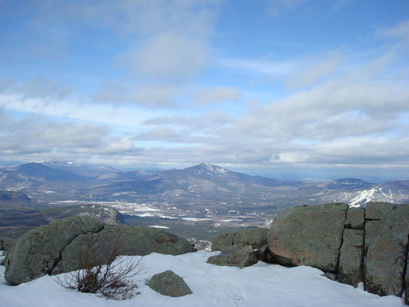
Surprisingly, Mt. Chocorua was in the clouds while Mt. Washington was out of the clouds for much of the time I took in the views at the summit. I don't recall seeing this before! Basically, stuff to the west was in low clouds wereas the northeast and southeast was partly sunny.
As the sun broke through the clouds, I enjoyed a nice pleasant descent, clearing blowdowns and downed branches. Hopefully this snow melts soon!
| Hike Ratings |
|
Getting To Trailhead: |
Easy |
| Destination: |
South Moat Mountain |
|
Length: |
Moderate |
|
Steepness: |
Difficult |
|
Navigation: |
Moderate |
|
Views: |
Excellent |
|
Crowds: |
Minimal |
|
| Hike Stats |
|
Date Hiked: |
Saturday, April 5, 2008 |
| Hike Commenced: |
2:55 PM |
| Parking Elevation: |
650' |
| Destination: |
South Moat Mountain |
| Ascent Commenced: |
2:55 PM |
| Summit Reached: |
4:27 PM |
| Time Elapsed: |
01:32 |
| Trailhead Elevation: |
650' |
| Summit Elevation: |
2,770' |
| Distance: |
2.7 miles |
| Vertical Gain: |
2,235' |
|
|
| Hike Ended: |
5:57 PM |
| Hike Time Elapsed: |
03:02 |
| Hike Distance: |
5.4 miles |
| Hike Vertical Gain: |
2,350' |
|
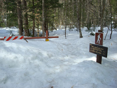
Moat Mountain Trail trailhead
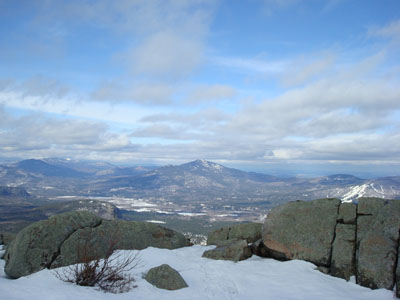
Looking east northeast toward Cranmore Mountain and Kearsarge North Mountain
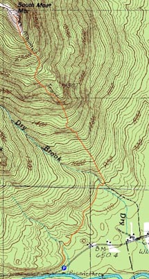

Directions to trailhead: Take Route 16 North into Conway. Take a left at the first set of downtown lights onto West Side Road. Soon after, take a left onto Passaconaway Road. A few minutes down the road, the Moat Mountain Trail trailhead and WMNF fee parking area will be on the right. If you pass the picnic area on your left, you've gone just a little bit too far.
Back to South Moat Mountain Profile
|