Home
States
Colorado
Connecticut
Maine
Massachusetts
New Hampshire
New York
Rhode Island
Utah
Vermont
View All
Lists
NE 4,000 Footers
NE 100 Highest
NH 4,000 Footers
NH 100 Highest
NH 52 With A View
NH Belknap Range
NH Ossipee 10
Links
Trail Conditions
Trip Log
Sunrises
Sunsets
About
|
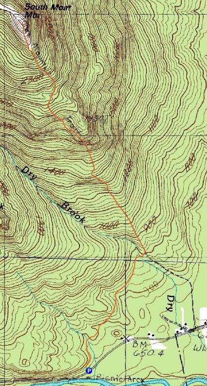
South Moat Mountain
Albany, NH
Trailheads, measurements, times, distances, and maps are all approximate and relative to the hike(s) as shown below.

Looking up the Moat Mountain Trail
Route: Moat Mountain Trail
The forecast showed the incoming clouds holding off until later in the night, so I figured it'd be a good afternoon for a sunset hike. As such, I timed my start with arriving at the summit around sunset.
The Moat Mountain Trail was in pretty good shape - mostly dry, not much in way of blowdowns. Unfortunately as I ascended, I could tell there were rather thick clouds moving in - not necessarily a good ingrediant for a sunset.
The summit was a bit breezy, but not too cold. The south was almost cloud free, while most other directions were being overtaken by increasingly heavy clouds. As the sun dipped behind the clouds, I could tell there wouldn't be much in way of a spectacular sunset. On the plus side, there were some nice colors to the southwest, between the Ossipees and Mt. Chocorua.
The descent proved to be slightly tricky. The Moat Mountain Trail, in my opinion, has been in need of reblazing ever since I first ascended it in 2007. While I have been on the section of trail to South Moat many times, the lack of markings as well as numerous ledges made it easy to stray from the trail a bit - twice I had to go back up and figure out where I went wrong.
Though I'm 0 for 3 in longer sunset hikes this fall, it was still nice to be out on the trails.
| Hike Ratings |
|
Getting To Trailhead: |
Easy |
| Destination: |
South Moat Mountain |
|
Length: |
Moderate |
|
Steepness: |
Difficult |
|
Navigation: |
Moderate |
|
Views: |
Excellent |
|
Crowds: |
Minimal |
|
| Hike Stats |
|
Date Hiked: |
Monday, October 20, 2008 |
| Hike Commenced: |
4:07 PM |
| Parking Elevation: |
650' |
| Destination: |
South Moat Mountain |
| Ascent Commenced: |
4:07 PM |
| Summit Reached: |
5:20 PM |
| Time Elapsed: |
01:13 |
| Trailhead Elevation: |
650' |
| Summit Elevation: |
2,770' |
| Distance: |
2.7 miles |
| Vertical Gain: |
2,235' |
|
|
| Hike Ended: |
7:42 PM |
| Hike Time Elapsed: |
03:35 |
| Hike Distance: |
5.4 miles |
| Hike Vertical Gain: |
2,350' |
|
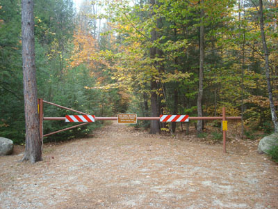
Moat Mountain Trail trailhead
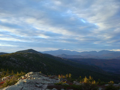
Looking at North Moat Mountain and Mt. Washington from the South Moat Mountain summit
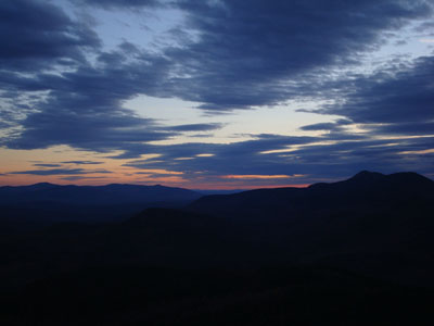
Sunset colors over the Ossipees
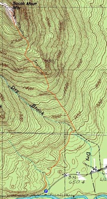

Directions to trailhead: Take Route 16 North into Conway. Take a left at the first set of downtown lights onto West Side Road. Soon after, take a left onto Passaconaway Road. A few minutes down the road, the Moat Mountain Trail trailhead and WMNF fee parking area will be on the right. If you pass the picnic area on your left, you've gone just a little bit too far.
Back to South Moat Mountain Profile
|