Home
States
Colorado
Connecticut
Maine
Massachusetts
New Hampshire
New York
Rhode Island
Utah
Vermont
View All
Lists
NE 4,000 Footers
NE 100 Highest
NH 4,000 Footers
NH 100 Highest
NH 52 With A View
NH Belknap Range
NH Ossipee 10
Links
Trail Conditions
Trip Log
Sunrises
Sunsets
About
|
Stacy Mountain
Madison, NH
Trailheads, measurements, times, distances, and maps are all approximate and relative to the hike(s) as shown below.
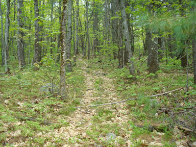
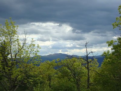
Looking up the trail to Stacy Mountain
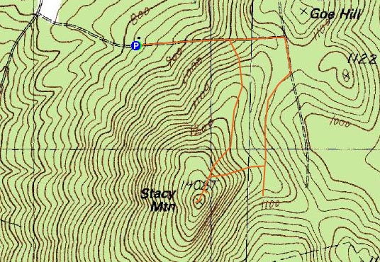
Route: Daniel Ward Road, Shawtown Road, unknown road, bushwack, unknown trail, (Stacy Mountain), unknown trail, Daniel Ward Road
Stacy Mountain had been in my sights for almost a year, however, I never could quite figure out how to access it. After recieving some directions, I decided to use an hour window of non-rainy weather to check it out.
Heading up Daniel Ward Road, I decided to park in a small field, as the road was looking very seldom travelled.
The road was a fairly gradual walk - and a somewhat spooky one, as it passed a very much abandoned house. Shortly after this, it passed a wet area, which I would later discover was where the actual trail was located. Continuing on the road, I soon reached the junction with Shawtown Road, and took a right, then shortly thereafter took another one.
Expecting to see something obvious, I continued straight on this trail, passing multiple logging roads. After reaching another open area, I soon arrived at a cabin. Knowing I was starting to head south of Stacy Mountain, I backtracked, chose a logging road, then started to bushwack when it ended.
After a few minutes of bushwacking, I reached the trail, and followed it to the summit area.
I was a bit let down, as the views weren't that great - there was one quasi-vista looking at Mt. Shaw, however the rest of the sights were through the trees (at the lakes and Green Mountain).
Since the bugs were rather annoying, I quickly headed back down the trail, eventually ending up on Daniel Ward Road (this sort of surprised me, as the descent was relatively fast and didn't seem to be cutting that far to the north).
While it sprinkled a bit at the end, the rain fortunately held off.
| Hike Ratings |
|
Getting To Trailhead: |
Difficult |
| Destination: |
Stacy Mountain |
|
Length: |
Moderate |
|
Steepness: |
Moderate |
|
Navigation: |
Difficult |
|
Views: |
Moderate |
|
Crowds: |
Minimal |
|
| Hike Stats |
|
Date Hiked: |
Thursday, May 22, 2008 |
| Hike Commenced: |
4:04 PM |
| Parking Elevation: |
820' |
| Destination: |
Stacy Mountain |
| Ascent Commenced: |
4:04 PM |
| Summit Reached: |
4:49 PM |
| Time Elapsed: |
00:45 |
| Trailhead Elevation: |
820' |
| Summit Elevation: |
1,408' |
| Vertical Gain: |
668' |
|
|
| Hike Ended: |
5:13 PM |
| Hike Time Elapsed: |
01:09 |
| Hike Vertical Gain: |
678' |
|
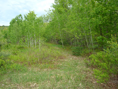
Looking up Daniel Ward Road
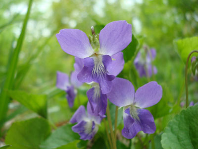
Violets along one of the logging roads
Looking at Mt. Shaw from near the Stacy Mountain summit


Directions to trailhead: Take Route 113 East from 16, then take the sharp right at the stop sign onto East Madison Road. Take a right onto Lead Mine Road. A few minutes later, take a left onto Daniel Ward Road. The road gets increasingly rough and obscure. The actual trailhead is about 3 minutes past an abandoned house, on the right, near a somewhat flat, exposed ledge.
Back to Stacy Mountain Profile
|