Home
States
Colorado
Connecticut
Maine
Massachusetts
New Hampshire
New York
Rhode Island
Utah
Vermont
View All
Lists
NE 4,000 Footers
NE 100 Highest
NH 4,000 Footers
NH 100 Highest
NH 52 With A View
NH Belknap Range
NH Ossipee 10
Links
Trail Conditions
Trip Log
Sunrises
Sunsets
About
|
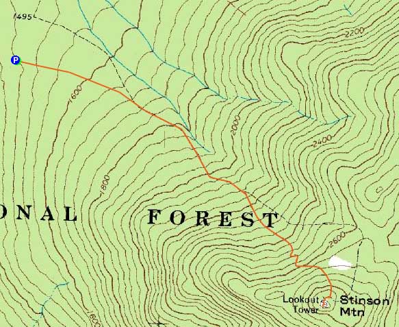
Stinson Mountain
Rumney, NH
Trailheads, measurements, times, distances, and maps are all approximate and relative to the hike(s) as shown below.
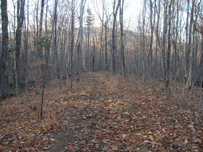
Looking down the Stinson Mountain Trail
Route: Stinson Mountain Trail
With an hour or two to spare, I headed over to Stinson Mountain for a quick hike.
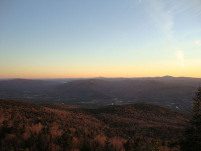
Starting at the trailhead, I jogged my way to the upper snowmobile trail junction, then walked the balance of the way to the summit. From the ledges, I had excellent southern views. In addition, I had a slight peak at the sunset - in a few more weeks, when the sunset is further south, this could be a decent perspective for it.
Once below the rockier/leafier terrain, I jogged the balance of the way back to the parking lot, just barely making it back without needing to put on my headlamp.
| Hike Ratings |
|
Getting To Trailhead: |
Easy |
| Destination: |
Stinson Mountain |
|
Length: |
Moderate |
|
Steepness: |
Moderate |
|
Navigation: |
Moderate |
|
Views: |
Excellent |
|
Crowds: |
Minimal |
|
| Hike Stats |
|
Date Hiked: |
Friday, November 12, 2010 |
| Hike Commenced: |
3:41 PM |
| Parking Elevation: |
1,495' |
| Destination: |
Stinson Mountain |
| Ascent Commenced: |
3:41 PM |
| Summit Reached: |
4:15 PM |
| Time Elapsed: |
00:34 |
| Trailhead Elevation: |
1,495' |
| Summit Elevation: |
2,900' |
| Distance: |
1.8 miles |
| Vertical Gain: |
1,415' |
|
|
| Hike Ended: |
5:04 PM |
| Hike Time Elapsed: |
01:23 |
| Hike Vertical Gain: |
1,425' |
|
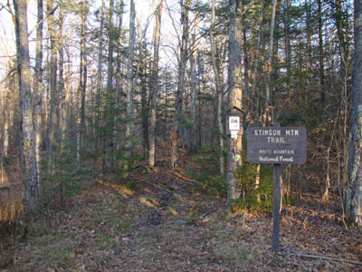
The Stinson Mountain Trail trailhead on Doetown Road
Looking south from Stinson Mountain
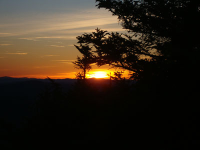
The sunset as seen from Stinson Mountain
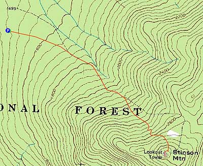

Directions to trailhead: Take Route 25 to Rumney. Take Main Street (it will become Stinson Lake Road) north, then take a right onto Cross Road. When Cross Road intersects Doetown Road, take a right. The small parking area and trailhead will be a bit down this road on the left.
Back to Stinson Mountain Profile
|