Home
States
Colorado
Connecticut
Maine
Massachusetts
New Hampshire
New York
Rhode Island
Utah
Vermont
View All
Lists
NE 4,000 Footers
NE 100 Highest
NH 4,000 Footers
NH 100 Highest
NH 52 With A View
NH Belknap Range
NH Ossipee 10
Links
Trail Conditions
Trip Log
Sunrises
Sunsets
About
|
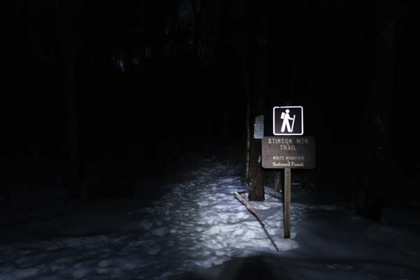
Stinson Mountain
Rumney, NH
Trailheads, measurements, times, distances, and maps are all approximate and relative to the hike(s) as shown below.
The Stinson Mountain Trail
Route: Stinson Mountain Trail
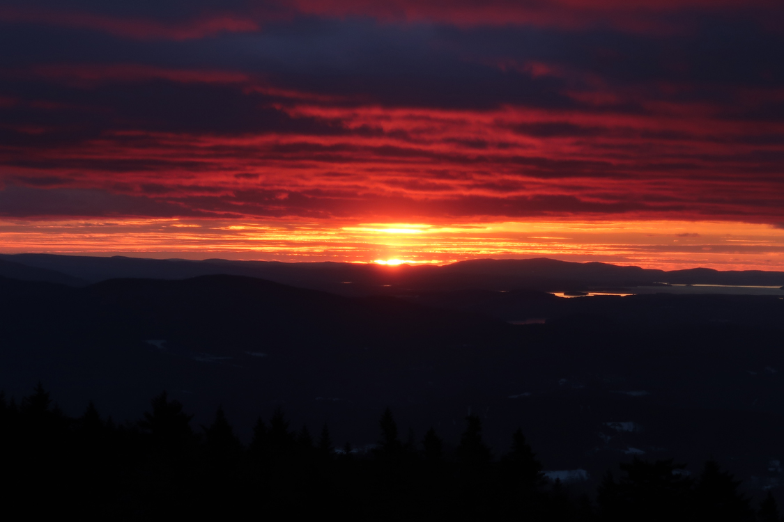
Snow was very soft prior to sunrise, but as temperatures dropped and winds picked up, things were in the initial stages of setting up. Snowpack is about 8 to 12 inches. Though there were a few snowflakes falling, no accumulation of new snow this morning.
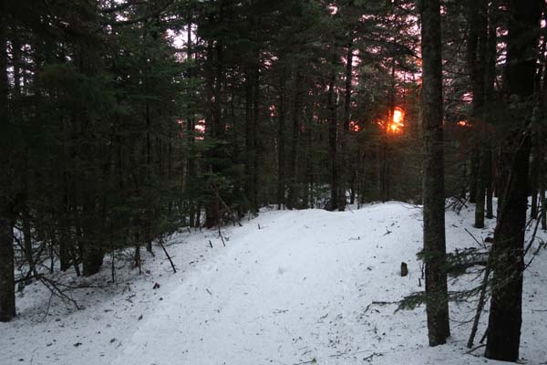
I snowshoed up the lower portion of the hiking trail, which was soft and had a monorail starting to form, but then decided to ascend the more packed snowmobile trail. Still generally wall to wall coverage, but some rocks/seeps/etc. exposed. Decent sunrise, but the wind farm really dominates the view due to the clearing that's been done in recent years.
I descended the snowmobile trail all the way to the parking lot.
Hopefully folks wear their snowshoes today, as any postholing will freeze solid and plague subsequent hikers for days thereafter.
| Hike Ratings |
|
Getting To Trailhead: |
Easy |
| Destination: |
Stinson Mountain |
|
Length: |
Moderate |
|
Steepness: |
Moderate |
|
Navigation: |
Easy |
|
Views: |
Excellent |
|
Crowds: |
Minimal |
|
| Hike Stats |
|
Date Hiked: |
Friday, January 13, 2017 |
| Parking Elevation: |
1,495' |
| Destination: |
Stinson Mountain |
| Time Elapsed: |
00:43 |
| Trailhead Elevation: |
1,495' |
| Summit Elevation: |
2,900' |
| Vertical Gain: |
1,415' |
|
|
| Hike Time Elapsed: |
01:25 |
| Hike Vertical Gain: |
1,475' |
|
The Stinson Mountain Trail trailhead on Doetown Road

The sunrise from Stinson Mountain
Directions to trailhead: Take Route 25 to Rumney. Take Main Street (it will become Stinson Lake Road) north, then take a right onto Cross Road. When Cross Road intersects Doetown Road, take a right. The small parking area and trailhead will be a bit down this road on the left. The last section of road may be difficult to drive in winter.
Back to Stinson Mountain Profile
|