Home
States
Colorado
Connecticut
Maine
Massachusetts
New Hampshire
New York
Rhode Island
Utah
Vermont
View All
Lists
NE 4,000 Footers
NE 100 Highest
NH 4,000 Footers
NH 100 Highest
NH 52 With A View
NH Belknap Range
NH Ossipee 10
Links
Trail Conditions
Trip Log
Sunrises
Sunsets
About
|
Stub Hill, North Stub Hill
Pittsburg, NH
Trailheads, measurements, times, distances, and maps are all approximate and relative to the hike(s) as shown below.
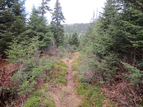
Looking down the trail to Stub Hill Pond
Started at the end of road 143 on a very muddy herd path. In hindsight, should have started at the height of land just prior - good unnamed trail goes almost direct to the pond. Went with the muddy herd path for awhile, then bushwhacked direct to the pond, crossed the herd paths around the pond, then bushwhacked direct to Stub Hill recognized summit - generally good going through fairly open softwoods. A few nice directional views along the way.
Dropped back down to the pond, then followed the trail to the height of land on road 143. Dropped down a little bit, then followed some herd paths for awhile up to the north peak. Ran out of herd paths, hit a brief pocket of steep going in somewhat thick spruce, then hit the summit area, which was covered in older blowdown. Found recognized highpoint sort of on the southeast side of it - dropped down direct thereafter, rather than wade through all of the blowdown. Different route, but similar to ascent - thick and steep at first, then good going.
| Hike Ratings |
|
Getting To Trailhead: |
Moderate |
| Destination: |
Stub Hill |
|
Length: |
Moderate |
|
Steepness: |
Moderate |
|
Navigation: |
Difficult |
|
Views: |
Excellent |
|
Crowds: |
Minimal |
| Destination: |
North Stub Hill |
|
Length: |
Moderate |
|
Steepness: |
Difficult |
|
Navigation: |
Very Difficult |
|
Views: |
Moderate |
|
Crowds: |
Minimal |
|
| Hike Stats |
|
Date Hiked: |
Sunday, October 28, 2012 |
| Parking Elevation: |
3,120' |
| Destination: |
Stub Hill |
| Time Elapsed: |
00:43 |
| Trailhead Elevation: |
3,120' |
| Summit Elevation: |
3,627' |
| Vertical Gain: |
507' |
| Destination: |
North Stub Hill |
| Time Elapsed: |
00:46 |
| Trailhead Elevation: |
3,627' |
| Summit Elevation: |
3,422' |
| Vertical Gain: |
322' |
|
|
| Hike Time Elapsed: |
02:05 |
| Hike Vertical Gain: |
829' |
|
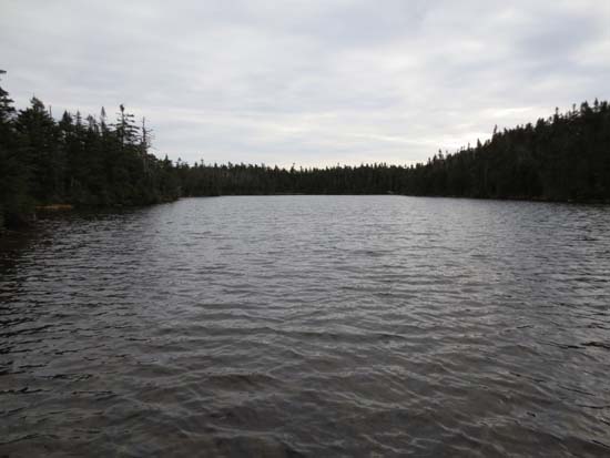
Stub Hill Pond
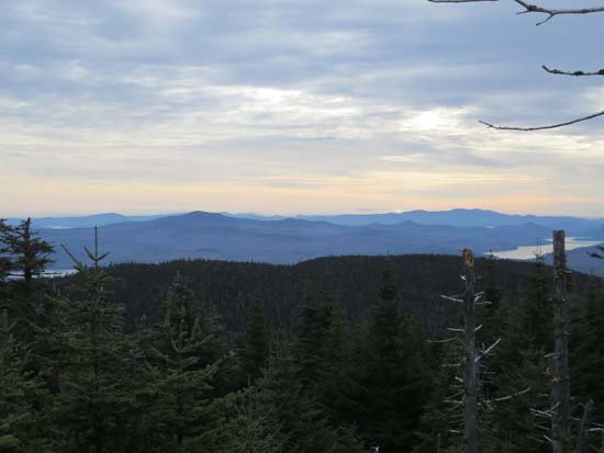
Looking southeast at Deer Mountain and Aziscohos Lake from near the summit of Stub Hill
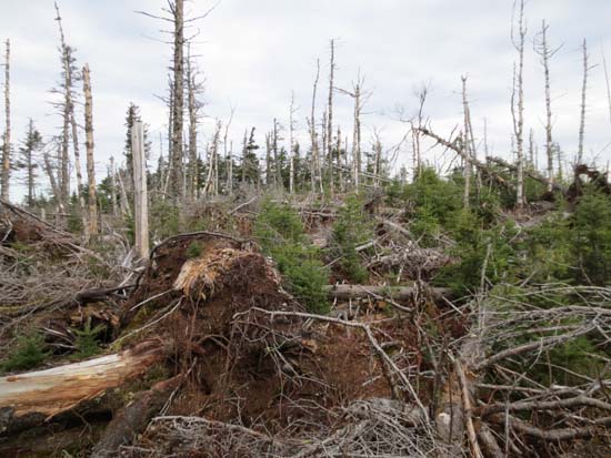
Blowdown on the summit area of North Stub Hill
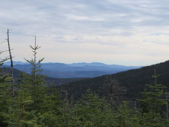
Looking southeast toward Saddleback Mountain from near the summit of North Stub Hill
Directions to trailhead: Take Route north to Parmachenee Road (west side of Lake Aziscohos) to Magalloway Road (sign missing at junction; also known as road 112) to Smith Brook Road (road 5) to road 20 to road 143. All roads were open and driveable for virtually any vehicle. All gates were open in late October, but this is not always the case during other non-winter months. Parked at the end of 143, but in hindsight should have parked at the height of land just prior to the end, where an unnamed trail ascends to the pond.
Back to Stub Hill Profile
Back to North Stub Hill Profile
|


