Home
States
Colorado
Connecticut
Maine
Massachusetts
New Hampshire
New York
Rhode Island
Utah
Vermont
View All
Lists
NE 4,000 Footers
NE 100 Highest
NH 4,000 Footers
NH 100 Highest
NH 52 With A View
NH Belknap Range
NH Ossipee 10
Links
Trail Conditions
Trip Log
Sunrises
Sunsets
About
|
Tin Mountain
Jackson, NH
Trailheads, measurements, times, distances, and maps are all approximate and relative to the hike(s) as shown below.
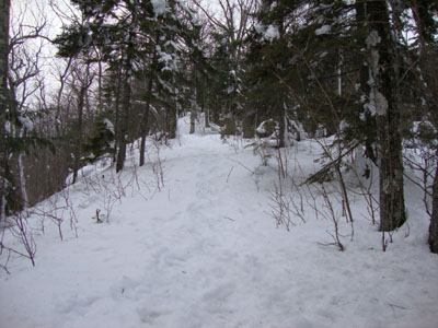
Looking up the blue trail on the way to Tin Mountain
On my to do list for a long time, I decided to head up to Tin Mountain for a quick hike.
My original intent was to hike off Middle Mountain Road. I could not find a marked trailhead, however, so I opted to go the main Tin Mountain Conservation lot on Tin Mine Road.
While there was a trail departing from the parking lot, it didn't show up on the area map, so I opted to take the road walk. I would later discover that this trail went parallel to the road and came out at the first field. The second field provided some superb views of the Montalban Range.
I found myself continuing to check a digital copy of the conversation map - the trails were somewhat marked, but not necessarily using the same color scheme on the map. Also, in part due to a bunch of recent blowdowns (which I didn't remove since I was unfamiliar with the trails), trails were quite vague to follow in places. While 'Grand Junction' was well marked on the map, I didn't realize I was there until I was descending at the end of the hike, for instance.
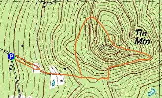
Using the contour lines on the map, I determined an unmarked path with some tracks was where I needed to go to hit the blue trail. Sure enough, I soon found myself on a blue blazed trail and was ascending the south side of Tin Mountain. Though views might be less when the leaves are on the trees, I found the scenery to be quite strong in this hardwood stand.
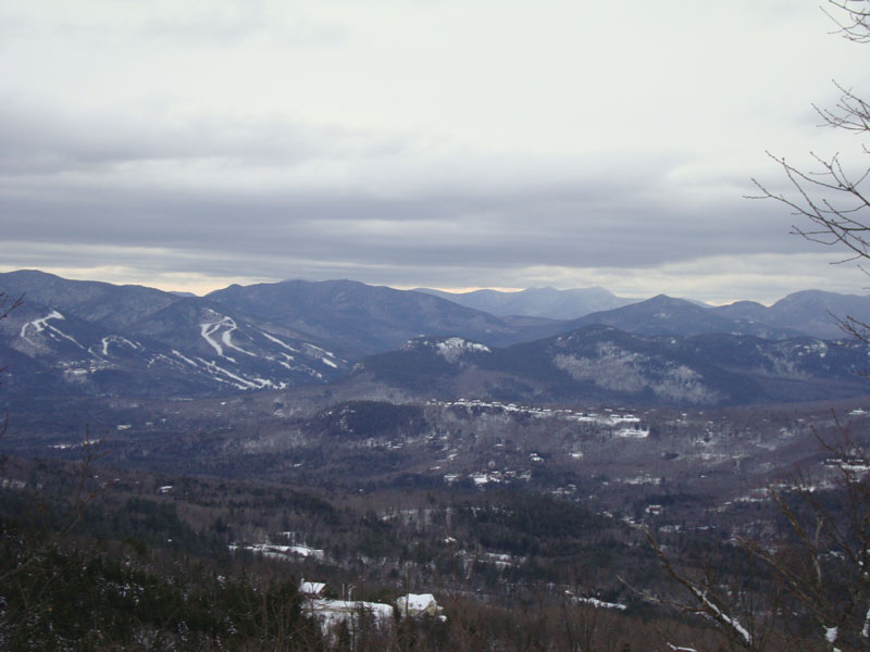
The summit area featured a directional viewpoint, looking at the abandoned Tyrol ski area on Thorn Mountain, as well as peaks in the distance like the Moats.
For the descent, I opted to continue on the blue trail. This ended up being a mistake, as it wasn't well marked, and was heavily trashed by recent blowdowns. After a few minutes, I opted to bushwhack down the slope, and later recrossed the trail near a home lot.
Eventually returning to Grand Junction, I was able to make it back to the parking lot prior to sunset. I think I'll have to check out this area again once the blowdowns are removed.
| Hike Ratings |
|
Getting To Trailhead: |
Easy |
| Destination: |
Tin Mountain |
|
Length: |
Moderate |
|
Steepness: |
Moderate |
|
Navigation: |
Difficult |
|
Views: |
Excellent |
|
Crowds: |
Minimal |
|
| Hike Stats |
|
Date Hiked: |
Wednesday, March 3, 2010 |
| Hike Commenced: |
4:01 PM |
| Parking Elevation: |
1,380' |
| Destination: |
Tin Mountain |
| Ascent Commenced: |
4:01 PM |
| Summit Reached: |
4:38 PM |
| Time Elapsed: |
00:37 |
| Trailhead Elevation: |
1,380' |
| Summit Elevation: |
2,031' |
| Vertical Gain: |
701' |
|
|
| Hike Ended: |
5:13 PM |
| Hike Time Elapsed: |
01:12 |
| Hike Vertical Gain: |
721' |
|
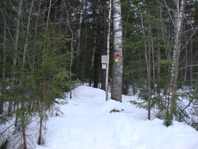
Trailhead at Tin Mountain Conservation parking lot
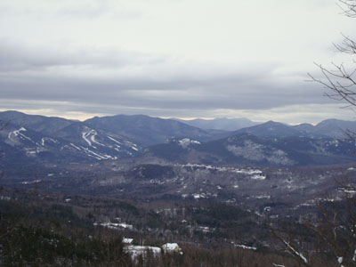
Looking at Attitash ski area, Bear Mountain, and in the distance, the Tripyramids from Tin Mountain

Directions to trailhead: From Jackson, take Route 16B up the hill, then take a right onto Tin Mine Road. At a righthand curve on the road, the Tin Mountain Conservation Center trails parking lot will be on the left. A yellow blazed trailhead is located on the opposite side of the parking lot.
Back to Tin Mountain Profile
|