Home
States
Colorado
Connecticut
Maine
Massachusetts
New Hampshire
New York
Rhode Island
Utah
Vermont
View All
Lists
NE 4,000 Footers
NE 100 Highest
NH 4,000 Footers
NH 100 Highest
NH 52 With A View
NH Belknap Range
NH Ossipee 10
Links
Trail Conditions
Trip Log
Sunrises
Sunsets
About
|
Vose Spur
Livermore, NH
Trailheads, measurements, times, distances, and maps are all approximate and relative to the hike(s) as shown below.
The Carrigain Notch Trail
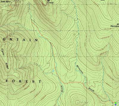
Route: Signal Ridge Trail, Carrigain Notch Trail, bushwhack, herd path, (Vose Spur), herd path, bushwhack, Carrigain Notch Trail, Signal Ridge Trail
Having never been to Vose Spur before, it seemed like as good a day as any to join a strong group and give it a try. Leaving the Signal Ridge parking area, we made decent time on the fairly flat terrain to the Carrigain Notch Trail junction and beyond. Though the water crossings were no problem, the mosquitoes were plentiful enough to prevent conditions from being ideal.
Reaching the large boulder in the trail alongside stepping stones, we proceeded a few feet before turning and heading into the woods. Though the vegetation wasn't too thick, there was nonetheless some steep terrain. Reaching the traprock slope, stopped for lunch whilst enjoying tremendous views.
Beyond there, we were able to follow a fairly obvious herd path to the false and then true summits of Vose Spur (the latter behind perhaps fifty feet from the former), climbing up some fairly steep terrain. While there were no views from the summit, the views from the traprock slope were nonetheless enough to make the hike feel quite scenic.
On the way down, I decided to follow another herd path down partway, arriving at the very top of the traprock slope (around the corner from the traditional approach), thus obtaining slightly different views. The rest of the descent was fairly gentle. We were able to make it back to the parking lot prior to some afternoon clouds arriving.
| Hike Ratings |
|
Getting To Trailhead: |
Easy |
| Destination: |
Vose Spur |
|
Length: |
Difficult |
|
Steepness: |
Very Difficult |
|
Navigation: |
Difficult |
|
Views: |
Minimal |
|
Crowds: |
Moderate |
|
| Hike Stats |
|
Date Hiked: |
Sunday, June 6, 2009 |
| Hike Commenced: |
8:46 AM |
| Parking Elevation: |
1,370' |
| Destination: |
Vose Spur |
| Ascent Commenced: |
8:47 AM |
| Summit Reached: |
12:19 PM |
| Time Elapsed: |
03:32 |
| Trailhead Elevation: |
1,370' |
| Summit Elevation: |
3,862' |
| Vertical Gain: |
2,617' |
|
|
| Hike Ended: |
3:07 PM |
| Hike Time Elapsed: |
06:21 |
| Hike Vertical Gain: |
2,742' |
|
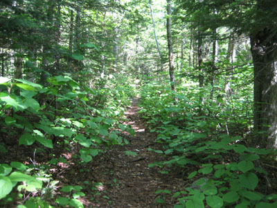
Signal Ridge Trail trailhead on Sawyer River Road
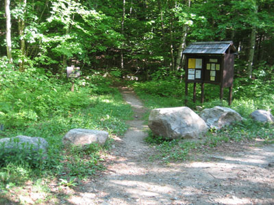
Lady slippers in the woods on the way to Vose Spur
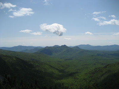
Looking at Mt. Tremont from near the top of the traprock field on Vose Spur

Directions to trailhead: Take Route 302 West from Bartlett to Sawyer River Road. WMNF fee parking lot is a few minutes up the dirt road on the left. Trailhead is across the road.
Back to Vose Spur Profile
|