Home
States
Colorado
Connecticut
Maine
Massachusetts
New Hampshire
New York
Rhode Island
Utah
Vermont
View All
Lists
NE 4,000 Footers
NE 100 Highest
NH 4,000 Footers
NH 100 Highest
NH 52 With A View
NH Belknap Range
NH Ossipee 10
Links
Trail Conditions
Trip Log
Sunrises
Sunsets
About
|
Welch Mountain, Dickey Mountain
Thornton, NH, Waterville Valley, NH
Trailheads, measurements, times, distances, and maps are all approximate and relative to the hike(s) as shown below.
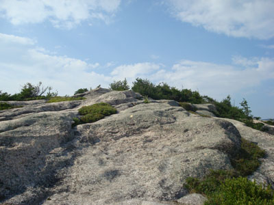
Heading up the Welch-Dickey Loop Trail to Welch Mountain
Route: Welch-Dickey Loop Trail, (Welch Mountain), Welch-Dickey Loop Trail, (Dickey Mountain), Welch-Dickey Loop Trail
While my intention had been to hike Mt. Osceola, I could see some dark clouds looming over the area as I emerged from Sandwich Mountain Road. As a result, I decided to scale down my plans and go to Welch-Dickey.
Arriving at a fairly empty parking lot, I quickly set foot up the Welch Mountain segment. Other than a few folks doing trail work and a few others picking blueberries, I didn't see a single hiker the entire hike. Fortunately the ledges were fairly dry, making the ascent up to Welch Mountain not nearly as challenging as it could have been.
While the haze and clouds limited views in most directions, there were still decent views up toward Waterville.
My next stop was Dickey Mountain. I was making decent time until I reached the ledges - and found a great blueberry patch. I spent a good 5 to 10 minutes eating blueberries before continuing up to the summit area.
On the way down, I made another detour to some blueberries as part of my leisurely descent.
If this hike was a little bit closer, I think I'd do it a heck of a lot more often than I do now (average of once a year).
| Hike Ratings |
|
Getting To Trailhead: |
Easy |
| Destination: |
Welch Mountain |
|
Length: |
Moderate |
|
Steepness: |
Difficult |
|
Navigation: |
Easy |
|
Views: |
Excellent |
|
Crowds: |
Minimal |
| Destination: |
Dickey Mountain |
|
Length: |
Moderate |
|
Steepness: |
Difficult |
|
Navigation: |
Easy |
|
Views: |
Excellent |
|
Crowds: |
Minimal |
|
| Hike Stats |
|
Date Hiked: |
Monday, July 28, 2008 |
| Hike Commenced: |
4:07 PM |
| Parking Elevation: |
1,080' |
| Destination: |
Welch Mountain |
| Ascent Commenced: |
4:07 PM |
| Summit Reached: |
5:00 PM |
| Time Elapsed: |
00:53 |
| Trailhead Elevation: |
1,090' |
| Summit Elevation: |
2,605' |
| Distance: |
2 miles |
| Vertical Gain: |
1,545' |
| Destination: |
Dickey Mountain |
| Ascent Commenced: |
5:03 PM |
| Summit Reached: |
5:23 PM |
| Time Elapsed: |
00:20 |
| Trailhead Elevation: |
2,600' |
| Summit Elevation: |
2,734' |
| Distance: |
.5 mile |
| Vertical Gain: |
314' |
|
|
| Hike Ended: |
6:39 PM |
| Hike Time Elapsed: |
02:32 |
| Hike Distance: |
4.5 miles |
| Hike Vertical Gain: |
1,899' |
|
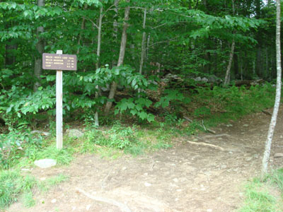
The Welch-Dickey Loop Trail trailhead
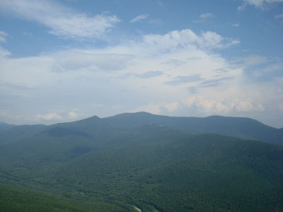
Looking at Sandwich Mountain from the Welch Mountain summit
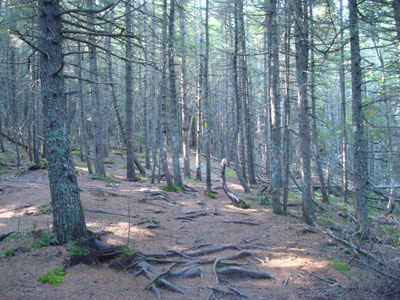
The Welch-Dickey Loop Trail between Welch Mountain and Dickey Mountain
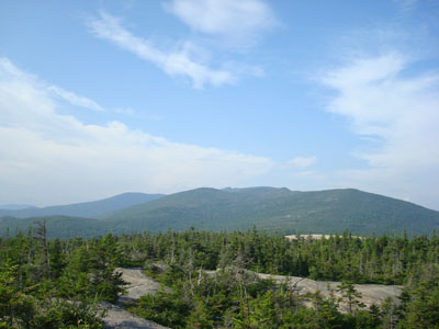
Looking at Mt. Tecumseh from near the Dickey Mountain summit
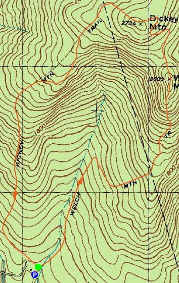

Directions to trailhead: Take Route 49 to Six Mile Bridge - take a left there and go up the hill. Take a right onto Orris Road. National Forest pay parking lot will be on the right after a short drive.
Back to Welch Mountain Profile
Back to Dickey Mountain Profile
|


