Home
States
Colorado
Connecticut
Maine
Massachusetts
New Hampshire
New York
Rhode Island
Utah
Vermont
View All
Lists
NE 4,000 Footers
NE 100 Highest
NH 4,000 Footers
NH 100 Highest
NH 52 With A View
NH Belknap Range
NH Ossipee 10
Links
Trail Conditions
Trip Log
Sunrises
Sunsets
About
|
West Rattlesnake
Holderness, NH
Trailheads, measurements, times, distances, and maps are all approximate and relative to the hike(s) as shown below.
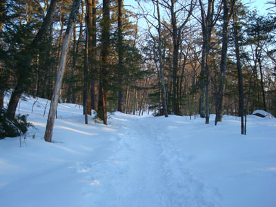
Looking up the Old Bridle Path
Route: Old Bridle Path
Wanting an easy hike, I set out for West Rattlesnake. Arriving at the parking lot, I was a bit worried, as the sun had sunk behind the Squam Range.
Despite all of the snow, I was able to bareboot up the Old Bridle Path due to it being very well packed. In addition, with temperatures around 40, it felt like spring. As I neared the summit, I was happy to see that there was still some sunlight at this elevation.
I decided to try to innovate as I waited for the sunset to start. Stick my ice axe into the snow, I fastened my camera clamp to the handle and built myself a tripod (unipod?), which made for steadier sunset photos. Though the sunset wasn't great from this view point (since the actual sunset was occuring awhile later beyond the immediate horizon), the colors and the mild weather still made it enjoyable.
On the ride home, I was able to look back and see some very vivid cloud colors. While I did wish I had stuck around for that display, I was just as content to get some KFC.
| Hike Ratings |
|
Getting To Trailhead: |
Easy |
| Destination: |
West Rattlesnake |
|
Length: |
Easy |
|
Steepness: |
Easy |
|
Navigation: |
Easy |
|
Views: |
Excellent |
|
Crowds: |
Moderate |
|
| Hike Stats |
|
Date Hiked: |
Monday, February 25, 2008 |
| Hike Commenced: |
4:49 PM |
| Parking Elevation: |
815' |
| Destination: |
West Rattlesnake |
| Ascent Commenced: |
4:50 PM |
| Summit Reached: |
5:08 PM |
| Time Elapsed: |
00:18 |
| Trailhead Elevation: |
800' |
| Summit Elevation: |
1,240' |
| Distance: |
.9 miles |
| Vertical Gain: |
455' |
|
|
| Hike Ended: |
5:47 PM |
| Hike Time Elapsed: |
00:58 |
| Hike Distance: |
1.8 miles |
| Hike Vertical Gain: |
485' |
|
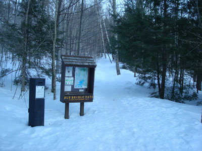
The Old Bridle Path trailhead on Route 113

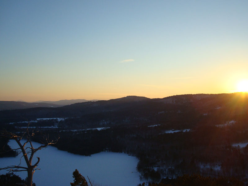
Looking across Squam Lake toward Mt. Livermore from West Rattlesnake
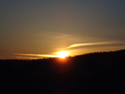
The sunset as seen from the West Rattlesnake ledges
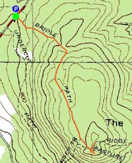

Directions to trailhead: Take Route 113 West from Center Sandwich. Shortly after the Mt. Morgan parking lot, the trailhead is on the left. Parking available in the Mt. Morgan parking lot and on the side of the road (not on pavement).
Back to West Rattlesnake Profile
|