Home
States
Colorado
Connecticut
Maine
Massachusetts
New Hampshire
New York
Rhode Island
Utah
Vermont
View All
Lists
NE 4,000 Footers
NE 100 Highest
NH 4,000 Footers
NH 100 Highest
NH 52 With A View
NH Belknap Range
NH Ossipee 10
Links
Trail Conditions
Trip Log
Sunrises
Sunsets
About
|
West Rattlesnake
Holderness, NH
Trailheads, measurements, times, distances, and maps are all approximate and relative to the hike(s) as shown below.
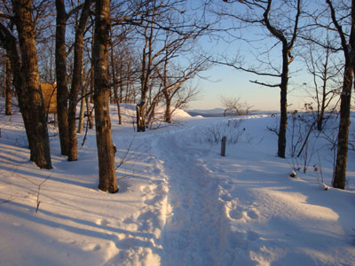
Looking up the Old Bridle Path
Route: Old Bridle Path
After hiking something like 28 miles on snowshoes over the weekend, I wasn't exactly in the mood for breaking trail or, for that matter, donning snowshoes. Thus, West Rattlesnake seemed like an attractive option.
The trail was very well broken out, thus enabling me to leave my snowshoes in my vehicle. The low angled sun rays helped make the trail quite scenic for the ascent.
The visibility from the ledges was tremendous - the fire tower on Red Hill, for instance, was very easily seen. The Belknaps were also quite a sight across the frozen lakes.
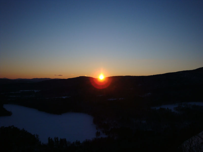
As is the case the further away one is from the winter solstice, the sunset wasn't overly spectacular from the ledge. As the days grow longer, the sun sets further up the higher Squam Range. Without many clouds in the sky, there wasn't much color. Nonetheless, it was nice to watch.
| Hike Ratings |
|
Getting To Trailhead: |
Easy |
| Destination: |
West Rattlesnake |
|
Length: |
Easy |
|
Steepness: |
Easy |
|
Navigation: |
Easy |
|
Views: |
Excellent |
|
Crowds: |
Minimal |
|
| Hike Stats |
|
Date Hiked: |
Monday, January 12, 2009 |
| Hike Commenced: |
3:42 PM |
| Parking Elevation: |
815' |
| Destination: |
West Rattlesnake |
| Ascent Commenced: |
3:42 PM |
| Summit Reached: |
4:03 PM |
| Time Elapsed: |
00:21 |
| Trailhead Elevation: |
815' |
| Summit Elevation: |
1,240' |
| Distance: |
.9 miles |
| Vertical Gain: |
440' |
|
|
| Hike Ended: |
4:45 PM |
| Hike Time Elapsed: |
01:03 |
| Hike Distance: |
1.8 miles |
| Hike Vertical Gain: |
455' |
|
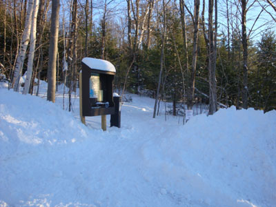
The Old Bridle Path trailhead at the back of the new parking area
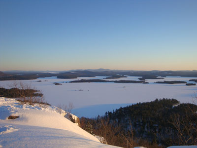
The Belknaps as seen from West Rattlesnake
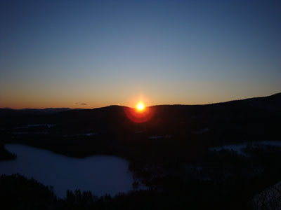
The sunset as seen from West Rattlesnake
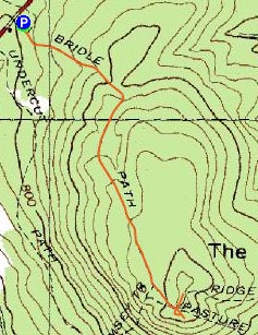

Directions to trailhead: Take Route 113 West from Center Sandwich. The new (2008) West Rattlesnake parking lot is on the left at a height of land, across from the Mt. Morgan parking area. The Old Bridle Path trailhead is located at the back of the new parking lot.
Back to West Rattlesnake Profile
|